Satellite View of Severe wildfires in Spain and Portugal
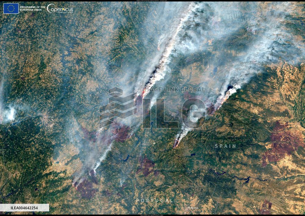
Handout photo dated on August 16, 2025 shows Massive wildfires are spreading in north-west and western Spain, forcing the evacuation of thousands of residents. By 17 August 2025, Spain had already recorded its highest annual total of estimated fire emissions in the 23-year Copernicus Atmosphere Monitoring Service (CAMS) dataset. This Copernicus Sentinel-2 image acquired on 16 August 2025 shows dense smoke plumes rising from active fires near the city of Ourense, located in the autonomous community of Galicia, northwestern Spain. Portugal has also been severely affected by the fires, with northern and central regions hit the hardest. According to CAMS data, the country’s estimated emissions have nearly reached the highest annual totals of 2003 and 2005. To support national authorities, the Copernicus Emergency Management Service (CEMS) has been activated to provide emergency mapping services. Further information is available here. Spain, Portugal. Photo by European Union, Copernicus Sentinel-2 imagery via ABAC
- Product Code
- ILEA004642254
- Registered date
- 2025/8/16 00:00:00
- Credit
- Abaca Press / Kyodo News Images
- Media source
- ABACA
- Media size
- 4960 × 3507 pixel
- Resolution
- 72 dpi
- Deployment size
- 11.20(MB)*
- Special instruction
*File size when opened in Photoshop, etc.


