Satellite View of flooding in northern Sumatra, Indonesia
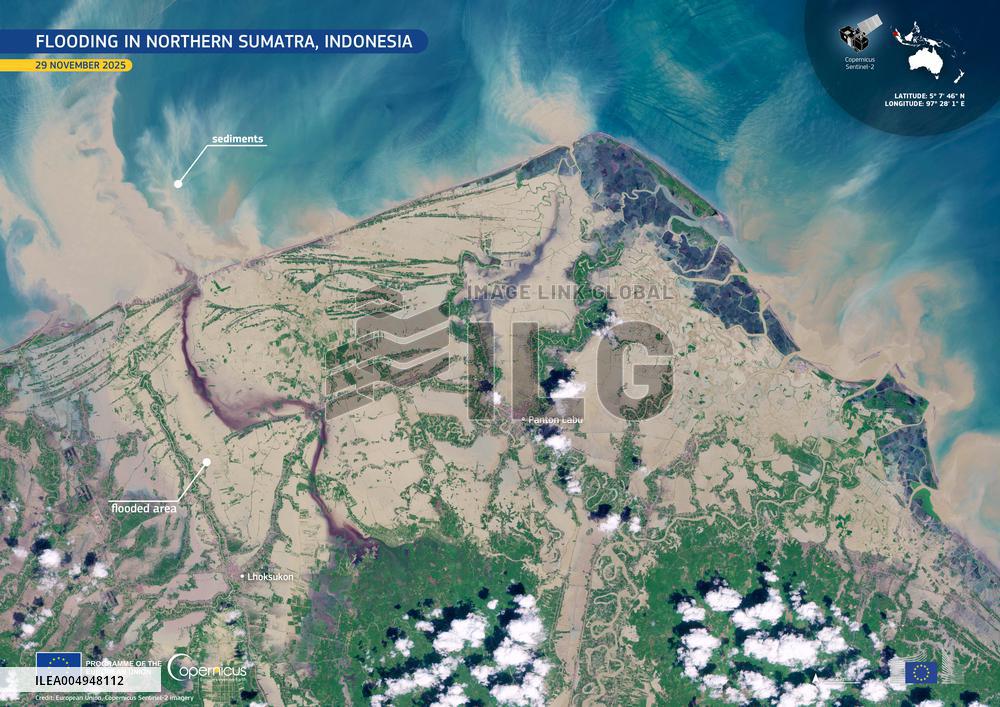
Handout photo datetd on November 29, 2025 shows satellite view of Flooding in northern Sumatra. Cyclone Senyar formed during the night of 25-26 November 2025 in the Strait of Malacca, an area in which tropical cyclones had not been recorded for decades. The day after its formation, Senyar hit Indonesia, where it made landfall, causing flooding, landslides and more than 400 casualties in the north of the island of Sumatra. This image, acquired by one of the Copernicus Sentinel-2 satellites on 29 November 2025, shows extensive inundation across Aceh province, with towns such as Lhoksukon and Panton Labu surrounded by floodwaters. Sediment-laden plumes discharged into the sea along the northern coast indicate substantial river outflow, caused by the heavy upstream rainfall. Photo by European Union, Copernicus Sentinel-2 imagery via ABACAPRESS.COM
- Product Code
- ILEA004948112
- Registered date
- 2025/12/02 00:00:00
- Credit
- Abaca Press / Kyodo News Images
- Media source
- ABACA
- Media size
- 4961 × 3508 pixel
- Resolution
- 72 dpi
- Deployment size
- 5.04(MB)*
- Special instruction
*File size when opened in Photoshop, etc.


