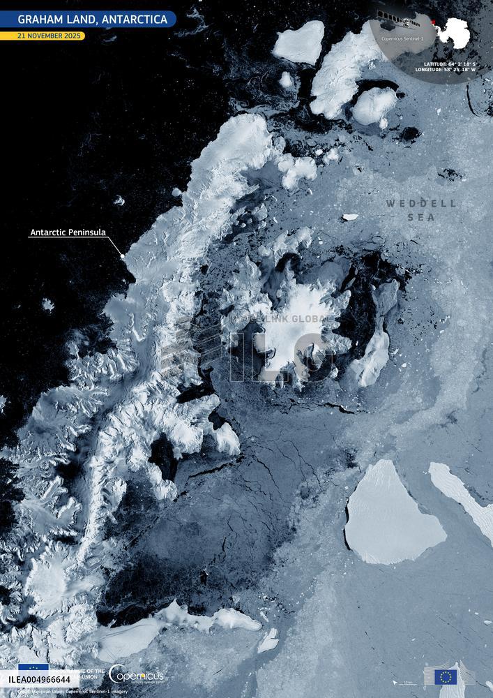
Satellite View of Graham Land - Antarctica
Handout Satellite views dated on November 21, 2025, shows Graham Land. Graham Land, the northernmost stretch of the Antarctic Peninsula, is one of the most rapidly warming regions on Earth. Its mountainous spine and outlet glaciers drain into the Weddell Sea, forming an important transition zone between grounded ice, floating shelves, and open water. This dynamic landscape supports rich marine ecosystems, including krill-dependent species such as seals, penguins, and seabirds, and plays an important role in global ocean circulation and climate regulation. This Copernicus Sentinel-1 image, acquired on 21 November 2025, shows the contrasting textures of grounded ice, fragmented sea ice, and dark, open ocean, revealing key glaciological features in radar backscatter. Copernicus data is essential to climate science. A recent study published in Nature used Copernicus Sentinel-1 and Sentinel-2 data to analyse glacier dynamics in Graham Land, Antarctica. Photo by European Union, Copernicus Sentinel-1 imagery via ABA
- Product Code
- ILEA004966644
- Registered date
- 2025/11/21 00:00:00
- Credit
- Abaca Press / Kyodo News Images
- Media source
- ABACA
- Media size
- 3508 × 4961 pixel
- Resolution
- 72 dpi
- Deployment size
- 5.88(MB)*
- Special instruction
*File size when opened in Photoshop, etc.


