•  
Fatal vehicle pileup on eastern Japan expressway

Fatal vehicle pileup on eastern Japan expressway

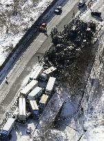
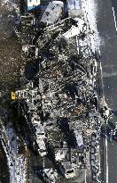
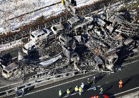
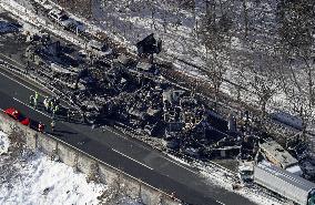
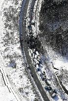
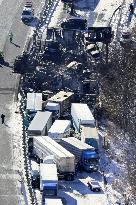
Photo taken from a Kyodo News helicopter shows the site of a 67-vehicle pileup on the Kan-etsu Expressway in Minakami in Gunma Prefecture, eastern Japan, on Dec. 27, 2025. The pileup occurred on the evening of Dec. 26, after vehicles lost traction on the icy road surface, triggering collisions stretching over about 300 meters and leaving two people dea

  •  
Fatal vehicle pileup on eastern Japan expressway

Fatal vehicle pileup on eastern Japan expressway

Photo taken from a Kyodo News helicopter shows the site of a 67-vehicle pileup on the Kan-etsu Expressway in Minakami in Gunma Prefecture, eastern Japan, on Dec. 27, 2025. The pileup occurred on the evening of Dec. 26, after vehicles lost traction on the icy road surface, triggering collisions stretching over about 300 meters and leaving two people dea

  •  
Fatal vehicle pileup on eastern Japan expressway

Fatal vehicle pileup on eastern Japan expressway

Photo taken from a Kyodo News helicopter shows the site of a 67-vehicle pileup on the Kan-etsu Expressway in Minakami in Gunma Prefecture, eastern Japan, on Dec. 27, 2025. The pileup occurred on the evening of Dec. 26, after vehicles lost traction on the icy road surface, triggering collisions stretching over about 300 meters and leaving two people dea

  •  
Fatal vehicle pileup on eastern Japan expressway

Fatal vehicle pileup on eastern Japan expressway

Photo taken from a Kyodo News helicopter shows the site of a 67-vehicle pileup on the Kan-etsu Expressway in Minakami in Gunma Prefecture, eastern Japan, on Dec. 27, 2025. The pileup occurred on the evening of Dec. 26, after vehicles lost traction on the icy road surface, triggering collisions stretching over about 300 meters and leaving two people dea

  •  
Fatal vehicle pileup on eastern Japan expressway

Fatal vehicle pileup on eastern Japan expressway

Photo taken from a Kyodo News helicopter shows the site of a 67-vehicle pileup on the Kan-etsu Expressway in Minakami in Gunma Prefecture, eastern Japan, on Dec. 27, 2025. The pileup occurred on the evening of Dec. 26, after vehicles lost traction on the icy road surface, triggering collisions stretching over about 300 meters and leaving two people dea

  •  
Fatal vehicle pileup on eastern Japan expressway

Fatal vehicle pileup on eastern Japan expressway

Photo taken from a Kyodo News helicopter shows the site of a 67-vehicle pileup on the Kan-etsu Expressway in Minakami in Gunma Prefecture, eastern Japan, on Dec. 27, 2025. The pileup occurred on the evening of Dec. 26, after vehicles lost traction on the icy road surface, triggering collisions stretching over about 300 meters and leaving two people dea

  •  
Fatal vehicle pileup on eastern Japan expressway

Fatal vehicle pileup on eastern Japan expressway

Photo taken from a Kyodo News helicopter shows the site of a 67-vehicle pileup on the Kan-etsu Expressway in Minakami in Gunma Prefecture, eastern Japan, on Dec. 27, 2025. The pileup occurred on the evening of Dec. 26, after vehicles lost traction on the icy road surface, triggering collisions stretching over about 300 meters and leaving two people dea

  •  
Fatal vehicle pileup on eastern Japan expressway

Fatal vehicle pileup on eastern Japan expressway

Photo taken from a Kyodo News helicopter shows the site of a 67-vehicle pileup on the Kan-etsu Expressway in Minakami in Gunma Prefecture, eastern Japan, on Dec. 27, 2025. The pileup occurred on the evening of Dec. 26, after vehicles lost traction on the icy road surface, triggering collisions stretching over about 300 meters and leaving two people dead.

  •  

France: Hérault Under Red Alert After Days of Intense Rainfall 5

Rare and severe flooding hit southern France on Monday, December 22, placing the Hérault department under red alert after torrential rain pushed river levels near Agde to a record 3.57 meters. Montpellier was inundated with around 300 millimeters of rain in three days, flooding streets, disrupting transportation, forcing evacuations, and leaving up to 3,000 households without power. On Tuesday, authorities said water levels were stabilizing and rainfall was easing, though Hérault remained under red alert. No casualties were reported.

  •  

France: Hérault Under Red Alert After Days of Intense Rainfall 3

Rare and severe flooding hit southern France on Monday, December 22, placing the Hérault department under red alert after torrential rain pushed river levels near Agde to a record 3.57 meters. Montpellier was inundated with around 300 millimeters of rain in three days, flooding streets, disrupting transportation, forcing evacuations, and leaving up to 3,000 households without power. On Tuesday, authorities said water levels were stabilizing and rainfall was easing, though Hérault remained under red alert. No casualties were reported.

  •  

France: Hérault Under Red Alert After Days of Intense Rainfall 4

Rare and severe flooding hit southern France on Monday, December 22, placing the Hérault department under red alert after torrential rain pushed river levels near Agde to a record 3.57 meters. Montpellier was inundated with around 300 millimeters of rain in three days, flooding streets, disrupting transportation, forcing evacuations, and leaving up to 3,000 households without power. On Tuesday, authorities said water levels were stabilizing and rainfall was easing, though Hérault remained under red alert. No casualties were reported.

  •  

France: Hérault Under Red Alert After Days of Intense Rainfall

Rare and severe flooding hit southern France on Monday, December 22, placing the Hérault department under red alert after torrential rain pushed river levels near Agde to a record 3.57 meters. Montpellier was inundated with around 300 millimeters of rain in three days, flooding streets, disrupting transportation, forcing evacuations, and leaving up to 3,000 households without power. On Tuesday, authorities said water levels were stabilizing and rainfall was easing, though Hérault remained under red alert. No casualties were reported.

  •  

France: Hérault Under Red Alert After Days of Intense Rainfall 2

Rare and severe flooding hit southern France on Monday, December 22, placing the Hérault department under red alert after torrential rain pushed river levels near Agde to a record 3.57 meters. Montpellier was inundated with around 300 millimeters of rain in three days, flooding streets, disrupting transportation, forcing evacuations, and leaving up to 3,000 households without power. On Tuesday, authorities said water levels were stabilizing and rainfall was easing, though Hérault remained under red alert. No casualties were reported.

  •  
Groundwater Mapping in Normandy - France

Groundwater Mapping in Normandy - France

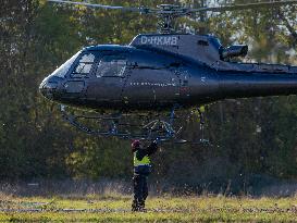
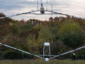
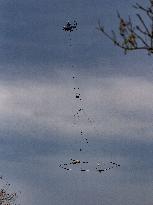
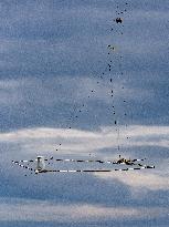
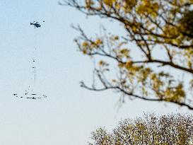
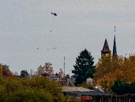
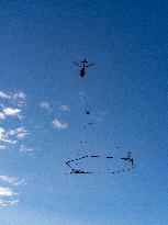
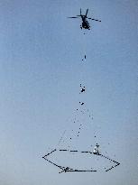
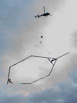
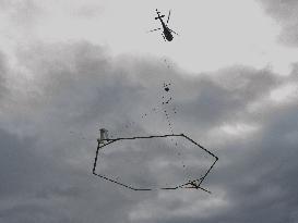
Eaux-SCARS, a large-scale scientific program involving the BRGM (Bureau of Geological and Mining Research), local authorities, and in this case the SMABI (Joint Development Authority for the Iton Basin) in the Normandy region. A helicopter from Germany, piloted by a specialist in this type of mission, tows a polygon measuring around 20 meters in diameter. This giant probe can map groundwater tables to a depth of 300 meters and see the interconnections with rivers. The Danish company SkyTEM is carrying out this work, which covers several regions of France, on October 31, 2025, in Saint Andre de l'Eure, Normandy, France. Photo by Mario Fourmy/ABACAPRESS.COM

  •  
Groundwater Mapping in Normandy - France

Groundwater Mapping in Normandy - France

Eaux-SCARS, a large-scale scientific program involving the BRGM (Bureau of Geological and Mining Research), local authorities, and in this case the SMABI (Joint Development Authority for the Iton Basin) in the Normandy region. A helicopter from Germany, piloted by a specialist in this type of mission, tows a polygon measuring around 20 meters in diameter. This giant probe can map groundwater tables to a depth of 300 meters and see the interconnections with rivers. The Danish company SkyTEM is carrying out this work, which covers several regions of France, on October 31, 2025, in Saint Andre de l'Eure, Normandy, France. Photo by Mario Fourmy/ABACAPRESS.COM

  •  
Groundwater Mapping in Normandy - France

Groundwater Mapping in Normandy - France

Eaux-SCARS, a large-scale scientific program involving the BRGM (Bureau of Geological and Mining Research), local authorities, and in this case the SMABI (Joint Development Authority for the Iton Basin) in the Normandy region. A helicopter from Germany, piloted by a specialist in this type of mission, tows a polygon measuring around 20 meters in diameter. This giant probe can map groundwater tables to a depth of 300 meters and see the interconnections with rivers. The Danish company SkyTEM is carrying out this work, which covers several regions of France, on October 31, 2025, in Saint Andre de l'Eure, Normandy, France. Photo by Mario Fourmy/ABACAPRESS.COM

  •  
Groundwater Mapping in Normandy - France

Groundwater Mapping in Normandy - France

Eaux-SCARS, a large-scale scientific program involving the BRGM (Bureau of Geological and Mining Research), local authorities, and in this case the SMABI (Joint Development Authority for the Iton Basin) in the Normandy region. A helicopter from Germany, piloted by a specialist in this type of mission, tows a polygon measuring around 20 meters in diameter. This giant probe can map groundwater tables to a depth of 300 meters and see the interconnections with rivers. The Danish company SkyTEM is carrying out this work, which covers several regions of France, on October 31, 2025, in Saint Andre de l'Eure, Normandy, France. Photo by Mario Fourmy/ABACAPRESS.COM

  •  
Groundwater Mapping in Normandy - France

Groundwater Mapping in Normandy - France

Eaux-SCARS, a large-scale scientific program involving the BRGM (Bureau of Geological and Mining Research), local authorities, and in this case the SMABI (Joint Development Authority for the Iton Basin) in the Normandy region. A helicopter from Germany, piloted by a specialist in this type of mission, tows a polygon measuring around 20 meters in diameter. This giant probe can map groundwater tables to a depth of 300 meters and see the interconnections with rivers. The Danish company SkyTEM is carrying out this work, which covers several regions of France, on October 31, 2025, in Saint Andre de l'Eure, Normandy, France. Photo by Mario Fourmy/ABACAPRESS.COM

  •  
Groundwater Mapping in Normandy - France

Groundwater Mapping in Normandy - France

Eaux-SCARS, a large-scale scientific program involving the BRGM (Bureau of Geological and Mining Research), local authorities, and in this case the SMABI (Joint Development Authority for the Iton Basin) in the Normandy region. A helicopter from Germany, piloted by a specialist in this type of mission, tows a polygon measuring around 20 meters in diameter. This giant probe can map groundwater tables to a depth of 300 meters and see the interconnections with rivers. The Danish company SkyTEM is carrying out this work, which covers several regions of France, on October 31, 2025, in Saint Andre de l'Eure, Normandy, France. Photo by Mario Fourmy/ABACAPRESS.COM

  •  
Groundwater Mapping in Normandy - France

Groundwater Mapping in Normandy - France

Eaux-SCARS, a large-scale scientific program involving the BRGM (Bureau of Geological and Mining Research), local authorities, and in this case the SMABI (Joint Development Authority for the Iton Basin) in the Normandy region. A helicopter from Germany, piloted by a specialist in this type of mission, tows a polygon measuring around 20 meters in diameter. This giant probe can map groundwater tables to a depth of 300 meters and see the interconnections with rivers. The Danish company SkyTEM is carrying out this work, which covers several regions of France, on October 31, 2025, in Saint Andre de l'Eure, Normandy, France. Photo by Mario Fourmy/ABACAPRESS.COM

  •  
Groundwater Mapping in Normandy - France

Groundwater Mapping in Normandy - France

Eaux-SCARS, a large-scale scientific program involving the BRGM (Bureau of Geological and Mining Research), local authorities, and in this case the SMABI (Joint Development Authority for the Iton Basin) in the Normandy region. A helicopter from Germany, piloted by a specialist in this type of mission, tows a polygon measuring around 20 meters in diameter. This giant probe can map groundwater tables to a depth of 300 meters and see the interconnections with rivers. The Danish company SkyTEM is carrying out this work, which covers several regions of France, on October 31, 2025, in Saint Andre de l'Eure, Normandy, France. Photo by Mario Fourmy/ABACAPRESS.COM

  •  
Groundwater Mapping in Normandy - France

Groundwater Mapping in Normandy - France

Eaux-SCARS, a large-scale scientific program involving the BRGM (Bureau of Geological and Mining Research), local authorities, and in this case the SMABI (Joint Development Authority for the Iton Basin) in the Normandy region. A helicopter from Germany, piloted by a specialist in this type of mission, tows a polygon measuring around 20 meters in diameter. This giant probe can map groundwater tables to a depth of 300 meters and see the interconnections with rivers. The Danish company SkyTEM is carrying out this work, which covers several regions of France, on October 31, 2025, in Saint Andre de l'Eure, Normandy, France. Photo by Mario Fourmy/ABACAPRESS.COM

  •  
Groundwater Mapping in Normandy - France

Groundwater Mapping in Normandy - France

Eaux-SCARS, a large-scale scientific program involving the BRGM (Bureau of Geological and Mining Research), local authorities, and in this case the SMABI (Joint Development Authority for the Iton Basin) in the Normandy region. A helicopter from Germany, piloted by a specialist in this type of mission, tows a polygon measuring around 20 meters in diameter. This giant probe can map groundwater tables to a depth of 300 meters and see the interconnections with rivers. The Danish company SkyTEM is carrying out this work, which covers several regions of France, on October 31, 2025, in Saint Andre de l'Eure, Normandy, France. Photo by Mario Fourmy/ABACAPRESS.COM

  •  
Groundwater Mapping in Normandy - France

Groundwater Mapping in Normandy - France

Eaux-SCARS, a large-scale scientific program involving the BRGM (Bureau of Geological and Mining Research), local authorities, and in this case the SMABI (Joint Development Authority for the Iton Basin) in the Normandy region. A helicopter from Germany, piloted by a specialist in this type of mission, tows a polygon measuring around 20 meters in diameter. This giant probe can map groundwater tables to a depth of 300 meters and see the interconnections with rivers. The Danish company SkyTEM is carrying out this work, which covers several regions of France, on October 31, 2025, in Saint Andre de l'Eure, Normandy, France. Photo by Mario Fourmy/ABACAPRESS.COM

  •  
Groundwater Mapping in Normandy - France

Groundwater Mapping in Normandy - France

Eaux-SCARS, a large-scale scientific program involving the BRGM (Bureau of Geological and Mining Research), local authorities, and in this case the SMABI (Joint Development Authority for the Iton Basin) in the Normandy region. A helicopter from Germany, piloted by a specialist in this type of mission, tows a polygon measuring around 20 meters in diameter. This giant probe can map groundwater tables to a depth of 300 meters and see the interconnections with rivers. The Danish company SkyTEM is carrying out this work, which covers several regions of France, on October 31, 2025, in Saint Andre de l'Eure, Normandy, France. Photo by Mario Fourmy/ABACAPRESS.COM

  •  

Japan: Historic Kishiwada Danjiri Festival Kicks Off in Osaka With Massive Floats

The annual Kishiwada Danjiri Festival began on September 13 in Kishiwada City, Osaka Prefecture, running through September 14. Thirty-four massive wooden floats, each over 4 meters tall and weighing more than 4 tons, raced through the city streets of the Kishiwada and Haruki districts to the spirited chant of “Sorya, Sorya.” Festival participants in matching happi coats pulled the floats with ropes, while “daiku-gata” performers danced atop the roofs with fans. At intersections, the floats performed the festival’s signature “yarimawashi,” a dramatic 90-degree turn executed at high speed, thrilling spectators with cheers. Drums, flutes, and bells added to the festive atmosphere. The festival, held for over 300 years since the Edo period, continues late into the evening on September 13, with a ceremonial shrine visit (“Miyairi”) scheduled on September 14.

  •  
Magnificent Milky Way Scenery - China

Magnificent Milky Way Scenery - China

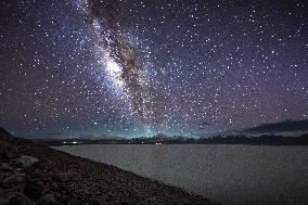
This photo taken on August 14, 2025 shows the Milky Way above Baiku Co in Xigaze City, southwest China's Xizang Autonomous Region. Baiku Co, with a water area of approximately 300 square kilometers, has its lake surface at an altitude of 4,590 meters. Thanks to the excellent air quality on the plateau, the Milky Way is clearly visible in the starry sky at the end of summer and the beginning of autumn, forming a magnificent scene together with the lake and snow-capped mountains. Photo by Ma Lichao/Xinhua/ABACAPRESS.COM

  •  
Magnificent Milky Way Scenery - China

Magnificent Milky Way Scenery - China

This photo taken on August 14, 2025 shows the Milky Way and a meteor shower above Baiku Co in Xigaze City, southwest China's Xizang Autonomous Region. Baiku Co, with a water area of approximately 300 square kilometers, has its lake surface at an altitude of 4,590 meters. Thanks to the excellent air quality on the plateau, the Milky Way is clearly visible in the starry sky at the end of summer and the beginning of autumn, forming a magnificent scene together with the lake and snow-capped mountains. Photo by Ma Lichao/Xinhua/ABACAPRESS.COM

  •  
Magnificent Milky Way Scenery - China

Magnificent Milky Way Scenery - China

This photo taken on August 14, 2025 shows the Milky Way above Baiku Co in Xigaze City, southwest China's Xizang Autonomous Region. Baiku Co, with a water area of approximately 300 square kilometers, has its lake surface at an altitude of 4,590 meters. Thanks to the excellent air quality on the plateau, the Milky Way is clearly visible in the starry sky at the end of summer and the beginning of autumn, forming a magnificent scene together with the lake and snow-capped mountains. Photo by Ma Lichao/Xinhua/ABACAPRESS.COM

  •  
Magnificent Milky Way Scenery - China

Magnificent Milky Way Scenery - China

This photo taken on August 14, 2025 shows the Milky Way above Baiku Co in Xigaze City, southwest China's Xizang Autonomous Region. Baiku Co, with a water area of approximately 300 square kilometers, has its lake surface at an altitude of 4,590 meters. Thanks to the excellent air quality on the plateau, the Milky Way is clearly visible in the starry sky at the end of summer and the beginning of autumn, forming a magnificent scene together with the lake and snow-capped mountains. Photo by Ma Lichao/Xinhua/ABACAPRESS.COM

  •  
Festival in northeastern Japan

Festival in northeastern Japan

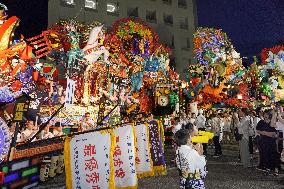
Decorated floats are lined up in Hachinohe in Aomori Prefecture, northeastern Japan, on July 31, 2025, as the annual Hachinohe Sansha Taisai festival kicks off. The floats, each 11 meters high and 8 meters wide, will be paraded for three days starting the following day as part of the five-day festival, which dates back around 300 years and, in 2016, was inscribed on UNESCO's Intangible Cultural Heritage list.

  •  
Festival in northeastern Japan

Festival in northeastern Japan

Decorated floats are lined up in Hachinohe in Aomori Prefecture, northeastern Japan, on July 31, 2025, as the annual Hachinohe Sansha Taisai festival kicks off. The floats, each 11 meters high and 8 meters wide, will be paraded for three days starting the following day as part of the five-day festival, which dates back around 300 years and, in 2016, was inscribed on UNESCO's Intangible Cultural Heritage list.

  •  
Festival in northeastern Japan

Festival in northeastern Japan

Decorated floats are lined up in Hachinohe in Aomori Prefecture, northeastern Japan, on July 31, 2025, as the annual Hachinohe Sansha Taisai festival kicks off. The floats, each 11 meters high and 8 meters wide, will be paraded for three days starting the following day as part of the five-day festival, which dates back around 300 years and, in 2016, was inscribed on UNESCO's Intangible Cultural Heritage list.

  •  
Festival in northeastern Japan

Festival in northeastern Japan

Decorated floats are lined up in Hachinohe in Aomori Prefecture, northeastern Japan, on July 31, 2025, as the annual Hachinohe Sansha Taisai festival kicks off. The floats, each 11 meters high and 8 meters wide, will be paraded for three days starting the following day as part of the five-day festival, which dates back around 300 years and, in 2016, was inscribed on UNESCO's Intangible Cultural Heritage list.

  •  
Snake festival in eastern Japan

Snake festival in eastern Japan

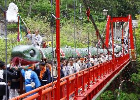
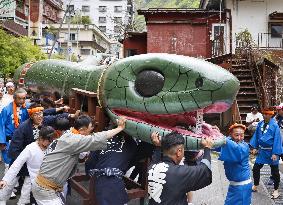
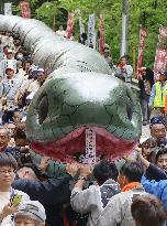
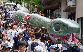
About 300 high school students carry a snake-shaped float during a festival at the Oigami hot spring resort in Numata, Gunma Prefecture, eastern Japan, on May 9, 2025, the year of the snake in the Chinese zodiac. The float, 108 meters long, has been recognized by Guinness World Records as the world's longest snake float used for a festival.

  •  
Snake festival in eastern Japan

Snake festival in eastern Japan

About 300 high school students carry a snake-shaped float during a festival at the Oigami hot spring resort in Numata, Gunma Prefecture, eastern Japan, on May 9, 2025, the year of the snake in the Chinese zodiac. The float, 108 meters long, has been recognized by Guinness World Records as the world's longest snake float used for a festival.

  •  
Snake festival in eastern Japan

Snake festival in eastern Japan

About 300 high school students carry a snake-shaped float during a festival at the Oigami hot spring resort in Numata, Gunma Prefecture, eastern Japan, on May 9, 2025, the year of the snake in the Chinese zodiac. The float, 108 meters long, has been recognized by Guinness World Records as the world's longest snake float used for a festival.

  •  
Snake festival in eastern Japan

Snake festival in eastern Japan

About 300 high school students carry a snake-shaped float during a festival at the Oigami hot spring resort in Numata, Gunma Prefecture, eastern Japan, on May 9, 2025, the year of the snake in the Chinese zodiac. The float, 108 meters long, has been recognized by Guinness World Records as the world's longest snake float used for a festival.

  •  
Future location of Herro wind farm

Future location of Herro wind farm

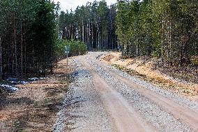
Uniküla, 08.04.2025. An area where Herro wind farm with nearly 300 meters high turbines is planned. Photo Arvo Meeks, Lõuna-Eesti Postimees

  •  
Future location of Herro wind farm

Future location of Herro wind farm

Uniküla, 08.04.2025. An area where Herro wind farm with nearly 300 meters high turbines is planned. Photo Arvo Meeks, Lõuna-Eesti Postimees

  •  
Future location of Herro wind farm

Future location of Herro wind farm

Uniküla, 08.04.2025. An area where Herro wind farm with nearly 300 meters high turbines is planned. Photo Arvo Meeks, Lõuna-Eesti Postimees

  •  
Future location of Herro wind farm

Future location of Herro wind farm

Uniküla, 08.04.2025. An area where Herro wind farm with nearly 300 meters high turbines is planned. Photo Arvo Meeks, Lõuna-Eesti Postimees

  •  
Future location of Herro wind farm

Future location of Herro wind farm

Uniküla, 08.04.2025. An area where Herro wind farm with nearly 300 meters high turbines is planned. Photo Arvo Meeks, Lõuna-Eesti Postimees

  •  
Future location of Herro wind farm

Future location of Herro wind farm

Uniküla, 08.04.2025. An area where Herro wind farm with nearly 300 meters high turbines is planned. Photo Arvo Meeks, Lõuna-Eesti Postimees

  •  
Future location of Herro wind farm

Future location of Herro wind farm

Uniküla, 08.04.2025. An area where Herro wind farm with nearly 300 meters high turbines is planned. Photo Arvo Meeks, Lõuna-Eesti Postimees

  •  
Future location of Herro wind farm

Future location of Herro wind farm

Uniküla, 08.04.2025. An area where Herro wind farm with nearly 300 meters high turbines is planned. Photo Arvo Meeks, Lõuna-Eesti Postimees

  •  
Future location of Herro wind farm

Future location of Herro wind farm

Uniküla, 08.04.2025. An area where Herro wind farm with nearly 300 meters high turbines is planned. Photo Arvo Meeks, Lõuna-Eesti Postimees

  •  

US: Kilauea’s Spectacular Lava Fountains Attract Onlookers in Hawaii

During a recent eruptive episode, Kilauea volcano in Hawaii ejected a lava fountain that reached a height of 1,000 feet (300 meters), attracting spectators.

  •  
The Sexiest Bridge Shaped Like Chinese Knotting in Changsha

The Sexiest Bridge Shaped Like Chinese Knotting in Changsha

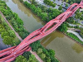
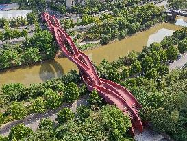
CHANGSHA, CHINA - SEPTEMBER 9, 2024 - An aerial footage shows the sexiest bridge shaped like Chinese knotting built with 800 tons of steel at a cost of 300 million yuan on the Longwangang River beside Meixi Lake in Changsha, Central China's Hunan province, Sept 9, 2024. The bridge has a total of 3 walking paths and 5 nodes, consisting of a straight "walking path" and an arched "hiking path". The middle path is the gentler, while the east-west path takes three up and three down. With a total length of 183.95 meters, a total width of 11.5 meters and a height of about 24 meters, the bridge is made of more than 800 tons of different types of square steel, each of which is irregular shaped steel. Inspired by the classic Moebius ring and ancient folk art Chinese knotting, it has been selected as one of the top ten "sexiest buildings in the world" by CNN.

  •  
The Sexiest Bridge Shaped Like Chinese Knotting in Changsha

The Sexiest Bridge Shaped Like Chinese Knotting in Changsha

CHANGSHA, CHINA - SEPTEMBER 9, 2024 - An aerial footage shows the sexiest bridge shaped like Chinese knotting built with 800 tons of steel at a cost of 300 million yuan on the Longwangang River beside Meixi Lake in Changsha, Central China's Hunan province, Sept 9, 2024. The bridge has a total of 3 walking paths and 5 nodes, consisting of a straight "walking path" and an arched "hiking path". The middle path is the gentler, while the east-west path takes three up and three down. With a total length of 183.95 meters, a total width of 11.5 meters and a height of about 24 meters, the bridge is made of more than 800 tons of different types of square steel, each of which is irregular shaped steel. Inspired by the classic Moebius ring and ancient folk art Chinese knotting, it has been selected as one of the top ten "sexiest buildings in the world" by CNN.

  • Main
  • Top
  • Editorial
  • Creative
  • About Us
  • About ILG
  • Terms of use
  • Company
  • BEHIND
  • Price List
  • Single Plan
  • Monthly Plan
  • Services
  • Shooting
  • Rights Clearance
  • Support
  • FAQ
  • How To Buy
  • Contact Us
  • Become a Partner

© KYODO NEWS IMAGES INC

All Rights Reserved.

  • Editorial
  • Olympics
  • News
  • Sports
  • Japan
  • Tech
  • Royal
  • Disaster
  • NorthKorea
  • Old Japan
  • SNS
  • Creative
  • Food
  • Japan
  • Landscape
  • Animal
  • Popular
  • #Ukraine
  • #China
  • #coronavirus
  • #N. Korea
  • #Thailand
  • #Russia
  • #Ukraine
  • #China
  • #coronavirus
  • #N. Korea
  • #Thailand
  • #Russia
  • Food
  • Japan
  • Landscape
  • Animal
  • Olympics
  • News
  • Sports
  • Japan
  • Tech
  • Royal
  • Disaster
  • NorthKorea
  • Old Japan
  • SNS