•  

Storm Kathleen Brings Strong Winds, High Waves To Ireland, UK Coasts 2

Storm Kathleen brought strong winds to Ireland, Northern Ireland, Scotland and parts of western England on Saturday, April 6. Videos posted on social media show big waves hitting the coasts across the regions.

  •  
Bigo Tomotsu

Bigo Tomotsu

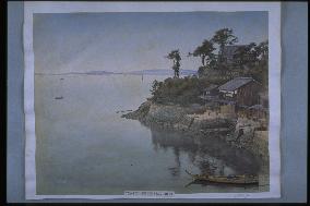
This is a view of Taiga Island, east of Tomo Port at Fukuyama, looking from Higashihama. Taigashima Castle was the headquarters of the Southern Court during the Southern and Northern Court Period (1336-92). During the Edo period, Enpukuji Temple was founded and a watch station was built to monitor boats coming in and out of Tomo Port. This photograph captures the boat docks with stairs behind the shop. Due to land reclamation these no longer exist.==Date:unknown, Place:Hiroshima, Photo:Uchida Kuichi, (Credit:Nagasaki University Library/Kyodo News Images) [Cabinet Number66‐2‐2]

  •  
The inner moat of the Imperial Palace

The inner moat of the Imperial Palace

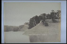
View of Koji-machi and Hanzo-mon from the west side of Soto Sakurada-mon. The area where the Imperial Palace (former Edo Castle) faces the inner moat (Sakurada Moat) is called Hachimaki Doi. The stone wall was constructed only on the upper portion, and the rest was a gently curving earthen embankment. Old pines still remain inside the stone walls, and this is one of the most beautiful spots in Tokyo. The Watari watchtower of Hanzo-mon, which was removed in 1871, is visible, indicating that this photograph was taken at the beginning of the Meiji Period. The photographer is Felix Beato.==Date:unknown, Place:Tokyo, Photo:F. Beato, (Credit:Nagasaki University Library/Kyodo News Images) [Cabinet Number62‐35‐0]

  •  
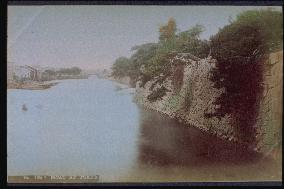
The outer moat of the Imperial Palace

The outer moat of the Imperial Palace

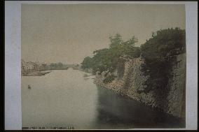
Southern view from the riverbank in Honmachi, near Tokiwa Bridge. Two waterways intersect here and, although not visible, a stone bridge called Ikkokubashi was located on the left spanning the canal which eventually becomes Nihonbashi River. The gap in the wall on the right is Dosan Moat, which originates from Ryunokuchi where the excess water from the inside moats is released. The moat was filled in around 1909. The outer moats beyond Nihonbashi River were filled in after World War II. Consequently, the waterway intersection can no longer be seen. Taken in the mid-Meiji Period. Same as photograph #2199.==Date:unknown, Place:Tokyo, Photo:unknown, (Credit:Nagasaki University Library/Kyodo News Images) [Cabinet Number59‐77‐0]

  •  
The lotus moat of the Imperial Palace

The lotus moat of the Imperial Palace

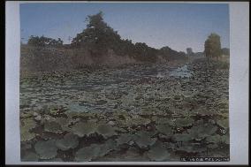
Hasuike (Lotus Pond) Moat between Honmaru and Koyozan. The height of the stone wall on the left indicates that the Honmaru Palace is on that side and therefore that this is a view of Hasuike-mon looking southeast from Shita-mon at Koyozan. Taken by Kusakabe Kinbei, probably between 1877 and 1887 (second decade of the Meiji Period).==Date:unknown, Place:Tokyo, Photo:unknown, (Credit:Nagasaki University Library/Kyodo News Images) [Cabinet Number59‐14‐0]

  •  
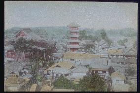
Osu Kannon Temple and the five-story pagoda

Osu Kannon Temple and the five-story pagoda

Honmachi Dori, which connects Nagoya Castle and Atsuta, was the main street in Nagoya during the Edo Period. Osu Kannon is located on the west side of Honmachi Dori. This photograph was taken from south of Osu Kannon. The buildings are (from the left) the main hall, five-story pagoda, and study. The kuri (priests' quarters) is in the background to the right. The theatre is in the right foreground. The Nio Gate is on the far right. Nagoya Castle is visible in the distance to the north between the main hall and the pagoda. A picture postcard using a similar photograph is entitled, View of Osu Kannon taken on May 12, 1880 and published by Zentokuji Temple. This photograph was probably taken around the same time. It is the same photograph #4145.==Date:unknown, Place:Nagoya, Photo:Tamamura Kozaburo, (Credit:Nagasaki University Library/Kyodo News Images) [Cabinet Number48‐121‐0]

  •  
Stonewalls along the moat

Stonewalls along the moat

View of the outer moat of Edo Castle looking south from the eastern edge of Tokiwa Bridge, with Gofuku Bridge in the distance to the south. The Gofuku-bashi Gomon Gate was removed in 1873, and the wooden bridge was replaced with a stone bridge in 1880. This photograph was therefore taken after 1880. The break in the middle of the stone wall on the right is the junction of the Dosan Moat and the outer moat. Zenikame Bridge is to the right.==Date:unknown, Place:Tokyo, Photo:Tamamura Kozaburo, (Credit:Nagasaki University Library/Kyodo News Images) [Cabinet Number48‐52‐0]

  •  
The inner moat of the Imperial Palace

The inner moat of the Imperial Palace

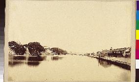
Deep green trees cast a shadow on the moat. The location of the place in the photo is unknown.==Date:unknown, Place:Tokyo, Photo:unknown, (Credit:Nagasaki University Library/Kyodo News Images) [Cabinet Number31‐63‐0]

  •  
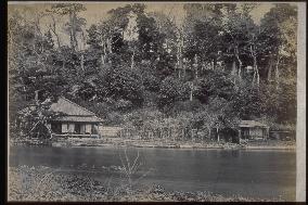
The inner moat of the Imperial Palace

The inner moat of the Imperial Palace

The shore on the other side of the turret with water quails swimming. A building(a study?) can be seen to the left and another to the right (tea house?). High trees stand in the background. The exact location is unknown.==Date:unknown, Place:Tokyo, Photo:unknown, (Credit:Nagasaki University Library/Kyodo News Images) [Cabinet Number22‐13‐0]

  •  
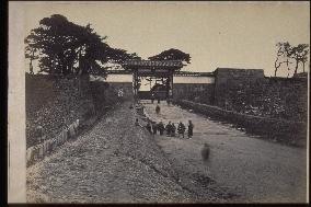
Akasakamon gate

Akasakamon gate

One of the castle gates and approach to Edo Castle. Kuroda built the square shape in 1636, and the gate was restored by Kato and Ogawa in 1639. The description in Edo Meisho says: This gate has a good view of the Big Dipper, so it is an excellent strategic point within Edo Castle. A very similar photo can be seen on page 53 of the Kadokawa Nihon Chimei Daijiten (The Kadokawa Dictionary of Japanese Geographic Names), saying it is a photo taken by the Englishman Black in 1872.==Date:unknown, Place:Tokyo, Photo:unknown, (Credit:Nagasaki University Library/Kyodo News Images) [Cabinet Number22‐11‐0]

  •  
The moat around Edo Castle

The moat around Edo Castle

View of Babasaki Gate from the vicinity of Hibiya-gomon Gate. The building on the right is the former main residence of the Ikeda family of Inaba Tottori Clan. It was acquired for military purposes in 1869 and became the Army Ministry three years later. This area is now Marunouchi 3-chome, site of the Teikoku Theatre and Tokyo Kaikan Hall. The street by the moat is now Hibiya Dori. The masugata (square plot of land in between the first and second castle gates) of Babasaki Gate and the Babasaki Gate Bridge were removed in 1906 as part of the construction of Gaisen Doro. Taken in 1868.==Date:unknown, Place:Tokyo, Photo:F. Beato, (Credit:Nagasaki University Library/Kyodo News Images) [Cabinet Number104‐8‐0]

  • Main
  • Top
  • Editorial
  • Creative
  • About Us
  • About ILG
  • Terms of use
  • Company
  • BEHIND
  • Price List
  • Single Plan
  • Monthly Plan
  • Services
  • Shooting
  • Rights Clearance
  • Support
  • FAQ
  • How To Buy
  • Contact Us
  • Become a Partner

© KYODO NEWS IMAGES INC

All Rights Reserved.

  • Editorial
  • Olympics
  • News
  • Sports
  • Japan
  • Tech
  • Royal
  • Disaster
  • NorthKorea
  • Old Japan
  • SNS
  • Creative
  • Food
  • Japan
  • Landscape
  • Animal
  • Popular
  • #Ukraine
  • #Thailand
  • #coronavirus
  • #N. Korea
  • #Russia
  • #China
  • #Ukraine
  • #Thailand
  • #coronavirus
  • #N. Korea
  • #Russia
  • #China
  • Food
  • Japan
  • Landscape
  • Animal
  • Olympics
  • News
  • Sports
  • Japan
  • Tech
  • Royal
  • Disaster
  • NorthKorea
  • Old Japan
  • SNS