•  
Broken embankment repaired

Broken embankment repaired

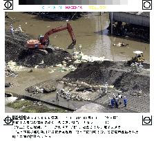
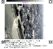
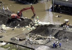
NAGOYA, Japan - Men work Sept. 13 to repair the broken embankment of the Shin River running through Nagoya's Nishi Ward which flooded the city's wide areas in the wake of the heaviest rainfall in almost a century.

  •  
Nagoya areas struggle after heaviest rainfall

Nagoya areas struggle after heaviest rainfall

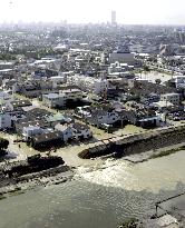
NAGOYA, Japan - Work gets under way Sept. 13 to repair the broken embankment of the Shin River running through Nagoya's Nishi Ward which had flooded the city's residential areas in the wake of the heaviest rainfall in almost a century. The rainstorm, triggered by typhoon Saomai and aggravated by an autumnal rain front, caused at least 436 landslides, damaged roads at 171 locations, swept away 12 bridges and broke 18 embankments.

  •  
Nunobiki Falls

Nunobiki Falls

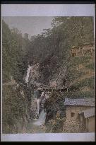
Medaki waterfall at Nunobiki Falls, taken sometime between the early and mid-Meiji Period. Although it is tinted differently, this is the same as photograph #2807, #4481 and #4682. The flow from Odaki to Medaki turns into the Shin Ikuta River and eventually pours into the sea. Many water mills for polishing rice were located downstream from this area.==Date:unknown, Place:Kobe, Photo:unknown, (Credit:Nagasaki University Library/Kyodo News Images) [Cabinet Number96‐45‐0]

  •  
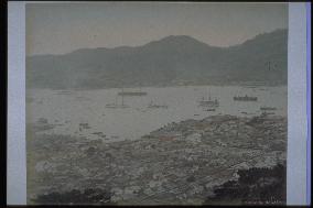
The city of Nagasaki and Nagasaki Harbour

The city of Nagasaki and Nagasaki Harbour

Many buildings were built on the Umegasaki landfill area on the left. The Nagasaki Custom House is also visible dockside. Western-style buildings have been built by the Shinchi sea side and an embankment is in the process of being built behind the buildings. Shin-Ohashi Bridge, constructed in 1869 at the mouth of Nakashima River before redirection work, is visible. A new western-style building is constructed on Dejima across from Tsukimachi. However, neither Mii Church built in 1876 nor the bell tower of Seikokai Theology School built in 1878 is visible. Therefore, this photo must have been taken around 1872. This is a bird's-eye view from Mt. Kazagashira of a typical view of Nagasaki around the beginning of the Meiji period.==Date:1873, Place:Nagasaki, Photo:Uchida Kuichi, (Credit:Nagasaki University Library/Kyodo News Images)

  •  
The central district of Nagasaki and Nagasaki Harbour

The central district of Nagasaki and Nagasaki Harbour

This photo was taken from the southern tip of Mt. Kazagashira around 1893 after the first Nagasaki port improvement project. Nakashima River had been redirected behind Dejima and Shin-Kawaguchi Bridge was constructed at the mouth of the river in 1890. Dozan river was redirected to flow north of Shinchi. There are big trading company buildings along the Shinchi coast. This photo shows the center of Nagasaki city around mid-Meiji when the city was growing rapidly.==Date:Middle Meiji (1883-1897), Place:Nagasaki, Photo:unknown, (Credit:Nagasaki University Library/Kyodo News Images) [Cabinet Number75‐9‐0]

  •  
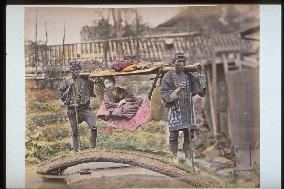
A woman in a basket palanquin

A woman in a basket palanquin

A mountain palanquin crosses the small bridge over the small river in the town. Two palanquin carriers may be the same as on the photo numbered 40-30.==Date:unknown, Place:unknown, Photo:Suzuki Shin-ichi, (Credit:Nagasaki University Library/Kyodo News Images) [Cabinet Number41‐28‐0]

  •  
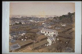
The Kannai foreign settlement seen from the hundred steps of Motomachi,Yokohama

The Kannai foreign settlement seen from the hundred steps of Motomachi,Yokohama

A panorama photo of the Hyakudanue in Motomachi was taken of the Yokohama settlement at the end of the Edo era and the early Meiji era. The fore is Motomachi, and the foreign settlement can be seen over the Hori River.==Date:unknown, Place:Yokohama, Photo:Suzuki Shin-ichi, (Credit:Nagasaki University Library/Kyodo News Images) [Cabinet Number41‐17‐0]

  •  
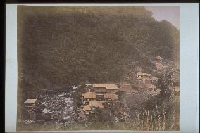
Tonosawa Spa

Tonosawa Spa

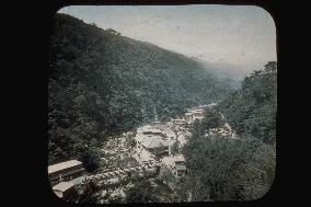
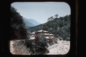
A view of Tonosawa spa from the mountain near the present Tonosawa station of the Hakone Tozan railway. Across the Haya River are the Azumaya to the left, and to the right can be seen the present Fukujuro (could be Tamanoyu at the time). Tonosawa prospered as a large spa before the war.==Date:unknown, Place:Hakone, Photo:Suzuki Shin-ichi, (Credit:Nagasaki University Library/Kyodo News Images) [Cabinet Number41‐18‐0]

  •  
Tonosawa Spa

Tonosawa Spa

A photo of Sawa Spa with Chitose Bridge over Haya River at the centre. To the left of the bridge is the Gyokusendo (presently the Shin Tamanoyu), to the right is Tamanoyu (presently Fukujuro in Tonosawa), and to the rear is Ichinoyu, Suzuki (presently Kansuiro), Fujiya and the former Fukujuro etc.==Date:unknown, Place:Hakone, Photo:unknown, (Credit:Nagasaki University Library/Kyodo News Images) [Cabinet Number31‐25‐0]

  •  
Tonosawa Spa

Tonosawa Spa

A photo taken from the former Prefectural Tourist Building in the direction upstream of Haya River. The hotel in the centre is Shin Tamanoyu. The hall of Katsureizan can be seen over it. The road to the left corrresponds to the present National Route 1, and since electric poles can be seen, this photo was taken after 1892.==Date:unknown, Place:Hakone, Photo:unknown, (Credit:Nagasaki University Library/Kyodo News Images) [Cabinet Number31‐2‐0]

  •  
The mouth of Nakashima River

The mouth of Nakashima River

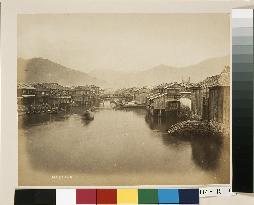
Before 1887, the mouth of Nakashima River was the area where the Eighteenth Bank presently stands. This is the view upstream from Shin-Ohashi Bridge, which was built at the mouth of the river in 1869. Chokyu Bridge is seen in the centre, with Tsuki-machi on the left and Nishihamano-machi on the right. The volume of water was obviously much greater then than it is now. Indeed, Nakashima River was used as a water route to transport goods. The date is the early Meiji Period.==Date:unknown, Place:Nagasaki, Photo:unknown, (Credit:Nagasaki University Library/Kyodo News Images) [Cabinet Number114‐15‐0]

  •  
The city of Nagasaki and Nagasaki Harbour

The city of Nagasaki and Nagasaki Harbour

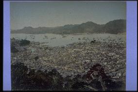
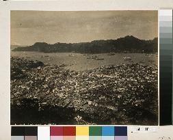
This is a view from Mt. Kazagashira looking over Nagasaki Harbour toward the Akunoura area. The hill with many trees on the left is Higashiyamate, while Dejima Island is seen to the right of centre. Shin-Ohashi Bridge built in 1869 is seen at the mouth of Nakashima River. The photograph portrays the tiled rooftops of Nagasaki reinforced with white plaster around 1880.==Date:unknown, Place:Nagasaki, Photo:unknown, (Credit:Nagasaki University Library/Kyodo News Images) [Cabinet Number114‐16‐0]

  •  
Panoramic view of Nagasaki Harbour from across the shore

Panoramic view of Nagasaki Harbour from across the shore

This is a three-panel panoramic photograph depicting Ohato, Shinchi, the Oura waterfront, Matsugae Bridge, Minamiyamate, Kozone, Naminohira and Furukawa-machi. Shin-Ohashi, Umegasaki and Matsugae bridges have been built as part of the re-routing of Nakashima River, indicating that the date is around 1887. The left panel captures the entire view of Dejima, Shin-ohashi Bridge, Shinchi and Umegasaki, the centre panel the area from Umegasaki to Minamiyamate, the Russian Consulate and the central part of the foreign settlement, and the right panel the area from the central part of the foreign settlement to Furukawa-machi. The southern end of the Minamiyamate neighbourhood area is visible.==Date:unknown, Place:Nagasaki, Photo:unknown, (Credit:Nagasaki University Library/Kyodo News Images) [Cabinet Number107‐1‐0]

  •  
Panoramic view of Nagasaki Harbour from across the shore

Panoramic view of Nagasaki Harbour from across the shore

This is a three-panel panoramic photograph depicting Ohato, Shinchi, the Oura waterfront, Matsugae Bridge, Minamiyamate, Kozone, Naminohira and Furukawa-machi. Shin-Ohashi, Umegasaki and Matsugae bridges have been built as part of the re-routing of Nakashima River, indicating that the date is around 1887. The left panel captures the entire view of Dejima, Shin-ohashi Bridge, Shinchi and Umegasaki, the centre panel the area from Umegasaki to Minamiyamate, the Russian Consulate and the central part of the foreign settlement, and the right panel the area from the central part of the foreign settlement to Furukawa-machi. The southern end of the Minamiyamate neighbourhood area is visible.==Date:unknown, Place:Nagasaki, Photo:unknown, (Credit:Nagasaki University Library/Kyodo News Images) [Cabinet Number107‐1‐0]

  •  
Panoramic view of Nagasaki Harbour from across the shore

Panoramic view of Nagasaki Harbour from across the shore

This is a three-panel panoramic photograph depicting Ohato, Shinchi, the Oura waterfront, Matsugae Bridge, Minamiyamate, Kozone, Naminohira and Furukawa-machi. Shin-Ohashi, Umegasaki and Matsugae bridges have been built as part of the re-routing of Nakashima River, indicating that the date is around 1887. The left panel captures the entire view of Dejima, Shin-ohashi Bridge, Shinchi and Umegasaki, the centre panel the area from Umegasaki to Minamiyamate, the Russian Consulate and the central part of the foreign settlement, and the right panel the area from the central part of the foreign settlement to Furukawa-machi. The southern end of the Minamiyamate neighbourhood area is visible.==Date:unknown, Place:Nagasaki, Photo:unknown, (Credit:Nagasaki University Library/Kyodo News Images) [Cabinet Number107‐1‐0]

  •  
Nagoya areas struggle after heaviest rainfall

Nagoya areas struggle after heaviest rainfall

NAGOYA, Japan - Work gets under way Sept. 13 to repair the broken embankment of the Shin River running through Nagoya's Nishi Ward which had flooded the city's residential areas in the wake of the heaviest rainfall in almost a century. The rainstorm, triggered by typhoon Saomai and aggravated by an autumnal rain front, caused at least 436 landslides, damaged roads at 171 locations, swept away 12 bridges and broke 18 embankments.

  •  
Broken embankment repaired

Broken embankment repaired

NAGOYA, Japan - Men work Sept. 13 to repair the broken embankment of the Shin River running through Nagoya's Nishi Ward which flooded the city's wide areas in the wake of the heaviest rainfall in almost a century.

  • Main
  • Top
  • Editorial
  • Creative
  • About Us
  • About ILG
  • Terms of use
  • Company
  • BEHIND
  • Price List
  • Single Plan
  • Monthly Plan
  • Services
  • Shooting
  • Rights Clearance
  • Support
  • FAQ
  • How To Buy
  • Contact Us
  • Become a Partner

© KYODO NEWS IMAGES INC

All Rights Reserved.

  • Editorial
  • Olympics
  • News
  • Sports
  • Japan
  • Tech
  • Royal
  • Disaster
  • NorthKorea
  • Old Japan
  • SNS
  • Creative
  • Food
  • Japan
  • Landscape
  • Animal
  • Popular
  • #Ukraine
  • #China
  • #coronavirus
  • #N. Korea
  • #Russia
  • #Thailand
  • #Ukraine
  • #China
  • #coronavirus
  • #N. Korea
  • #Russia
  • #Thailand
  • Food
  • Japan
  • Landscape
  • Animal
  • Olympics
  • News
  • Sports
  • Japan
  • Tech
  • Royal
  • Disaster
  • NorthKorea
  • Old Japan
  • SNS