•  

Storm Kathleen Brings Strong Winds, High Waves To Ireland, UK Coasts 2

Storm Kathleen brought strong winds to Ireland, Northern Ireland, Scotland and parts of western England on Saturday, April 6. Videos posted on social media show big waves hitting the coasts across the regions.

  •  
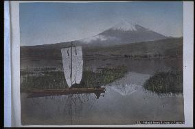
Mt. Fuji seen from Kashiwabara

Mt. Fuji seen from Kashiwabara

Northern view of the snow-capped peak of Mt. Fuji from Ukishimanuma (Floating Island Bog) near Kashiwabara-Shinden in Fuji City. The water from the bog becomes Numa River and flows into Tagonoura harbour. The area surrounding Ukishimanuma was a marsh called Ukishimagahara. People moved around by boat, creating a water traffic network. Two men are riding a river boat with a sail.==Date:unknown, Place:Shizuoka, Photo:A. Farsari, (Credit:Nagasaki University Library/Kyodo News Images) [Cabinet Number81‐23‐0]

  •  
A view of the mouth of a river,Osaka

A view of the mouth of a river,Osaka

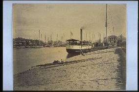
Kawaguchi Wharf. The port of Osaka was opened for foreign trade on July 15, 1868. The wharf was located about four kilometers upstream from the mouth of Anji River and later had a customs office and telegraph office. The ship is a paddle steamer. The Western-style buildings visible in the distance are part of the foreign settlement. Taken around 1888.==Date:unknown, Place:Osaka, Photo:Uchida Kuichi, (Credit:Nagasaki University Library/Kyodo News Images) [Cabinet Number66‐10‐0]

  •  
Mt. Fuji seen from Numakawa,Tagonoura

Mt. Fuji seen from Numakawa,Tagonoura

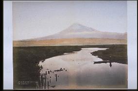
Northern view of Mt. Fuji from Ukishimanuma (Floating Island Bog) near Kashiwabara-Shinden in Fuji City. Ukishimagahara is the land surrounding Ukishimanuma Bog. The water from the bog becomes Numa River and flows into Tagonoura harbour. This photograph was taken near the origin of Numa River, with Mt. Fuji reflected upside down on the bog. The foot of Mt. Fuji is tinted roughly. There is a small boat on the right, and many wooden posts are visible on the left.==Date:unknown, Place:Shizuoka, Photo:unknown, (Credit:Nagasaki University Library/Kyodo News Images) [Cabinet Number64‐62‐0]

  •  
A traditional boat

A traditional boat

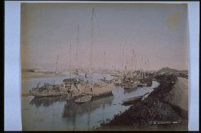
Wakayama City, located at the mouth of Kino River and called Kii Minato (Kii Port), was a meeting point for sea and river transportation. Many boats are docked around what appears to be Nezumijima Island. The mountains in the distance are the Izumi Range. The building on the hill on the right may be Wakayama Castle.==Date:unknown, Place:Wakayama, Photo:unknown, (Credit:Nagasaki University Library/Kyodo News Images) [Cabinet Number59‐71‐0]

  •  
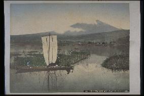
Mt. Fuji seen from Numakawa,Tagonoura

Mt. Fuji seen from Numakawa,Tagonoura

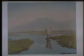
Northern view of Mt. Fuji from Ukishimanuma (Floating Island Bog) near Kashiwabara-Shinden in Fuji City. Ukishimanuma was formerly a stretch of low land between the southern foot of Mt. Fuji/Mt. Ashitaka and Suruga Bay. It flows into Numa River and Tagonoura harbour. Mt. Fuji and a sailboat are reflected on the pond. A man is on a small craft, with small islands scattered in the background.==Date:unknown, Place:Shizuoka, Photo:unknown, (Credit:Nagasaki University Library/Kyodo News Images) [Cabinet Number59‐48‐0]

  •  
Mt. Fuji seen from Numakawa,Tagonoura

Mt. Fuji seen from Numakawa,Tagonoura

Northern view of Mt. Fuji from Ukishimanuma (Floating Island Bog) near Kashiwabara-Shinden in Fuji City. Ukishimanuma was formerly a stretch of low land between the southern foot of Mt. Fuji/Mt. Ashitaka and Suruga Bay. It flows into Numa River and Tagonoura harbour. Mt. Fuji and a sailboat are reflected on the pond. A man is on a small craft, with small islands scattered in the background.==Date:unknown, Place:Shizuoka, Photo:unknown, (Credit:Nagasaki University Library/Kyodo News Images) [Cabinet Number59‐8‐2]

  •  
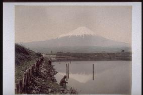
Mt. Fuji seen from Numakawa,Tagonoura

Mt. Fuji seen from Numakawa,Tagonoura

Northern view of snow-capped Mt. Fuji from the mouth of Numa River, which flows into Tagonoura Harbour in Fuji City. The location of Mt. Hoei indicates that this was developed from the wrong side of the negative. The piled stones on the left could be part of a stone gate. A retaining wall constructed of wooden posts and pebbles protect the riverbank. Two men are visible.==Date:unknown, Place:Shizuoka, Photo:unknown, (Credit:Nagasaki University Library/Kyodo News Images) [Cabinet Number47‐21‐0]

  •  
The central district of Nagasaki

The central district of Nagasaki

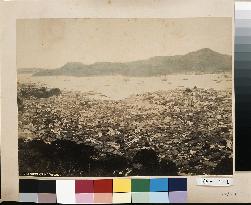
The old city and harbour of Nagasaki. The opposite bank is Inasa. Nakashima River fiows through the centre of the city. The stone bridges spanning the river can also be seen. The colours in this picture have changed to brownish tones, but it is probably the same picture as No. 21-4 and the original.==Date:Middle Meiji, Place:Nagasaki, Photo:Ueno Hikoma, (Credit:Nagasaki University Library/Kyodo News Images) [Cabinet Number21‐6‐0]

  •  
The central district of Nagasaki

The central district of Nagasaki

The old city and harbour of Nagasaki. The opposite bank is Inasa. Nakashima River flows through the centre of the city. The stone bridges spanning the river can also be seen. The white buildings in the center are normal schools and elementary schools. Probably a copy of the photo numbered 21-6.==Date:About 1879, Place:Nagasaki, Photo:unknown, (Credit:Nagasaki University Library/Kyodo News Images) [Cabinet Number21‐4‐0]

  •  
Center of NAGASAKI downtown and umegasaki settlement

Center of NAGASAKI downtown and umegasaki settlement

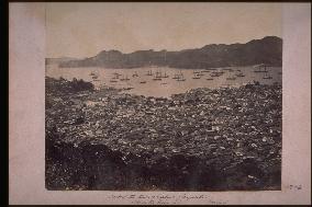
Written March 1866 by Beato. A wide view of the central part of Nagasaki and Dejima, Shinchi and Umegasaki from Mt.Kazagashira. There is no bridge at the mouth of Nakashima river, and the building of the Nishiyakusho is seen to the upper right. Shinchi is still skirtde on the rea by sea. There are many foreign ships in the harbour.==Date:1866, Place:Nagasaki, Photo:F. Beato, (Credit:Nagasaki University Library/Kyodo News Images) [Cabinet Number17‐2‐0]

  •  
A panoramic view of Nagasaki Harbour

A panoramic view of Nagasaki Harbour

A bird's eye view of the north part of the city from Kazagashira. Nakashima River was later diverted to the back of Dejima and now has a bridge built over it. The customs building is seen on the sea.The caption reads Nagasaki Harbour in English at the left corner. The photo was taken from the same angle as the photo numbered 21-10.==Date:unknown, Place:Nagasaki, Photo:Tamamura Kozaburo, (Credit:Nagasaki University Library/Kyodo News Images) [Cabinet Number11‐45‐0]

  •  
A panoramic view of Kobe

A panoramic view of Kobe

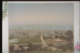
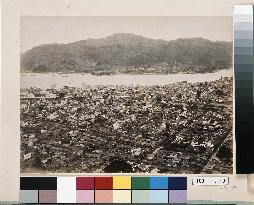
A view of Kobe Harbour from Yamate. On the occasion of the opening of the harbour to foreigners in 1861, the area to the east from Ikuta River to Uji River was designated as a foreign settlement. This area developed into what is now Kobe City.==Date:unknown, Place:Kobe, Photo:Ogawa Kazumasa, (Credit:Nagasaki University Library/Kyodo News Images) [Cabinet Number5‐47‐0]

  •  
The city of Nagasaki and Nagasaki Harbour

The city of Nagasaki and Nagasaki Harbour

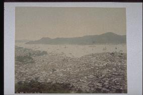
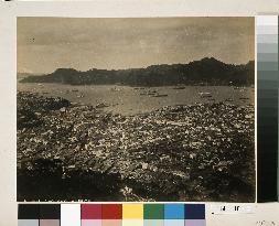
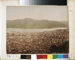
This is a view from Mt. Kazagashira looking over Nagasaki Harbour toward the Akunoura area. The hill with many trees on the left is Higashiyamate, while Dejima Island is seen to the right of centre. Shin-Ohashi Bridge built in 1869 is seen at the mouth of Nakashima River. The photograph portrays the tiled rooftops of Nagasaki reinforced with white plaster around 1880.==Date:unknown, Place:Nagasaki, Photo:unknown, (Credit:Nagasaki University Library/Kyodo News Images) [Cabinet Number114‐16‐0]

  •  
Panoramic view of NAGASAKI

Panoramic view of NAGASAKI

This panoramic photograph of central Nagasaki was taken from Mt. Kazagashira. This is the first of three panels (#5615-5617) showing the area from the elevation of Umegasaki, Nagasaki Prefecture Office and Nagasaki City Hall to the then high school (now Sakura-machi Primary School) and all the way to Suwa Shinto Shrine. The date is after 1893, because the re-routing of Nakashima River has been completed. This first panel depicts (from the left) Umegasaki, Nagasaki Customs, Shinchi, Dejima and Nakashima River (after the re-routing work), Nagasaki Prefecture Office and Nagasaki District Court.==Date:unknown, Place:Nagasaki, Photo:unknown, (Credit:Nagasaki University Library/Kyodo News Images) [Cabinet Number109‐1‐0]

  •  
Panoramic view of NAGASAKI

Panoramic view of NAGASAKI

This panoramic photograph of central Nagasaki was taken from Mt. Kazagashira. This is the first of three panels (#5615-5617) showing the area from the elevation of Umegasaki, Nagasaki Prefecture Office and Nagasaki City Hall to the then high school (now Sakura-machi Primary School) and all the way to Suwa Shinto Shrine. The date is after 1893, because the re-routing of Nakashima River has been completed. This third panel depicts (from the left) the area from Sakura-machi to the former high school and Suwa Shinto Shrine. Koeiji Temple is visible on the lower left along with the bridges Ichiran-bashi, Furumachi-bashi, Amigasa-bashi and Oide-bashi.==Date:unknown, Place:Nagasaki, Photo:unknown, (Credit:Nagasaki University Library/Kyodo News Images) [Cabinet Number109‐3‐0]

  •  
Panoramic view of NAGASAKI

Panoramic view of NAGASAKI

This panoramic photograph of central Nagasaki was taken from Mt. Kazagashira. This is the first of three panels (#5615-5617) showing the area from the elevation of Umegasaki, Nagasaki Prefecture Office and Nagasaki City Hall to the then high school (now Sakura-machi Primary School) and all the way to Suwa Shinto Shrine. The date is after 1893, because the re-routing of Nakashima River has been completed. This second panel depicts (from the left) the Court of Appeals, Nagasaki Commercial High School and Nagasaki City Hall. The stone bridges over Nakashima River are, from downstream, Fukuro-bashi, Megane-bashi and Susukihara-bashi.==Date:unknown, Place:Nagasaki, Photo:unknown, (Credit:Nagasaki University Library/Kyodo News Images) [Cabinet Number109‐2‐0]

  •  
Panoramic view of Nagasaki Harbour from across the shore

Panoramic view of Nagasaki Harbour from across the shore

This is a three-panel panoramic photograph depicting Ohato, Shinchi, the Oura waterfront, Matsugae Bridge, Minamiyamate, Kozone, Naminohira and Furukawa-machi. Shin-Ohashi, Umegasaki and Matsugae bridges have been built as part of the re-routing of Nakashima River, indicating that the date is around 1887. The left panel captures the entire view of Dejima, Shin-ohashi Bridge, Shinchi and Umegasaki, the centre panel the area from Umegasaki to Minamiyamate, the Russian Consulate and the central part of the foreign settlement, and the right panel the area from the central part of the foreign settlement to Furukawa-machi. The southern end of the Minamiyamate neighbourhood area is visible.==Date:unknown, Place:Nagasaki, Photo:unknown, (Credit:Nagasaki University Library/Kyodo News Images) [Cabinet Number107‐1‐0]

  •  
Panoramic view of Nagasaki Harbour from across the shore

Panoramic view of Nagasaki Harbour from across the shore

This is a three-panel panoramic photograph depicting Ohato, Shinchi, the Oura waterfront, Matsugae Bridge, Minamiyamate, Kozone, Naminohira and Furukawa-machi. Shin-Ohashi, Umegasaki and Matsugae bridges have been built as part of the re-routing of Nakashima River, indicating that the date is around 1887. The left panel captures the entire view of Dejima, Shin-ohashi Bridge, Shinchi and Umegasaki, the centre panel the area from Umegasaki to Minamiyamate, the Russian Consulate and the central part of the foreign settlement, and the right panel the area from the central part of the foreign settlement to Furukawa-machi. The southern end of the Minamiyamate neighbourhood area is visible.==Date:unknown, Place:Nagasaki, Photo:unknown, (Credit:Nagasaki University Library/Kyodo News Images) [Cabinet Number107‐1‐0]

  •  
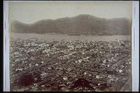
The north part of the city of Nagasaki and Nagasaki Harbour

The north part of the city of Nagasaki and Nagasaki Harbour

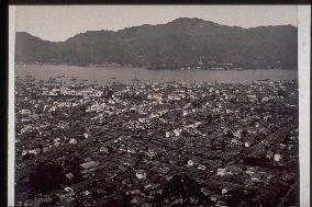
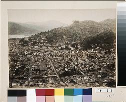
This photograph taken from Mt. Kazagashira captures the central part of Nagasaki and the elevated area where the Nagasaki Prefecture Office, Nagasaki City Hall and Daikoku-machi are situated, with Urakami Shinden on the right. The date is around 1887. Nakashima River is visible in the centre. This provides a view of the densely populated downtown area of Nagasaki city in the mid-Meiji Period.==Date:unknown, Place:Nagasaki, Photo:Tamamura Kozaburo, (Credit:Nagasaki University Library/Kyodo News Images) [Cabinet Number106‐41‐0]

  • Main
  • Top
  • Editorial
  • Creative
  • About Us
  • About ILG
  • Terms of use
  • Company
  • BEHIND
  • Price List
  • Single Plan
  • Monthly Plan
  • Services
  • Shooting
  • Rights Clearance
  • Support
  • FAQ
  • How To Buy
  • Contact Us
  • Become a Partner

© KYODO NEWS IMAGES INC

All Rights Reserved.

  • Editorial
  • Olympics
  • News
  • Sports
  • Japan
  • Tech
  • Royal
  • Disaster
  • NorthKorea
  • Old Japan
  • SNS
  • Creative
  • Food
  • Japan
  • Landscape
  • Animal
  • Popular
  • #Ukraine
  • #Thailand
  • #coronavirus
  • #N. Korea
  • #China
  • #Russia
  • #Ukraine
  • #Thailand
  • #coronavirus
  • #N. Korea
  • #China
  • #Russia
  • Food
  • Japan
  • Landscape
  • Animal
  • Olympics
  • News
  • Sports
  • Japan
  • Tech
  • Royal
  • Disaster
  • NorthKorea
  • Old Japan
  • SNS