•  

US: Massive Warehouse Fire Destroys Medline Distribution Center in Northern California

A massive fire broke out at a Medline distribution warehouse in Tracy, Northern California, on Thursday, June 11, destroying the one-million-square-foot facility and sending a large column of black smoke into the sky. The blaze started around 1 p.m. and prompted evacuations in the surrounding area.

  •  

China: Mazda Loses Tire During Attempted Overtake in Zhejiang

On May 11, 2026, in Zhejiang, eastern China, a dashcam captured a road accident on a curve. A red Mazda attempted to overtake a large truck by moving quickly to its left side. The overtake speed appeared excessive, causing one of the Mazda's tires to burst. The tire rolled toward a roadside guardrail while the car was left stopped, awaiting rescue.

  •  

China: Wedding Feast Carries On as Heavy Rain Floods Venue in Shaanxi

This unforgettable scene was captured in Weinan, Shaanxi Province, on May 18, 2026. It looks like a party on a river, but it’s actually an outdoor wedding feast. A sudden heavy downpour flooded the square with dozens of centimeters of water. Relatives and friends sit around dozens of round tables, watching the ceremony and waiting for the meal. Thankfully, the organizers set up cozy canopies and fences, keeping guests dry. Rain can’t stop love and blessings—everyone shows up in the storm to celebrate the newlyweds.

  •  

China: Off-Road Team Rescues Camel Trapped in Wire Fencing in Inner Mongolia

On April 24, 2026, in Chifeng, Inner Mongolia, a video captured a rescue mission unfolding along a desert crossing route from the sacred tree area of the Ulan Buh Desert to Ji’aobao. Members of an off-road team spotted a camel that had been stuck for three to four days, its leg tightly entangled in wire fencing. The team leader carefully crouched down and began cutting away the metal wires wrapped around the animal’s leg, taking care not to cause further injury. The camel appeared exhausted and weak, remaining motionless even after being freed, its legs stiff from prolonged restraint. The video ended with the camel gradually managing to stand up, wobbling at first before stabilizing itself as the rescuers looked on.

  •  

New Zealand: Landslide Hits Mount Maunganui 3

Six people, including two teenagers, are missing after a major landslide struck a local campground in Mount Maunganui on Thursday, January 22. Police are also seeking information on three others as search and rescue operations continue in a dangerous environment, with authorities describing the incident as a national tragedy and the community rallying to support affected families.

  •  

Philippines: Typhoon Kalmaegi Triggers Severe Flooding, Displacing Thousands 2

Severe flooding has submerged towns and displaced hundreds of thousands as Typhoon Kalmaegi battered the central Philippines. Rivers overflowed in Cebu and nearby islands, forcing residents onto rooftops while cars and containers were swept through the streets. Local officials said some evacuation centers were inundated, and many survivors of a recent earthquake had to be evacuated again. More than 380,000 people fled their homes across the Visayas, southern Luzon, and northern Mindanao. Kalmaegi, locally named Tino, made landfall late Monday, November 3 with winds of up to 130 kph before moving toward the South China Sea on Tuesday, November 4.

  •  

China: Tourists and Locals Rescue Yaks from Mud Pit in Qinghai

In Qinghai, China, tourists and locals joined forces with an excavator operator to rescue four yaks stuck in deep mud on September 30, 2025. After spotting the trapped animals, the tourists alerted a herdsman and enlisted help from a nearby construction site. Working for nearly an hour, they freed all four yaks safely. The herdsman said the rescue prevented losses of over RMB 40,000.

  •  

US: North Dakota Sees Powerful Winds Amid Tornado-Producing Storm

Severe weather swept across the upper Midwest on Friday, June 20, bringing powerful winds and leaving at least 3 dead in North Dakota as a tornado ripped through the area.

  •  

China: Typhoon Wutip Darkens Hainan Skies Ahead of Landfall in Hainan

This is the terrifying moment a massive wall of dark clouds engulfed the skies over Hainan as Typhoon Wutip approached southern China. On June 11, 2025, in Hainan, China, video captured thick, menacing clouds rolling in ahead of Typhoon Wutip's landfall. The sky turned eerily dark as the season’s first typhoon neared, creating a heavy, ominous atmosphere. The storm made landfall around 11 p.m. on June 13 along the coast of Dongfang, a city in Hainan, with winds reaching up to 30 meters per second and a central pressure of 980 hPa. Heavy rain swept through southern parts of the island, with some areas experiencing torrential downpours and localized extreme rainfall. According to China National Radio, by June 15, Typhoon Wutip had weakened into a tropical depression after moving inland into Jiangxi Province, and continued to lose strength. The video ends with the storm clouds blanketing the landscape as residents brace for the typhoon’s impact.

  •  

Japan: Heavy Snowfall Hits Sea Of Japan Coast 4

Heavy snowfall has battered a wide area of Japan, especially the Hokuriku region along the Sea of Japan coast. This video shows blizzard conditions in the city Otaru, Hokkaido.

  •  

US: EF-1 Tornado Touches Down In Athens, AL, Leaving Devastating Damage

The National Weather Service in Huntsville has confirmed that an EF-1 tornado touched down in downtown Athens, Alabama, on Saturday night, December 28.

  •  

Philippines: Typhoon Yinxing Makes Landfall In Cagayan, Damaging Infrastructure 3

Typhoon Yinxing, known as Marce in the Philippines, made landfall near Santa Ana, Cagayan, on Thursday afternoon, November 7, forcing more than 21,000 people to evacuate and damaging two domestic airports and homes. Telecommunications and power supplies have remained down due to damaged cables and power lines, severely affecting residents in the affected areas.

  •  

Philippines: Typhoon Yinxing Makes Landfall In Cagayan, Damaging Infrastructure 2

Typhoon Yinxing, known as Marce in the Philippines, made landfall near Santa Ana, Cagayan, on Thursday afternoon, November 7, forcing more than 21,000 people to evacuate and damaging two domestic airports and homes. Telecommunications and power supplies have remained down due to damaged cables and power lines, severely affecting residents in the affected areas.

  •  

Thailand: Overflowing Of Ping River Causes Flooding In Chiang Mai Amid Rainy Season 3

Water levels in the Ping River rose, causing severe flooding across Chiang Mai on September 25 and affecting infrastructure. Small vehicles were stranded on flooded roads, and local shops and stalls were forced to close.

  •  

US: Beryl Causes Widespread Power Outages And Flooding, Leaves Multiple Dead In Texas 4

Beryl has weakened into a tropical storm after making landfall as a category 1 hurricane near Matagorda in Texas, on Monday, July 8, shortly before 4 a.m. local time. The hurricane caused power outages and life-threatening flooding and left multiple dead in Houston and the surrounding areas.

  •  

US: Days-Long Winter Storm Dumps Heavy Snow On Sierra Nevada, Closing Roads, Schools

A days-long winter storm dumped heavy snow on the Sierra Nevada, closing major highways, ski resorts, and schools in parts of California. More than 10 feet of snow and hurricane-force wind gusts of 170 mph-plus were reported.

  •  

US: Strong Winter Storm Brings Blizzard Conditions To Sierra Nevada

A strong winter storm hit the Sierra Nevada on Friday, March 1, bringing heavy snow and high winds. Blizzard Warnings were issued for the Sierra, including Lake Tahoe and eastern Nevada. The Sierra Avalanche Center warned that the danger of avalanches was high. Yosemite National Park and many ski resorts in the region announced they were closing at least for the day.

  •  
More Than 2100 Killed By Earthquake Near Marrakech - Morocco

More Than 2100 Killed By Earthquake Near Marrakech - Morocco

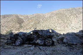
A car heavily damaged by the earthquake is left on the side of a road on the way to Ijjoukak village, near Marrakech. Al Haouz, Morocco on September 10, 2023. Photo by Youssef Boudlal/ABACAPRESS.COM

  •  

One Ukrainian evacuee dies in Italy after bus accident: media

STORY: One Ukrainian evacuee dies in Italy after bus accident: media DATELINE: March 14, 2022 LENGTH: 00:01:04 LOCATION: Rome CATEGORY: SOCIETY SHOTLIST: 1. various of firefighters STORYLINE: An accident involving a bus carrying Ukrainian evacuees in Italy left one woman dead on Sunday, according to multiple Italian media reports. Italian firefighters confirmed the accident, which took place early Sunday near the central Italian town of Forli, southeast of Bologna, but they did not confirm the death. Multiple media reports said the accident involved one of two buses carrying Ukrainian evacuees in Italy. A social media post from Italian firefighters said the bus involved in the accident drove off the road and flipped onto its side. Later in the day, officials used two cranes to pull the bus back into the road. The bus was reportedly carrying around 50 people who fled from Ukraine, including the woman who died after being crushed by the vehicle. The second of the two buses was not involved in the accide

  •  
Hiroshige - 53 Stations of the Tokaido - Print 52

Hiroshige - 53 Stations of the Tokaido - Print 52

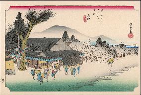
52 Ishibe - View of a tea-house on left, under a large tree, and travellers watching a man dancing; hills in background from graded colour-block, the lower part in mist. This station was one of the most desolate stations on the highway. The road-side restaurant offered travellers rice wine, rice boiled with leafy vegetables, and baked bean-curd coated with bean paste. Utagawa Hiroshige (1797 - 1858). The Fifty-Three Stations of the Tokaido - Hoeido edition (1831-4) Date: 1831 - 1834

  •  
Hiroshige - 53 Stations of the Tokaido - Print 15

Hiroshige - 53 Stations of the Tokaido - Print 15

15 Yoshiwara - A road lined with trees running through ricefields, along which a man leads a horse carrying three women; Fuji in the distance. This section of highway was lined with pine trees for the comfort of travellers. Through the trees, Mount Fuji was seen on the left-hand side of the highway and was popularly called "left Fuji". Utagawa Hiroshige (1797 - 1858). The Fifty-Three Stations of the Tokaido - Hoeido edition (1831-4) Date: 1831 - 1834

  •  

Okinawa.

Six years after Okinawa's reversion to the mainland, a major effort was made to change road signs to reflect the change from people left, cars right to people left, cars right at 6 a.m. on July 30. The film was released on August 4, 1978.

  •  
Valley at yumoto

Valley at yumoto

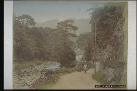
A view of Yumoto with the Haya River to the left from the right side of Asahi Bridge. The road between Yumoto and Miyanoshita by Yamaguchi Sennosuke of the Fujiya Hotel was completed at the end of 1887, and electric lights came to Yumoto in 1892, so from the rickshaws and lights in the photo, we can say that this was taken after 1892.==Date:unknown, Place:Hakone, Photo:Ogawa Kazumasa, (Credit:Nagasaki University Library/Kyodo News Images) [Cabinet Number7‐19‐0]

  •  
Kiga Spa

Kiga Spa

Since the new road opened in 1889 between Miyanoshita and Miyagino can not be seen, this is the spa town of Kiga prior to that time. Yakusuhido is where the torii gate is. Before that are the buildings of Kameya Inn, and Jindairo is on the right. Matsuzakaya Inn is across from it on the other side of Susawa River. The building with a white wall on the left is Chokairo of Matsuzakaya Inn. Finally the one in the foreground is Sengokuya Inn. Hayakawa is visible on the right and one of the outer mountain ranges of Hakone, Myojingadake, is visible.==Date:unknown, Place:Hakone, Photo:A. Farsari, (Credit:Nagasaki University Library/Kyodo News Images) [Cabinet Number82‐24‐0]

  •  
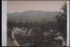
The city of Kyoto seen from Maruyama

The city of Kyoto seen from Maruyama

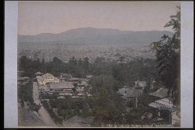
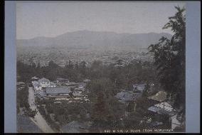
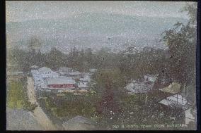
Western view of the northern part of Kyoto from the Yoshimizu Hot Spring building. The road stretching from the centre of the photo to the left corner is the approach to Yasaka Shinto Shrine. Although the site would later become Maruyama Park, no work has been done yet, and a few restaurants stand in the area. A two-story Western-style building of yosemune-zukuri style stands on the northeast side of the street where cherry blossoms would later become a tourist attraction. The Nishiyama Mountain Range is faintly visible in the background.==Date:unknown, Place:Kyoto, Photo:Tamamura Kozaburo, (Credit:Nagasaki University Library/Kyodo News Images) [Cabinet Number80‐3‐0]

  •  
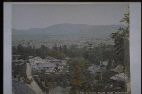
The city of Kyoto seen from Maruyama

The city of Kyoto seen from Maruyama

Western view of the northern part of Kyoto from the Yoshimizu Hot Spring building. The road stretching from the centre of the photo to the left corner is the approach to Yasaka Shinto Shrine. Although the site would later become Maruyama Park, no work has been done yet, and a few restaurants stand in the area. A two-story Western-style building of yosemune-zukuri style stands on the northeast side of the street where cherry blossoms would later become a tourist attraction. The Nishiyama Mountain Range is faintly visible in the background.==Date:unknown, Place:Kyoto, Photo:Tamamura Kozaburo, (Credit:Nagasaki University Library/Kyodo News Images) [Cabinet Number79‐5‐0]

  •  
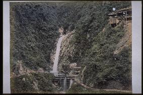
Nunobiki Falls

Nunobiki Falls

Medaki waterfall at Nunobiki Falls, taken around the same time as photograph #2271 (Shinkoji Temple), #4092 (Mt. Suwa), and #4094 (Arima Spa) in the mid-Meiji Period. Visitors normally took the path on the right side of the river and then proceeded along the road to the left to Medaki waterfall. After that, they crossed a wooden bridge and negotiated the winding mountain path to Odaki waterfall.==Date:unknown, Place:Kobe, Photo:Tamamura Kozaburo, (Credit:Nagasaki University Library/Kyodo News Images) [Cabinet Number68‐4‐2]

  •  
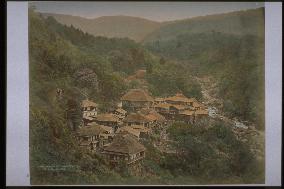
Kiga Spa

Kiga Spa

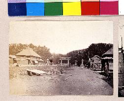
This is the spa town of Kiga before the new road to Miyagino opened in 1889. The torii gate a little far back is Yakushido ( a Buddhist temple hall housing a statue of the Buddha of healing,) and the building on the left is Yuyoin. The buildings before them belong to Kameya Inn. The house on the right is Jindairo. Matsuzakaya Inn is across from it on the other side of Susawa River. The building with a white wall on the left is Chokairo of Matsuzakaya Inn. Finally the one in the foreground is Sengokuya. Hayakawa Rver is visible on the right and continues to Kiga Valley.==Date:unknown, Place:Hakone, Photo:unknown, (Credit:Nagasaki University Library/Kyodo News Images) [Cabinet Number64‐23‐0]

  •  
A view of a village in the mountains

A view of a village in the mountains

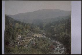
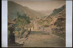
The Kamakura Highway (Misakaji) connecting the Kofu Basin in the south with Shizuoka is an old road dating back to ancient times. This photograph depicts the village of Fujinoki (present-day Misaka-machi, Fuefuki, Yamanashi Prefecture). Fujinoki was a tenma-shuku (a post town where travelers changed horses) on the Kofu Basin side, leading to the Misaka Pass of the Kamakura Highway. Misaka Pass is in the left background, viewed looking south from the Kofu Basin side. Nothing is known about the stone statue visible in the lower left.==Date:unknown, Place:Yamanashi, Photo:unknown, (Credit:Nagasaki University Library/Kyodo News Images) [Cabinet Number59‐28‐0]

  •  
The city of Kyoto seen from Maruyama

The city of Kyoto seen from Maruyama

Western view of the northern part of Kyoto from the Yoshimizu Hot Spring building. The road stretching from the centre of the photo to the left corner is the approach to Yasaka Shinto Shrine. Although the site would later become Maruyama Park, no work has been done yet, and a few restaurants stand in the area. A two-story Western-style building of yosemune-zukuri style stands on the northeast side of the street where cherry blossoms would later become a tourist attraction. The Nishiyama Mountain Range is faintly visible in the background.==Date:unknown, Place:Kyoto, Photo:unknown, (Credit:Nagasaki University Library/Kyodo News Images) [Cabinet Number52‐32‐0]

  •  
The city of Kyoto seen from Maruyama

The city of Kyoto seen from Maruyama

Western view of the northern part of Kyoto from the Yoshimizu Hot Spring building. The road stretching from the centre of the photo to the left corner is the approach to Yasaka Shinto Shrine. Although the site would later become Maruyama Park, no work has been done yet, and a few restaurants stand in the area. A two-story Western-style building of yosemune-zukuri style stands on the northeast side of the street where cherry blossoms would later become a tourist attraction. The Nishiyama Mountain Range is faintly visible in the background.==Date:unknown, Place:Kyoto, Photo:unknown, (Credit:Nagasaki University Library/Kyodo News Images) [Cabinet Number52‐22‐0]

  •  
The city of Kyoto seen from Maruyama

The city of Kyoto seen from Maruyama

Western view of the northern part of Kyoto from the Yoshimizu Hot Spring building. The road stretching from the centre of the photo to the left corner is the approach to Yasaka Shinto Shrine. Although the site would later become Maruyama Park, no work has been done yet, and a few restaurants stand in the area. A two-story Western-style building of yosemune-zukuri style stands on the northeast side of the street where cherry blossoms would later become a tourist attraction. The Nishiyama Mountain Range is faintly visible in the background.==Date:unknown, Place:Kyoto, Photo:Tamamura Kozaburo, (Credit:Nagasaki University Library/Kyodo News Images) [Cabinet Number48‐115‐0]

  •  
A woman carrying a child on her back

A woman carrying a child on her back

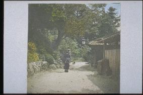
A woman carrying a child stands in a garden. A dog is lying behind her on the road. The one-story house has a kokera-buki (thin planks with bamboo nails) roof. There is a gas light in front of the house. This house is built on a ledge of the slope, and the left side is hilly. The box held shut with a roof tile on the right may be a garbage receptacle.==Date:unknown, Place:Kyoto, Photo:unknown, (Credit:Nagasaki University Library/Kyodo News Images) [Cabinet Number46‐87‐0]

  •  
SHIMOSUWA

SHIMOSUWA

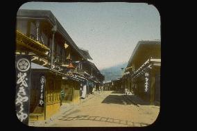
It was a junction of Nakasendo and Koshu Road, and was shot from Koshu Road to Nakasendo Edo-direction. Some buildings on both sides of the road have signboard with the family emblem. At the left side, you can see ”Kikyoya” and ”Maruya”, both keep running inns now. The shadow of ladder is the ladder of Cabinet No.38-39 in center.==Date:unknown, Place:Nagano, Photo:unknown, (Credit:Nagasaki University Library/Kyodo News Images) [Cabinet Number31‐15‐0]

  •  
Arashiyama

Arashiyama

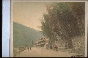
Arashiyama (Mt. Arashi) has a height of about 380 meters. It is located on the east edge of the Tanba Highlands and has Torigamine and Yamagamine to the northwest and Mt. Matsuo to the southeast. Hozu River runs from the north to the east at the northern foot of the mountain. A bamboo grove with a brushwood fence is shown at the bank of Hozu River, with hotels in the distance. A rickshaw with a woman passenger stands in front of the grove and a man stands nearby. The left side of the road is probably a boat anchorage. Two people stand with towels hanging from their necks.==Date:unknown, Place:Kyoto, Photo:unknown, (Credit:Nagasaki University Library/Kyodo News Images) [Cabinet Number19‐6‐0]

  •  
Arashiyama

Arashiyama

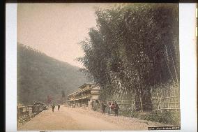
The mountain is approximately 380 meters in height and is located to the east corner of the Tanba highlands, with Torigamine and Yamakamigamine to the northwest and Mt. Matsuo to the south east. Hozu River runs from the north to the east at the northern foot of the mountain. A bamboo grove is seen along the Hozu River at the foot of Mt. Arashi with hotel-like buildings at the rear. A rickshaw with a woman passenger is visible at the side of the road, and a man stands near it. The left side of the road is probably a pier. Two people stand nearby with towels hanging on their necks.==Date:unknown, Place:Kyoto, Photo:Ogawa Kazumasa, (Credit:Nagasaki University Library/Kyodo News Images) [Cabinet Number6‐3‐0]

  •  
Approach to Tsurugaoka Hachimangu Shrine

Approach to Tsurugaoka Hachimangu Shrine

The approach of Tsurugaoka Hachimangu(Wakamiya-oji Street). The road extended to San-no-Torii(The 3rd torii gate) from left side is Dankazura, it is one step highter than other roads. The big structure in the left side of Torii is Ryokan(Inn) Kadosho.==Date:1865, Place:Kamakura, Photo:F. Beato, (Credit:Nagasaki University Library/Kyodo News Images) [Cabinet Number123‐53‐0]

  •  
Hotarujaya and Ichinose-bashi Bridge

Hotarujaya and Ichinose-bashi Bridge

Hotarujaya is viewed from the upstream side. Ichinose Bridge is on the right of the teahouse, and the handrail is visible through the trees. The road on the left is Nagasaki Road leading to Himi Pass. A new road stretching from this point to Yagami on the other side of the mountain was constructed in 1882 by the Himi Shindo Co. led by Matsuda Gengoro and eight others. This was Japan's first toll road, charging one sen a person.==Date:unknown, Place:Nagasaki, Photo:unknown, (Credit:Nagasaki University Library/Kyodo News Images) [Cabinet Number109‐31‐0]

  •  
Nakashima River and the residence of Ueno Hikoma

Nakashima River and the residence of Ueno Hikoma

This is Zeniya River, upstream from Nakashima River. The residence of photographer Ueno Hikoma is the house with the white wall by the side of the large tree. To the left of the stone lantern (washed away by the great flood of 1982) is Nakashima Confucian Shrine. A sluice probably to control water flow is seen on the riverbed in front of the Ueno residence. The person on the left is standing on the road paved with stones for rickshaws. The protruding area of the mountain in the background is Buzenbo peak and the range continuing to Mt. Hiko.==Date:unknown, Place:Nagasaki, Photo:unknown, (Credit:Nagasaki University Library/Kyodo News Images) [Cabinet Number109‐26‐0]

  •  
Sam Lowes

Sam Lowes

Road racer Sam Lowes (Britain) is seen after crash in the Moto2 category during the Czech Republic motorcycle Grand Prix 2019 in Brno Circuit, Czech Republic, on August 4, 2019. On the left side of the photo is seen motorcycle of road racer Mattia Pasini (Italy). (CTK Photo/Lubos Pavlicek)

  •  
Ofo shared bicycles in Beijing

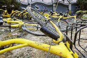
Ofo shared bicycles in Beijing

Photo taken Nov. 2, 2018, shows bikes belonging to Chinese bicycle-sharing company Ofo left strewn about on the side of a road on the outskirts of Beijing. (Kyodo) ==Kyodo

  • Main
  • Top
  • Editorial
  • Creative
  • About Us
  • About ILG
  • Terms of use
  • Company
  • BEHIND
  • Price List
  • Single Plan
  • Monthly Plan
  • Services
  • Shooting
  • Rights Clearance
  • Support
  • FAQ
  • How To Buy
  • Contact Us
  • Become a Partner

© KYODO NEWS IMAGES INC

All Rights Reserved.

  • Editorial
  • Olympics
  • News
  • Sports
  • Japan
  • Tech
  • Royal
  • Disaster
  • NorthKorea
  • Old Japan
  • SNS
  • Creative
  • Food
  • Japan
  • Landscape
  • Animal
  • Popular
  • #Ukraine
  • #Thailand
  • #coronavirus
  • #N. Korea
  • #Russia
  • #China
  • #Ukraine
  • #Thailand
  • #coronavirus
  • #N. Korea
  • #Russia
  • #China
  • Food
  • Japan
  • Landscape
  • Animal
  • Olympics
  • News
  • Sports
  • Japan
  • Tech
  • Royal
  • Disaster
  • NorthKorea
  • Old Japan
  • SNS