•  
Desert Highway in Xinjiang

Desert Highway in Xinjiang

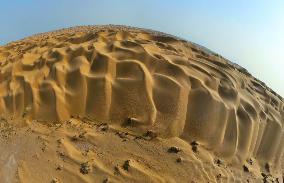
BOZHOU, CHINA - SEPTEMBER 23, 2024 - Panoramic view of the "Whale Sand Mountain" scenic spot on the desert highway, September 23, 2024, Bazhou, Xinjiang, China.

  •  
Desert Highway in Xinjiang

Desert Highway in Xinjiang

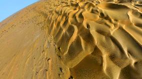
BOZHOU, CHINA - SEPTEMBER 23, 2024 - Panoramic view of the "Whale Sand Mountain" scenic spot on the desert highway, September 23, 2024, Bazhou, Xinjiang, China.

  •  

Storm Kathleen Brings Strong Winds, High Waves To Ireland, UK Coasts 2

Storm Kathleen brought strong winds to Ireland, Northern Ireland, Scotland and parts of western England on Saturday, April 6. Videos posted on social media show big waves hitting the coasts across the regions.

  •  
Hiroshige - 53 Stations of the Tokaido - Print 17

Hiroshige - 53 Stations of the Tokaido - Print 17

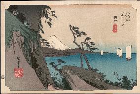
17 Yui - A fine view of Fuji, snow covered, from Satta-toge, overlooking Saruga Bay. This rugged mountain pass commanded the most magnificent view of the whole highway. Utagawa Hiroshige (1797 - 1858). The Fifty-Three Stations of the Tokaido - Hoeido edition (1831-4) Date: 1831 - 1834

  •  
MT. NANTAIZAN and MT. NYOHOYAMA

MT. NANTAIZAN and MT. NYOHOYAMA

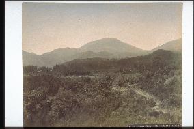
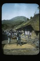
A view of Mt. Nantai from Shono in Nikko. Only the foot of Mt. Nyoho can be seen to the right. The left edge is the area around Yamauchi of Nikko.==Date:unknown, Place:Nikko, Photo:Ogawa Kazumasa, (Credit:Nagasaki University Library/Kyodo News Images) [Cabinet Number8‐41‐0]

  •  
Entire view of nikko hachi-ishi

Entire view of nikko hachi-ishi

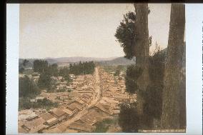
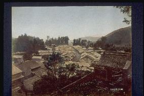
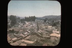
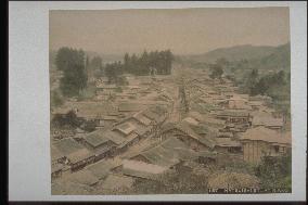
Nikko Hachiishi is shown from the middle of the mountain located to the west of Kannonji. Nikko Kaido bends near Kannonji and the present Nikko town hall, leading to leading to Shinkyo Bridge at the entrance of Nikkoshaji.==Date:unknown, Place:Nikko, Photo:Kusakabe Kinbei, (Credit:Nagasaki University Library/Kyodo News Images) [Cabinet Number2‐34‐0]

  •  
The Hakone post town and a girl in a palanquin

The Hakone post town and a girl in a palanquin

This is the view from Shin-machi of the post town of Hakone when facing Hakone checkpoint. The mountain behind is Komagadake. The street where the palanquin men are is Tokaido Highway (present-day National Route 1). The house on the right is facing toward southwest and a child and an old man are enjoying the sun. Judging from their clothes, it appears to be either late autumn or early spring. The girl on the palanquin is probably a tourist.==Date:unknown, Place:Hakone, Photo:unknown, (Credit:Nagasaki University Library/Kyodo News Images) [Cabinet Number98‐25‐0]

  •  
Mitake new road at Koshu

Mitake new road at Koshu

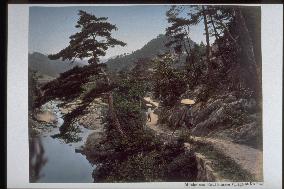
The view of Mitake-shosenkyo from Hirase-machi, present Kofu. The Mitake-sindo(new road) passing through Mitake-shosenkyo had been built in Tenpo era(1830-1844).==Date:unknown, Place:Yamanashi, Photo:Kusakabe Kinbei, (Credit:Nagasaki University Library/Kyodo News Images) [Cabinet Number38‐21‐0]

  •  
Entire view of nikko hachi-ishi

Entire view of nikko hachi-ishi

The town of Nikko Hatsuishi seen from the middle of the mountain of Kannonji to the west. Nikko Kaido made a turn in the location of the present Kannonji and the Nikko City Office, leading to the Kami bridge which is at the entrance of Nikko Shaji.==Date:unknown, Place:Nikko, Photo:unknown, (Credit:Nagasaki University Library/Kyodo News Images) [Cabinet Number37‐10‐0]

  •  
Tokaido highway,between YOKOHAMA and fujisawa

Tokaido highway,between YOKOHAMA and fujisawa

A photo from the album of F. Beato. A view of the Tokaido between Yokohama and Fujisawa. A photo depicting the Tokaido as it looked at the end of the Edo Era and early Meiji Era.==Date:unknown, Place:Kanagawa, Photo:F. Beato, (Credit:Nagasaki University Library/Kyodo News Images) [Cabinet Number36‐4‐0]

  •  
Entire view of nikko hachi-ishi

Entire view of nikko hachi-ishi

A photo of the city of Hatsuishi of Nikko from the middle of the western side of the mountain of Kannonji. Near Kannonji and the present Nikko City Office, Nikko Road took a turn leading to Kami Bridge at the entrance to Nikko Shrine.==Date:unknown, Place:Nikko, Photo:unknown, (Credit:Nagasaki University Library/Kyodo News Images) [Cabinet Number31‐40‐0]

  •  
Tokaido highway

Tokaido highway

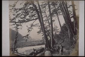
A view of Irikita, Kazamatsuri, and the direction of Yamazaki in Hakone from the area near Kamiitabashi of Odawara City on the old Tokaido Highway (the present National Route 1). Pine trees remain in the same style at present, and the shape of the mountain has not changed. The river to the left is Haya River. The pine trees have been cut down due to construction, possibly for road expansion.==Date:unknown, Place:Odawara, Photo:F. Beato, (Credit:Nagasaki University Library/Kyodo News Images) [Cabinet Number28‐3‐0]

  •  
View near nikko kiyotaki

View near nikko kiyotaki

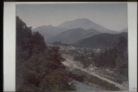
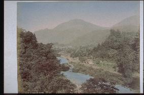
The Nikko Kiyotaki area seen from the hill where the Kanaya Hotel is located. There is an electric pole to the west of the road running along the Daiya River. The hydraulic power plant of Nikko was established in 1893 further upstream in Mukogawara. Mt. Nantai is seen in the center.==Date:unknown, Place:Nikko, Photo:unknown, (Credit:Nagasaki University Library/Kyodo News Images) [Cabinet Number19‐1‐0]

  •  
View near nikko kiyotaki

View near nikko kiyotaki

This photo captures the Shimogawara area of Nishimachi in Nikko taken from the hill where the Kanaya Hotel stands. There is an electric pole on the west side of the street by Otani River. it was in 1893 when the Nikko hydroelectric power plant was built upstream at Mukogawara. Mt. Nantai is visible in the center.==Date:unknown, Place:Nikko, Photo:unknown, (Credit:Nagasaki University Library/Kyodo News Images) [Cabinet Number19‐2‐0]

  •  
Entire view of nikko hachi-ishi

Entire view of nikko hachi-ishi

The city of Hatsuishi from the middle of the mountain to the west of Kannonji. Near Kannonji and the present town office, Nikko Kaido curves leading to the entrance of Nikko shaji, the Shinkyo Bridge.==Date:unknown, Place:Nikko, Photo:Tamamura Kozaburo, (Credit:Nagasaki University Library/Kyodo News Images) [Cabinet Number11‐6‐0]

  •  
View near nikko kiyotaki

View near nikko kiyotaki

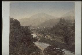
A photo of the view near Nishi-machi Shimogawara, Nikko where the Kanaya Hotel is located. Electric poles stand to the west of the road along the Daiya River. The Nikko hydraulic electric power plant was constructed upstream in Kogawara in 1893. In the centre is Mt. Nantai.==Date:unknown, Place:Nikko, Photo:Ogawa Kazumasa, (Credit:Nagasaki University Library/Kyodo News Images) [Cabinet Number8‐20‐0]

  •  
Old hakone highway near yumoto teahouse

Old hakone highway near yumoto teahouse

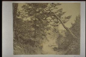
A view of the stone pavement on the old route of Hakone coming down from the tea house in Yumoto. Pictures at that time had to be taken with heavy glass panels and a darkroom in the shape of a telephone box carried by several men, so many pictures were taken at tea houses where the photography group was resting.==Date:unknown, Place:Hakone, Photo:Ogawa Kazumasa, (Credit:Nagasaki University Library/Kyodo News Images) [Cabinet Number7‐22‐0]

  • Main
  • Top
  • Editorial
  • Creative
  • About Us
  • About ILG
  • Terms of use
  • Company
  • BEHIND
  • Price List
  • Single Plan
  • Monthly Plan
  • Services
  • Shooting
  • Rights Clearance
  • Support
  • FAQ
  • How To Buy
  • Contact Us
  • Become a Partner

© KYODO NEWS IMAGES INC

All Rights Reserved.

  • Editorial
  • Olympics
  • News
  • Sports
  • Japan
  • Tech
  • Royal
  • Disaster
  • NorthKorea
  • Old Japan
  • SNS
  • Creative
  • Food
  • Japan
  • Landscape
  • Animal
  • Popular
  • #Ukraine
  • #Thailand
  • #coronavirus
  • #N. Korea
  • #China
  • #Russia
  • #Ukraine
  • #Thailand
  • #coronavirus
  • #N. Korea
  • #China
  • #Russia
  • Food
  • Japan
  • Landscape
  • Animal
  • Olympics
  • News
  • Sports
  • Japan
  • Tech
  • Royal
  • Disaster
  • NorthKorea
  • Old Japan
  • SNS