•  
World's First Mountain Canyon Landscape Bridge

World's First Mountain Canyon Landscape Bridge

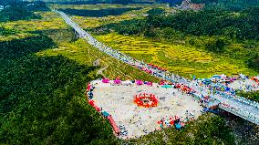
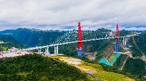
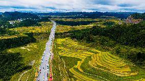
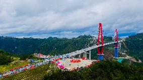
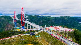
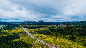
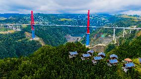
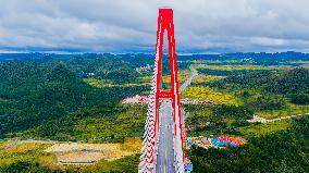
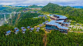
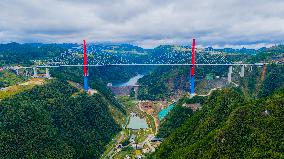
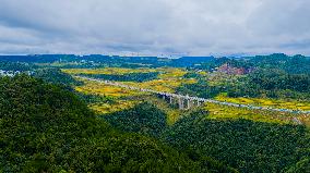
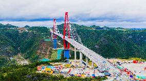
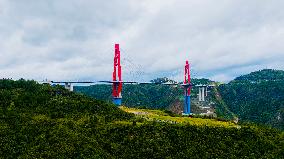
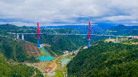
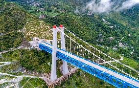
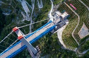
QIANNAN, CHINA - OCTOBER 1, 2025 - World's First Mountain Canyon Landscape Bridge Longli River Bridge at Longli County, Qiannan Buyi and Miao Autonomous Prefecture, Guizhou Province, China on October 1, 2025.

  •  
World's First Mountain Canyon Landscape Bridge

World's First Mountain Canyon Landscape Bridge

QIANNAN, CHINA - OCTOBER 1, 2025 - World's First Mountain Canyon Landscape Bridge Longli River Bridge at Longli County, Qiannan Buyi and Miao Autonomous Prefecture, Guizhou Province, China on October 1, 2025.

  •  
World's First Mountain Canyon Landscape Bridge

World's First Mountain Canyon Landscape Bridge

QIANNAN, CHINA - OCTOBER 1, 2025 - World's First Mountain Canyon Landscape Bridge Longli River Bridge at Longli County, Qiannan Buyi and Miao Autonomous Prefecture, Guizhou Province, China on October 1, 2025.

  •  
World's First Mountain Canyon Landscape Bridge

World's First Mountain Canyon Landscape Bridge

QIANNAN, CHINA - OCTOBER 1, 2025 - World's First Mountain Canyon Landscape Bridge Longli River Bridge at Longli County, Qiannan Buyi and Miao Autonomous Prefecture, Guizhou Province, China on October 1, 2025.

  •  
World's First Mountain Canyon Landscape Bridge

World's First Mountain Canyon Landscape Bridge

QIANNAN, CHINA - OCTOBER 1, 2025 - World's First Mountain Canyon Landscape Bridge Longli River Bridge at Longli County, Qiannan Buyi and Miao Autonomous Prefecture, Guizhou Province, China on October 1, 2025.

  •  
World's First Mountain Canyon Landscape Bridge

World's First Mountain Canyon Landscape Bridge

QIANNAN, CHINA - OCTOBER 1, 2025 - World's First Mountain Canyon Landscape Bridge Longli River Bridge at Longli County, Qiannan Buyi and Miao Autonomous Prefecture, Guizhou Province, China on October 1, 2025.

  •  
World's First Mountain Canyon Landscape Bridge

World's First Mountain Canyon Landscape Bridge

QIANNAN, CHINA - OCTOBER 1, 2025 - World's First Mountain Canyon Landscape Bridge Longli River Bridge at Longli County, Qiannan Buyi and Miao Autonomous Prefecture, Guizhou Province, China on October 1, 2025.

  •  
World's First Mountain Canyon Landscape Bridge

World's First Mountain Canyon Landscape Bridge

QIANNAN, CHINA - OCTOBER 1, 2025 - World's First Mountain Canyon Landscape Bridge Longli River Bridge at Longli County, Qiannan Buyi and Miao Autonomous Prefecture, Guizhou Province, China on October 1, 2025.

  •  
World's First Mountain Canyon Landscape Bridge

World's First Mountain Canyon Landscape Bridge

QIANNAN, CHINA - OCTOBER 1, 2025 - World's First Mountain Canyon Landscape Bridge Longli River Bridge at Longli County, Qiannan Buyi and Miao Autonomous Prefecture, Guizhou Province, China on October 1, 2025.

  •  
World's First Mountain Canyon Landscape Bridge

World's First Mountain Canyon Landscape Bridge

QIANNAN, CHINA - OCTOBER 1, 2025 - World's First Mountain Canyon Landscape Bridge Longli River Bridge at Longli County, Qiannan Buyi and Miao Autonomous Prefecture, Guizhou Province, China on October 1, 2025.

  •  
World's First Mountain Canyon Landscape Bridge

World's First Mountain Canyon Landscape Bridge

QIANNAN, CHINA - OCTOBER 1, 2025 - World's First Mountain Canyon Landscape Bridge Longli River Bridge at Longli County, Qiannan Buyi and Miao Autonomous Prefecture, Guizhou Province, China on October 1, 2025.

  •  
World's First Mountain Canyon Landscape Bridge

World's First Mountain Canyon Landscape Bridge

QIANNAN, CHINA - OCTOBER 1, 2025 - World's First Mountain Canyon Landscape Bridge Longli River Bridge at Longli County, Qiannan Buyi and Miao Autonomous Prefecture, Guizhou Province, China on October 1, 2025.

  •  
World's First Mountain Canyon Landscape Bridge

World's First Mountain Canyon Landscape Bridge

QIANNAN, CHINA - OCTOBER 1, 2025 - World's First Mountain Canyon Landscape Bridge Longli River Bridge at Longli County, Qiannan Buyi and Miao Autonomous Prefecture, Guizhou Province, China on October 1, 2025.

  •  
World's First Mountain Canyon Landscape Bridge

World's First Mountain Canyon Landscape Bridge

QIANNAN, CHINA - OCTOBER 1, 2025 - World's First Mountain Canyon Landscape Bridge Longli River Bridge at Longli County, Qiannan Buyi and Miao Autonomous Prefecture, Guizhou Province, China on October 1, 2025.

  •  
Yuzhong Mountain Torrents Rescue Efforts - China

Yuzhong Mountain Torrents Rescue Efforts - China

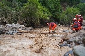
Rescuers attempt to get across a torrential river via a makeshift bridge in Mapo Township, Yuzhong County of northwest China's Gansu Province, on August 10, 2025. Roads damaged by mountain torrents in Yuzhong County, northwest China's Gansu Province, reopened on Sunday and power supply has been restored following the disaster that left 13 dead and 30 missing. Search and rescue efforts for the missing are underway. Photo by Bai Qiyuan /Xinhua/ABACAPRESS.COM

  •  
Charity ascent to highest peak of Carpathians Hoverla-2025

Charity ascent to highest peak of Carpathians Hoverla-2025

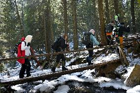
Participants cross the bridge over the mountain river during the Hoverla 2025 charity climb to the highest peak of the Carpathians to raise funds for the needs of the National Guard of Ukraine and the 80th Separate Assault Galician Brigade of the Armed Forces of Ukraine, on March 22, 2025 (Photo by Anastasiia Smolienko/Ukrinform)

  •  
Pylypets ski resort in summer

Pylypets ski resort in summer

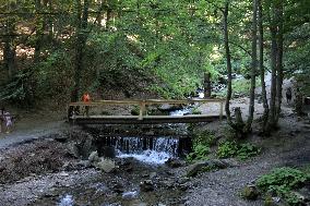
ZAKARPATTIA REGION, UKRAINE - AUGUST 15, 2024 - A bridge is near the Shypit Waterfall at the Pylypets ski resort in summer, Zakarpattia region, western Ukraine.

  •  

World's highest mountain bridge over SW China grand canyon under construction

STORY: World's highest mountain bridge over SW China grand canyon under construction DATELINE: Feb. 8, 2023 LENGTH: 00:01:10 LOCATION: GUIYANG, China CATEGORY: SOCIETY SHOTLIST: 1. various of Grand Canyon of Huajiang River and animation of the bridge 2. Voice of CHEN FEI, Chairman of Guizhou Liuzhi to Anlong Expressway Co., Ltd. 3. aerial view of the bridge construction site STORYLINE: A suspension bridge across the grand canyon over the Huajiang River in southwest China's Guizhou Province is under construction. Upon completion, it will be the world's highest mountain bridge. Voice of CHEN FEI, Chairman of Guizhou Liuzhi to Anlong Expressway Co., Ltd. "The total length of the Huajiang Grand Canyon Bridge is 2,980 meters. Its main span is 1,420 meters. It is a suspension bridge. The bridge floor is 625 meters above the water surface. The main structure is expected to be completed by the end of 2024. It's set to put into use in early 2025." After completion, the bridge will cut the travel time across the

  •  
CHINA-YUNNAN-SHANGRI-LA-RAILWAY-CONSTRUCTION (CN)

CHINA-YUNNAN-SHANGRI-LA-RAILWAY-CONSTRUCTION (CN)

(220727) -- SHANGRI-LA, July 27, 2022 (Xinhua) -- Aerial photo taken on July 27, 2022 shows the Jinsha River grand bridge linked with the entrance of the Haba Snow Mountain tunnel along the Lijiang-Shangri-La railway in southwest China's Yunnan Province. With a designed speed of 120 kilometers per hour, the 140-kilometer Lijiang-Shangri-La railway is expected to shorten the travel time between Lijiang and Shangri-La after its operation. (Xinhua/Chen Xinbo)

  •  
CHINA-YUNNAN-SHANGRI-LA-RAILWAY-CONSTRUCTION (CN)

CHINA-YUNNAN-SHANGRI-LA-RAILWAY-CONSTRUCTION (CN)

(220727) -- SHANGRI-LA, July 27, 2022 (Xinhua) -- Aerial photo taken on July 26, 2022 shows the Jinsha River grand bridge linked with the entrance of the Haba Snow Mountain tunnel along the Lijiang-Shangri-La railway in southwest China's Yunnan Province. With a designed speed of 120 kilometers per hour, the 140-kilometer Lijiang-Shangri-La railway is expected to shorten the travel time between Lijiang and Shangri-La after its operation. (Xinhua/Chen Xinbo)

  •  
Hiroshige - 53 Stations of the Tokaido - Print 55

Hiroshige - 53 Stations of the Tokaido - Print 55

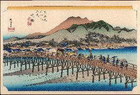
55 Kyoto - In the foreground the "long" bridge over the Kamo River, and people crossing over, with the town beyond, behind which rise hills overlooking it, the most distant printed from graded colourblock only. While decending to Kyoto, travellers could enjoy a panoramic view of the elegant imperial capital from the mountain pass and undoubtedly felt joy and relief at seeing the final destination of their journey from Edo. In those days it was the wish of every Japanese to see Kyoto once in his life.Utagawa Hiroshige (1797 - 1858). The Fifty-Three Stations of the Tokaido - Hoeido edition (1831-4) Date: 1831 - 1834

  •  
Hiroshige - 53 Stations of the Tokaido - Print 27

Hiroshige - 53 Stations of the Tokaido - Print 27

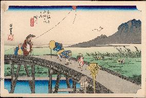
27 Kakegawa - Travellers crossing a high trestle-bridge over the Kake River, two of them peering into the water below, and behind a small boy watching a kite up in the air, while beyond another, with broken string, flutters to earth. Peasants transplanting rice in the flooded fields, and in the distance Mount Akiba rising above the mists. A shrine standing on the top of a mountain near this station attracted worshippers from all over Japan who came to pray for protection against the calamity of fire. An old couple of travellers are struggling against a strong wind as they toil to cross the arched bridge. A naughty boy is following them with a mocking gesture. Utagawa Hiroshige (1797 - 1858). The Fifty-Three Stations of the Tokaido - Hoeido edition (1831-4) Date: 1831 - 1834

  •  
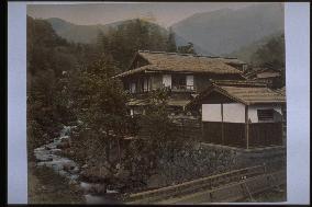
A rapid river at Miyanoshita

A rapid river at Miyanoshita

This is Hayakawa River as seen between Miyanoshita and Kiga Hot Springs. The wooden bridge must be the one near present-day Tokyo Electric Kawakubo Power Plant along the Hayakawa Promenade. The roof of a building is visible at center left, but it is not clear what it is.==Date:unknown, Place:Hakone, Photo:unknown, (Credit:Nagasaki University Library/Kyodo News Images) [Cabinet Number98‐37‐0]

  •  
A yamakago (mountain palanquin) in the River Otani

A yamakago (mountain palanquin) in the River Otani

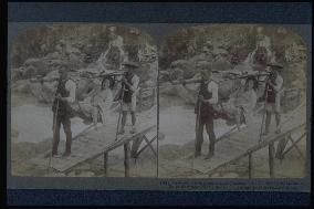
Two men carry a woman in a yama-kago (mountain palanquin) across Daiya River. The location is unclear, but the style and type of bridge over the narrow mountain river suggests that it is the gorge near Umagaeshi.==Date:1904, Place:Nikko, Photo:Underwood, (Credit:Nagasaki University Library/Kyodo News Images) [Cabinet Number97‐55‐0]

  •  
Oji-bashi Bridge

Oji-bashi Bridge

There is no Ojibashi bridge in Tokyo. Even the scenery does not appear to be Tokyo. If the title Ohjibashi is correct, then this must be the bridge over Ibi River in Mitsu-machi in present-day Hyogo Prefecture, one of many bridges all over Japan that share a similar name.==Date:unknown, Place:Tokyo, Photo:unknown, (Credit:Nagasaki University Library/Kyodo News Images) [Cabinet Number90‐33‐0]

  •  
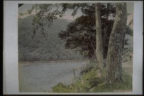
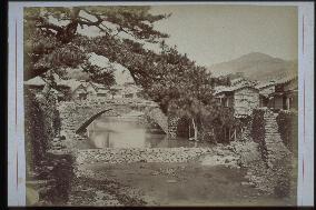
The Togetsukyo Bridge,Arashiyama

The Togetsukyo Bridge,Arashiyama

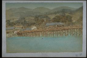
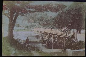
Distant view of Togetsu Bridge at Arashiyama, taken facing west from the northern shore of Katsura River. A promenade was built beside the pine trees. A small house, possibly a teahouse, is visible. People are standing on the bridge. Togetsu Bridge was destroyed by a flood in 1892.==Date:unknown, Place:Kyoto, Photo:unknown, (Credit:Nagasaki University Library/Kyodo News Images) [Cabinet Number87‐39‐0]

  •  
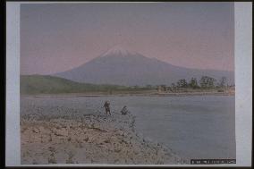
Mt. Fuji seen from the Fuji River

Mt. Fuji seen from the Fuji River

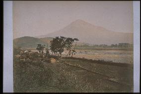
Northeastern view of the snow-capped peak of Mt. Fuji, taken from the bank of Fuji River in Iwabuchi, Fujikawa-machi. The mountain on the left is Mt. Iwamoto, and the tree line reaches to the forest of Matsuoka Sui Shinto Shrine (Fuji City) on the left. Two men are at the riverside, and Fujigawa Bridge, which crosses from the south of the shrine to Iwabuchi, is visible. This bridge was washed away many times from the beginning of the Meiji Period. It is difficult to determine exactly when this photograph was taken.==Date:unknown, Place:Shizuoka, Photo:unknown, (Credit:Nagasaki University Library/Kyodo News Images) [Cabinet Number86‐5‐0]

  •  
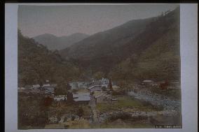
Yumoto Spa

Yumoto Spa

This is the spa town of Yumoto. The white building in the centre is Fukuzumi Inn, Kinzenro Inn built in 1877, and Bansuiro Inn completed in 1878 are visible. The old Asahi Bridge is over Hayakawa River on the right, which will be replaced by the new wooden truss bridge in September, 1885. Hence, this photo was taken between 1878 and 1885. The river in the foreground is Sukumo, and the mountain on the left is Yusaka.==Date:unknown, Place:Hakone, Photo:A. Farsari, (Credit:Nagasaki University Library/Kyodo News Images) [Cabinet Number81‐21‐0]

  •  
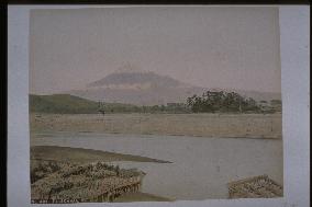
Mt. Fuji seen from the Fuji River

Mt. Fuji seen from the Fuji River

Northeastern view of Mt. Fuji from the bank of Fuji River at Iwabuchi in Fujigawa-machi. The ferry port of Iwabuchi is in the foreground, and Matsuoka Sui Shinto Shrine of Fuji City is visible in the forest on the other side. The bridge between the shrine and Iwabuchi is not visible in this photograph, perhaps because it had been recently washed away, which often happened due to the rapid flow of Fuji River. The mountain on the left is Mt. Iwamoto, and pine trees line the other side of the river.==Date:unknown, Place:Shizuoka, Photo:Tamamura Kozaburo, (Credit:Nagasaki University Library/Kyodo News Images) [Cabinet Number79‐16‐0]

  •  
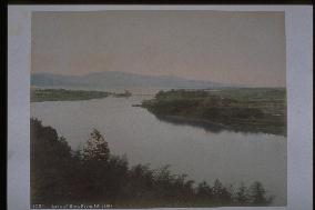
Lake Biwa seen from Ishiyama

Lake Biwa seen from Ishiyama

View of Seta River from Tsukimi-tei at Ishiyamadera Temple, with Lake Biwa and the Hira Mountain Range in the distance. The bridge in the centre is Seta-no-Karahashi, formerly the only bridge spanning Seta River and an important transportation route in ancient times. At present there are many bridges over the river.==Date:unknown, Place:Shiga, Photo:Tamamura Kozaburo, (Credit:Nagasaki University Library/Kyodo News Images) [Cabinet Number79‐14‐0]

  •  
OYAMA

OYAMA

See the explanation for photo numbered 7-17.==Date:unknown, Place:Kanagawa, Photo:R. Stillfried, (Credit:Nagasaki University Library/Kyodo News Images) [Cabinet Number77‐14‐0]

  •  
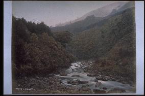
Tonosawa

Tonosawa

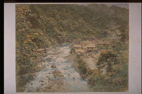
This is a little higher up from the present iron bridge of Deyama. The Hayakawa River flows in the center. The gradient is milder around here, and so is the flow. The mountain on the right is the foot of Tonomine and a part of Mt. Myougadake is visible behind. There is Amida Temple in Tonomine. The forest on the left is at the foot of Mt. Yusaka, and at present National Route 1 runs along Hayakawa River.==Date:unknown, Place:Hakone, Photo:R. Stillfried, (Credit:Nagasaki University Library/Kyodo News Images) [Cabinet Number77‐15‐0]

  •  
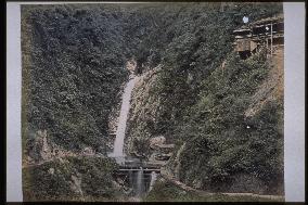
Nunobiki Falls

Nunobiki Falls

Medaki waterfall at Nunobiki Falls, taken around the same time as photograph #2271 (Shinkoji Temple), #4092 (Mt. Suwa), and #4094 (Arima Spa) in the mid-Meiji Period. Visitors normally took the path on the right side of the river and then proceeded along the road to the left to Medaki waterfall. After that, they crossed a wooden bridge and negotiated the winding mountain path to Odaki waterfall.==Date:unknown, Place:Kobe, Photo:Tamamura Kozaburo, (Credit:Nagasaki University Library/Kyodo News Images) [Cabinet Number68‐4‐2]

  •  
Mt. Fuji seen from Iwabuchi,Tokaido Road

Mt. Fuji seen from Iwabuchi,Tokaido Road

Northeastern view of Mt. Fuji from the terraced bank of Fuji River near Iwabuchi, Fujigawa-cho. Rice paddies stretch away from the foot of the hill, and the village of Iwabuchi is visible on the left. Fujigawa Bridge is visible beyond the pine trees on the right of Fuji River. Due to the rapid flow of the river, the bridge was washed away many times. The mountain on the left is Mt. Iwamoto, and pine trees line the other side of the river.==Date:unknown, Place:Shizuoka, Photo:unknown, (Credit:Nagasaki University Library/Kyodo News Images) [Cabinet Number64‐18‐0]

  •  
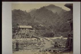
A wooden brifge in the mountains of Hakone

A wooden brifge in the mountains of Hakone

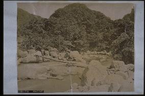
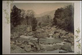
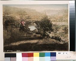
There are many rivers and streams, big and small, in Hakone mountains. However, the major rivers are Hayakawa and Sukumo. It is difficult to tell which one this is, but judging from the width and the shapes of the rocks, it is probable that this is Sukumo River. The wooden bridge, whcih seems like just a log was placed, like this one can be seen in the photos of Dogashima and Kiga over Hayakawa River, but the sceneries of them appear different from this one.==Date:unknown, Place:Hakone, Photo:unknown, (Credit:Nagasaki University Library/Kyodo News Images) [Cabinet Number59‐81‐0]

  •  
The Togetsukyo Bridge,Arashiyama

The Togetsukyo Bridge,Arashiyama

Togetsu Bridge at Arashiyama is viewed from the northern end, facing south. Horinji Temple is visible on the hillside. Kimono-clad women look toward the camera from the bridge. A man is fishing under the cherry tree. The bridge was destroyed by a flood in 1892. The stone bridge in the foreground is Kinmonkyo, which was later moved to Kurumazaki Shrine. Taken by Tamamura Kozaburo.==Date:unknown, Place:Kyoto, Photo:Tamamura Kozaburo, (Credit:Nagasaki University Library/Kyodo News Images) [Cabinet Number48‐113‐0]

  •  
Clear stream among mountains

Clear stream among mountains

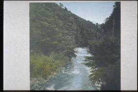
A view of the direction of Tonosawa from downstream of the Haya River, near the steel bridge of the present Hakone Tozan Railway. The place is called Osaka. Since electric wires can be seen, we know that the photo was taken after 1892. Probably taken simultaneously as the photo numbered 46-181.==Date:unknown, Place:Hakone, Photo:unknown, (Credit:Nagasaki University Library/Kyodo News Images) [Cabinet Number46‐182‐0]

  •  
Hozu River

Hozu River

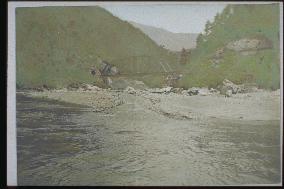
The iron bridge of Kyoto Railway Company is seen from a boat going down Hozu River. Hozu Gorge, also called Arashi Gorge, is a 13km stretch from around Hozu Bridge in Kameoka to Togetsu Bridge in Arashiyama. This is a scenic point where rapids and unusual rock formations can be enjoyed. Tributaries such as Kiyotaki River flow into the V-shaped gorge at an altitude of 400 meters. This photograph was taken sometime after August 1899, when the Kyoto Railway Company line between Saga and Sonobe opened.==Date:unknown, Place:Kyoto, Photo:unknown, (Credit:Nagasaki University Library/Kyodo News Images) [Cabinet Number46‐107‐0]

  •  
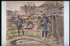
A woman in a basket palanquin

A woman in a basket palanquin

A mountain palanquin crosses the small bridge over the small river in the town. Two palanquin carriers may be the same as on the photo numbered 40-30.==Date:unknown, Place:unknown, Photo:Suzuki Shin-ichi, (Credit:Nagasaki University Library/Kyodo News Images) [Cabinet Number41‐28‐0]

  •  
Miyagase,Nakatsugawa Gorge

Miyagase,Nakatsugawa Gorge

A photo from the album of F. Beato. A view of Miyagase valley on the Nakatsu River, a stream flowing from Sagami River (Banyu River). Miyanose is the entrance to Mt. Daisen (Amefuriyama).==Date:unknown, Place:Kanagawa, Photo:F. Beato, (Credit:Nagasaki University Library/Kyodo News Images) [Cabinet Number36‐8‐0]

  •  
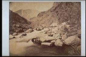
River in valley

River in valley

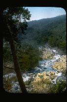
Great rocks stand here and there, and the water rushes past them. The exposure time is long so the splashes of water cannot be seen, but the fast river flow can be observed. A person crosses the bridge in the distance.==Date:unknown, Place:unknown, Photo:[R. Stillfried], (Credit:Nagasaki University Library/Kyodo News Images) [Cabinet Number27‐10‐0]

  •  
Nakashima River and Amigasa-bashi Bridge

Nakashima River and Amigasa-bashi Bridge

A bridge in front of Isenomiya Shrine. At present, it is hidden under concrete reinforcements. To the left of the bridge is Isenomiya Shrine and to the right is Yahata-machi. The background is Tateyama.==Date:unknown, Place:Nagasaki, Photo:unknown, (Credit:Nagasaki University Library/Kyodo News Images) [Cabinet Number21‐7‐0]

  •  
River at miyagino

River at miyagino

A view of Miyagino bridge from the bottom of the present Gorazaka. The water of the Haya River and people fishing can be seen. The present scenery is different due to the change in the stone walls and embankment, but the same big rocks in the photo still exist. The trees on both sides and the distant mountain (Myojindake) have not changed to the present day.==Date:unknown, Place:Hakone, Photo:Ogawa Kazumasa, (Credit:Nagasaki University Library/Kyodo News Images) [Cabinet Number5‐12‐0]

  •  
Tonosawa Spa

Tonosawa Spa

The site of present-day Fukujuro in Tonosawa (Tamanoyu at that time, or its predecessor), seen from the vicinity of the present Chitose Bridge. A bridge over the Azumaya or riverbed of Haya River can be seen. The mountain is Mt.Yusaka. Haya River and Mt.Yusaka are both mentioned in Izayoi Nikki (a travelogue written in the 13th century).==Date:Before 30th year of Meiji, Place:Hakone, Photo:Kusakabe Kinbei, (Credit:Nagasaki University Library/Kyodo News Images) [Cabinet Number3‐36‐0]

  •  
Yumoto Spa

Yumoto Spa

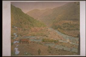
A distant view of Yumoto without the Western-style building, Kinsenro, of the Hotel Fukujuro which was built in 1878, which means that the photo was taken before that time. The area where Sugumo River to the left meets Haya River to the right is the centre of Yumoto, but in those days there were many agricultural fields, and villages can only be seen to the north.==Date:Early Meiji, Place:Hakone, Photo:Kusakabe Kinbei, (Credit:Nagasaki University Library/Kyodo News Images) [Cabinet Number3‐35‐0]

  •  
Downstream area of Oura River

Downstream area of Oura River

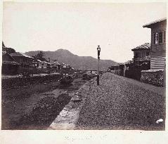
This photo is taken halfway up the Oura River looking downstream. The street light was particular to the foreign settlement. The bridge downstream is Benten Bridge and the mountain on the other side of Nagasaki Port is Mt. Inasa. A boat called ‘sanpan’, used to fetch goods from the ships offshore, is moored. The area, ‘Sagarimatsu’, was named after the pine tree on the left. The roof of Myogyoji Temple is barely discernable. The Sagarimatsu area was the foreign settlement’s town center with a bar for foreigners, a restaurant, an inexpensive international hotel, and a shop selling goods for foreigners and until around 1900, the place for locals to socialize.==Date:about 1874, Place:Nagasaki, Photo:Ueno Hikoma?, (Credit:Nagasaki University Library/Kyodo News Images)

  •  
Hotarujaya and Ichinose-bashi Bridge

Hotarujaya and Ichinose-bashi Bridge

Hotarujaya is viewed from the upstream side. Ichinose Bridge is on the right of the teahouse, and the handrail is visible through the trees. The road on the left is Nagasaki Road leading to Himi Pass. A new road stretching from this point to Yagami on the other side of the mountain was constructed in 1882 by the Himi Shindo Co. led by Matsuda Gengoro and eight others. This was Japan's first toll road, charging one sen a person.==Date:unknown, Place:Nagasaki, Photo:unknown, (Credit:Nagasaki University Library/Kyodo News Images) [Cabinet Number109‐31‐0]

  • Main
  • Top
  • Editorial
  • Creative
  • About Us
  • About ILG
  • Terms of use
  • Company
  • BEHIND
  • Price List
  • Single Plan
  • Monthly Plan
  • Services
  • Shooting
  • Rights Clearance
  • Support
  • FAQ
  • How To Buy
  • Contact Us
  • Become a Partner

© KYODO NEWS IMAGES INC

All Rights Reserved.

  • Editorial
  • Olympics
  • News
  • Sports
  • Japan
  • Tech
  • Royal
  • Disaster
  • NorthKorea
  • Old Japan
  • SNS
  • Creative
  • Food
  • Japan
  • Landscape
  • Animal
  • Popular
  • #Ukraine
  • #China
  • #coronavirus
  • #N. Korea
  • #Russia
  • #Thailand
  • #Ukraine
  • #China
  • #coronavirus
  • #N. Korea
  • #Russia
  • #Thailand
  • Food
  • Japan
  • Landscape
  • Animal
  • Olympics
  • News
  • Sports
  • Japan
  • Tech
  • Royal
  • Disaster
  • NorthKorea
  • Old Japan
  • SNS