•  
Menorca In Pictures

Menorca In Pictures

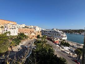
View of the old and historical city of Mahon, Menorca, Balearic Islands, Spain, on August 6, 2024. Cruise ship in Harbour. Photo by Marie Hubert Psaila/ABACAPRESS.COM

  •  
Menorca In Pictures

Menorca In Pictures

View of the old and historical city of Mahon, Menorca, Balearic Islands, Spain, on August 6, 2024. Cruise ship in Harbour. Photo by Marie Hubert Psaila/ABACAPRESS.COM

  •  

Storm Kathleen Brings Strong Winds, High Waves To Ireland, UK Coasts 2

Storm Kathleen brought strong winds to Ireland, Northern Ireland, Scotland and parts of western England on Saturday, April 6. Videos posted on social media show big waves hitting the coasts across the regions.

  •  
MALTA-VALLETTA-SHIP-SWEDEN

MALTA-VALLETTA-SHIP-SWEDEN

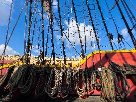
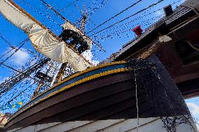
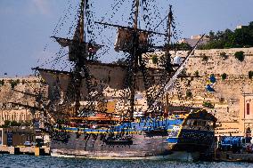
(221018) -- VALLETTA, Oct. 18, 2022 (Xinhua) -- Photo taken on Oct. 17, 2022 shows a view of the ship Gotheborg of Sweden in Valletta, Malta. The world's largest ocean-going wooden sailing ship sailed into Malta's Grand Harbour this past weekend before sailing on to Barcelona, Spain, on Tuesday. The Gotheborg of Sweden will be moored at the Spanish port for the winter before continuing its voyage to east China's Shanghai. The vessel is on a two-year Asia Expedition, which aims to promote Swedish-Asian trade and create new business opportunities. (Photo by Jonathan Borg/Xinhua)

  •  
MALTA-VALLETTA-SHIP-SWEDEN

MALTA-VALLETTA-SHIP-SWEDEN

(221018) -- VALLETTA, Oct. 18, 2022 (Xinhua) -- Photo taken on Oct. 17, 2022 shows a view of the ship Gotheborg of Sweden in Valletta, Malta. The world's largest ocean-going wooden sailing ship sailed into Malta's Grand Harbour this past weekend before sailing on to Barcelona, Spain, on Tuesday. The Gotheborg of Sweden will be moored at the Spanish port for the winter before continuing its voyage to east China's Shanghai. The vessel is on a two-year Asia Expedition, which aims to promote Swedish-Asian trade and create new business opportunities. (Photo by Jonathan Borg/Xinhua)

  •  
MALTA-VALLETTA-SHIP-SWEDEN

MALTA-VALLETTA-SHIP-SWEDEN

(221018) -- VALLETTA, Oct. 18, 2022 (Xinhua) -- Photo taken on Oct. 17, 2022 shows a view of the ship Gotheborg of Sweden in Valletta, Malta. The world's largest ocean-going wooden sailing ship sailed into Malta's Grand Harbour this past weekend before sailing on to Barcelona, Spain, on Tuesday. The Gotheborg of Sweden will be moored at the Spanish port for the winter before continuing its voyage to east China's Shanghai. The vessel is on a two-year Asia Expedition, which aims to promote Swedish-Asian trade and create new business opportunities. (Photo by Jonathan Borg/Xinhua)

  •  
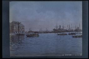
The Yokohama Customs Inspection office and the main pier

The Yokohama Customs Inspection office and the main pier

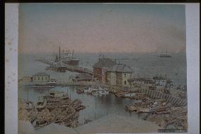
Panoramic view of the great pier from the waterfront. A symbol of Yokohama Harbour, the 19-meter-wide, 730-meter-long pier was built as part of the first port construction project started in 1889 and completed in 1894. The building on the left is the Customs Supervision Department built the same year.==Date:unknown, Place:Yokohama, Photo:Kusakabe Kinbei, (Credit:Nagasaki University Library/Kyodo News Images) [Cabinet Number96‐88‐0]

  •  
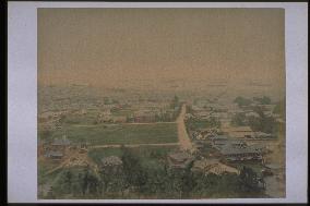
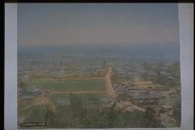
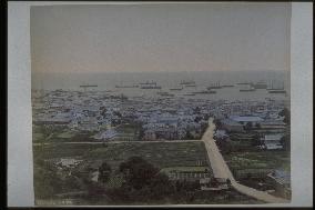
A distant view of the city of Kobe

A distant view of the city of Kobe

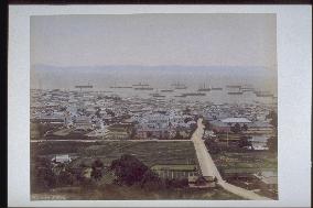
View of Kobe harbour from Mt. Suwa. Mid-Meiji Period. This is the same as photograph #4485, although the tinting of the buildings is different. The house surrounded by walls on the right of the main street running north-south is the residence of Kodera Yasujiro. The City of Kobe acquired this house in 1941 and named it Sorakuen. Yasujiro was a retainer of the Kuki family in the Sanda feudal domain. His first son, Kenkichi, became the first elected mayor of Kobe City in 1947.==Date:unknown, Place:Kobe, Photo:unknown, (Credit:Nagasaki University Library/Kyodo News Images) [Cabinet Number96‐46‐0]

  •  
A distant view of the city of Kobe

A distant view of the city of Kobe

View of Kobe harbour from Mt. Suwa. Mid-Meiji Period. This is the same as photograph #4871, although the tinting of the buildings is different. The Kodera family residence is visible, surrounded by walls on the right of the main street running north-south. The area beyond the residence and to the left (east) is the present-day hub of the Hyogo Prefecture administration and site of both the Prefecture Office and Prefecture Police Headquarters. The photograph, taken about 20 years after the opening of Kobe port, shows the town expanding from the coast to the mountain side.==Date:unknown, Place:Kobe, Photo:unknown, (Credit:Nagasaki University Library/Kyodo News Images) [Cabinet Number88‐1‐0]

  •  
A distant view of the city of Kobe

A distant view of the city of Kobe

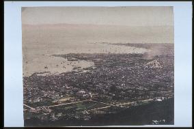
View of Kobe harbour from Mt. Suwa (present-day Chuo Ward). Mid-Meiji Period. This is a tinted version of photograph #2823. The octagonal building on the left is the Hyogo Prefecture Council Hall built in 1882. The iron pier for foreign vessels (built in 1884) is visible further down to the south. On the right of the north-south street is the Kodera residence and its garden under construction (present-day Sorakuen).==Date:unknown, Place:Kobe, Photo:unknown, (Credit:Nagasaki University Library/Kyodo News Images) [Cabinet Number87‐46‐0]

  •  
Mt. Fuji seen from Kashiwabara

Mt. Fuji seen from Kashiwabara

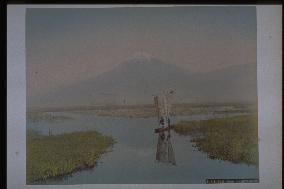
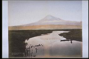
Northern view of the snow-capped peak of Mt. Fuji from Ukishimanuma (Floating Island Bog) near Kashiwabara-Shinden in Fuji City. The water from the bog becomes Numa River and flows into Tagonoura harbour. The area surrounding Ukishimanuma was a marsh called Ukishimagahara. People moved around by boat, creating a water traffic network. Two men are riding a river boat with a sail.==Date:unknown, Place:Shizuoka, Photo:A. Farsari, (Credit:Nagasaki University Library/Kyodo News Images) [Cabinet Number81‐23‐0]

  •  
The Yokohama Customs Inspection office and the main pier

The Yokohama Customs Inspection office and the main pier

Panoramic view of the great pier from Yokohama Customs Building. The curved stone-walled quay stretching from the edge of the pier to the left was called the Elephant Trunk and was one of the protrusions of Igirisu Hatoba (British Wharf) built at the time of the port-opening.==Date:unknown, Place:Yokohama, Photo:A. Farsari, (Credit:Nagasaki University Library/Kyodo News Images) [Cabinet Number81‐8‐0]

  •  
The Yokohama Customs Inspection office and the main pier

The Yokohama Customs Inspection office and the main pier

Panoramic view of the great pier from the waterfront. A symbol of Yokohama Harbour, the 19-meter-wide, 730-meter-long pier was built as part of the first port construction project started in 1889 and completed in 1894. The building on the left is the Customs Supervision Department built the same year.==Date:unknown, Place:Yokohama, Photo:A. Farsari, (Credit:Nagasaki University Library/Kyodo News Images) [Cabinet Number81‐9‐0]

  •  
A view of the mouth of a river,Osaka

A view of the mouth of a river,Osaka

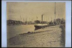
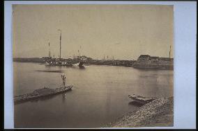
Kawaguchi Wharf. The port of Osaka was opened for foreign trade on July 15, 1868. The wharf was located about four kilometers upstream from the mouth of Anji River and later had a customs office and telegraph office. The ship is a paddle steamer. The Western-style buildings visible in the distance are part of the foreign settlement. Taken around 1888.==Date:unknown, Place:Osaka, Photo:Uchida Kuichi, (Credit:Nagasaki University Library/Kyodo News Images) [Cabinet Number66‐10‐0]

  •  
A view of Sakurajima Volcano from the harbour

A view of Sakurajima Volcano from the harbour

This photograph depicting the battery of Satsuma and a distant view of Sakurajima was taken by Uchida Kuichi when the photographer accompanied Emperor Meiji on his trip around western Japan in 1872. Funagata Battery (Shinhato Battery) is seen from the mouth of Namekawa River. The boat in front of the battery could be the one used by the Ryukyu (Okinawa) officials Toyomigusuku-uehkata, Ikegusuku-uehkata, and Amuro-uehkata to meet the emperor.==Date:1872, Place:Kagoshima, Photo:Uchida Kuichi, (Credit:Nagasaki University Library/Kyodo News Images) [Cabinet Number66‐7‐0]

  •  
Mt. Fuji seen from Numakawa,Tagonoura

Mt. Fuji seen from Numakawa,Tagonoura

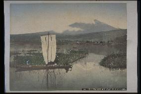
Northern view of Mt. Fuji from Ukishimanuma (Floating Island Bog) near Kashiwabara-Shinden in Fuji City. Ukishimagahara is the land surrounding Ukishimanuma Bog. The water from the bog becomes Numa River and flows into Tagonoura harbour. This photograph was taken near the origin of Numa River, with Mt. Fuji reflected upside down on the bog. The foot of Mt. Fuji is tinted roughly. There is a small boat on the right, and many wooden posts are visible on the left.==Date:unknown, Place:Shizuoka, Photo:unknown, (Credit:Nagasaki University Library/Kyodo News Images) [Cabinet Number64‐62‐0]

  •  
Tagonoura Bridge and Mt. Fuji

Tagonoura Bridge and Mt. Fuji

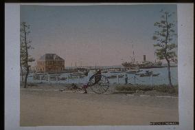
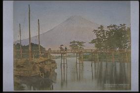
Northern view of Mt. Fuji from the mouth of Tagonoura (formerly Yoshiwara Minato) harbour in Fuji City. A rickshaw driver is carrying a passenger with an umbrella over the Tagonoura Bridge built in 1873. Since the stone gate to block the back flow is missing in the inner part of the harbour, this photograph must have been taken before 1886. Two boats are docked on the left.==Date:unknown, Place:Shizuoka, Photo:unknown, (Credit:Nagasaki University Library/Kyodo News Images) [Cabinet Number64‐44‐0]

  •  
A traditional boat

A traditional boat

Wakayama City, located at the mouth of Kino River and called Kii Minato (Kii Port), was a meeting point for sea and river transportation. Many boats are docked around what appears to be Nezumijima Island. The mountains in the distance are the Izumi Range. The building on the hill on the right may be Wakayama Castle.==Date:unknown, Place:Wakayama, Photo:unknown, (Credit:Nagasaki University Library/Kyodo News Images) [Cabinet Number59‐71‐0]

  •  
Mt. Fuji seen from Numakawa,Tagonoura

Mt. Fuji seen from Numakawa,Tagonoura

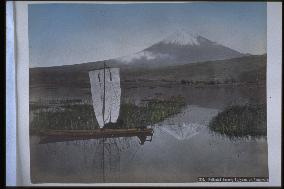
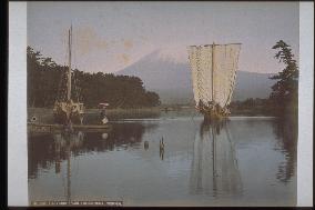
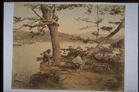
Northern view of Mt. Fuji from Ukishimanuma (Floating Island Bog) near Kashiwabara-Shinden in Fuji City. Ukishimanuma was formerly a stretch of low land between the southern foot of Mt. Fuji/Mt. Ashitaka and Suruga Bay. It flows into Numa River and Tagonoura harbour. Mt. Fuji and a sailboat are reflected on the pond. A man is on a small craft, with small islands scattered in the background.==Date:unknown, Place:Shizuoka, Photo:unknown, (Credit:Nagasaki University Library/Kyodo News Images) [Cabinet Number59‐48‐0]

  •  
Mt. Fuji seen from Numakawa,Tagonoura

Mt. Fuji seen from Numakawa,Tagonoura

Northern view of Mt. Fuji from Ukishimanuma (Floating Island Bog) near Kashiwabara-Shinden in Fuji City. Ukishimanuma was formerly a stretch of low land between the southern foot of Mt. Fuji/Mt. Ashitaka and Suruga Bay. It flows into Numa River and Tagonoura harbour. Mt. Fuji and a sailboat are reflected on the pond. A man is on a small craft, with small islands scattered in the background.==Date:unknown, Place:Shizuoka, Photo:unknown, (Credit:Nagasaki University Library/Kyodo News Images) [Cabinet Number59‐8‐2]

  •  
A distant view of the city of Kobe

A distant view of the city of Kobe

View of Kobe harbour from Mt. Suwa. Mid-Meiji Period. This is a non-tinted version of photograph #4480. The symmetrical building in the center on the street running horizontally is the elementary school attached to Kobe Teacher's College founded in 1879. Behind it are the Hyogo Prefecture Police Headquarters, completed in 1887, and Hyogo Prefecture Office. The building opposite the elementary school is Kobe Teacher's College.==Date:unknown, Place:Kobe, Photo:unknown, (Credit:Nagasaki University Library/Kyodo News Images) [Cabinet Number56‐29‐0]

  •  
A distant view of the city of Kobe

A distant view of the city of Kobe

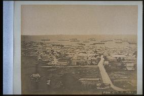
A distant view of the city of Kobe==Date:unknown, Place:Kobe, Photo:unknown, (Credit:Nagasaki University Library/Kyodo News Images)

  •  
Mt. Fuji seen from Numakawa,Tagonoura

Mt. Fuji seen from Numakawa,Tagonoura

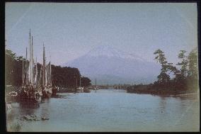
Northern view of Mt. Fuji from Tagonoura (formerly Yoshiwara Minato) harbour in Fuji City. Since the stone dam has already been built, this photograph was taken after 1886. Only part of the foundation of the former bridge remains. Two cargo ships are docked, one with sails hoisted.==Date:unknown, Place:Shizuoka, Photo:unknown, (Credit:Nagasaki University Library/Kyodo News Images) [Cabinet Number51‐166‐0]

  •  
Mt. Fuji seen from Numakawa,Tagonoura

Mt. Fuji seen from Numakawa,Tagonoura

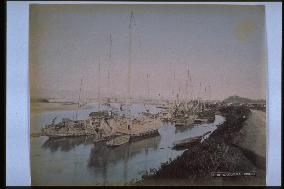
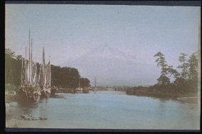
Northern view of Mt. Fuji from Tagonoura (formerly Yoshiwara Minato) harbour in Fuji City. Since the stone dam has already been built, this photograph was taken after 1886. Only part of the foundation of former bridge remains. Many boats are docked in the harbour. Taken by Hanbei Mizuno, the photograph may have been sold by Tamamura.==Date:unknown, Place:Shizuoka, Photo:Mizuno Hanbei, (Credit:Nagasaki University Library/Kyodo News Images) [Cabinet Number48‐131‐0]

  •  
Mt. Fuji seen from Numakawa,Tokaido Road

Mt. Fuji seen from Numakawa,Tokaido Road

Northern view of Mt. Fuji from Tagonoura (formerly Yoshiwara Minato) harbour in Fuji City. Since the stone dam has already been built, this photograph was taken after 1886. Only part of the foundation of former bridge remains. Many boats are docked in the harbour. Taken by Mizuno Hanbei Mizuno, the photograph may have been sold by Tamamura.==Date:unknown, Place:Shizuoka, Photo:Mizuno Hanbei, (Credit:Nagasaki University Library/Kyodo News Images) [Cabinet Number48‐100‐0]

  •  
A distant view of the city of Kobe

A distant view of the city of Kobe

A general view of Kobe from Mt. Suwa. The building with a six-angled roof in the center is the parliament building of the prefecture built in 1882. It is a photo taken in the mid Meiji period.==Date:unknown, Place:Kobe, Photo:unknown, (Credit:Nagasaki University Library/Kyodo News Images) [Cabinet Number42‐4‐0]

  •  
Nagasaki Harbour seen from Akunoura

Nagasaki Harbour seen from Akunoura

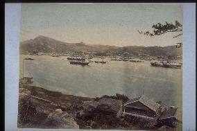
A series of photos following that numbered 26-15. The fleet following the Emperor is seen at sea. Coal is stacked by the seaside.==Date:5th year of Meiji, Place:Nagasaki, Photo:unknown, (Credit:Nagasaki University Library/Kyodo News Images) [Cabinet Number26‐27‐0]

  •  
Nagasaki Harbour seen from Akunoura

Nagasaki Harbour seen from Akunoura

A panoramic view of Nagasaki Harbour by Uchida Kuichi taken from Akunoura. This was taken when Emperor Meiji visited Nagasaki in 1872. The imperial ship can be seen to the left. This is only a quarter of the original photo.==Date:5th year of Meiji, Place:Nagasaki, Photo:Uchida Kuichi, (Credit:Nagasaki University Library/Kyodo News Images) [Cabinet Number26‐15‐0]

  •  
A distant view of Nagasaki Harbour from Tateyama

A distant view of Nagasaki Harbour from Tateyama

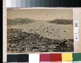
This photograph taken from Tateyama depicts the northern part of Nagasaki and the waterfront from Daikoku-machi to Dejima around 1877. A cannon installed by the former Saga Clan is visible on the lower right. The area from Daikoku-machi, Uragoto-machi and Ohato to Dejima is shown. The waterfront was extended around 1887 to make way for the newly constructed Togitsu Road.==Date:unknown, Place:Nagasaki, Photo:unknown, (Credit:Nagasaki University Library/Kyodo News Images) [Cabinet Number108‐1‐0]

  •  
The city of Nagasaki seen from Fukusaiji Temple

The city of Nagasaki seen from Fukusaiji Temple

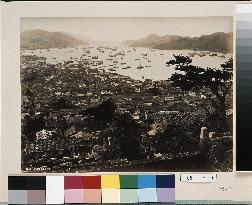
This is a view from the cemetery at Fukusaiji Temple looking over central Nagasaki and the waterfront area from Daikoku-machi to Dejima. The re-routing of Nakashima River had not been completed at this time, so the date is between 1877 and 1887. Also, the construction of the new Urakami Road along the waterfront from Dejima to Goto-machi has not been completed yet. A cannon platform is visible near the edge of the pine tree. The open land in the centre is the site of the former Omura Clan residence.==Date:unknown, Place:Nagasaki, Photo:unknown, (Credit:Nagasaki University Library/Kyodo News Images) [Cabinet Number109‐4‐0]

  •  
Panoramic view of Nagasaki Harbour from across the shore

Panoramic view of Nagasaki Harbour from across the shore

This is a three-panel panoramic photograph depicting Ohato, Shinchi, the Oura waterfront, Matsugae Bridge, Minamiyamate, Kozone, Naminohira and Furukawa-machi. Shin-Ohashi, Umegasaki and Matsugae bridges have been built as part of the re-routing of Nakashima River, indicating that the date is around 1887. The left panel captures the entire view of Dejima, Shin-ohashi Bridge, Shinchi and Umegasaki, the centre panel the area from Umegasaki to Minamiyamate, the Russian Consulate and the central part of the foreign settlement, and the right panel the area from the central part of the foreign settlement to Furukawa-machi. The southern end of the Minamiyamate neighbourhood area is visible.==Date:unknown, Place:Nagasaki, Photo:unknown, (Credit:Nagasaki University Library/Kyodo News Images) [Cabinet Number107‐1‐0]

  •  
Panoramic view of Nagasaki Harbour from across the shore

Panoramic view of Nagasaki Harbour from across the shore

This is a three-panel panoramic photograph depicting Ohato, Shinchi, the Oura waterfront, Matsugae Bridge, Minamiyamate, Kozone, Naminohira and Furukawa-machi. Shin-Ohashi, Umegasaki and Matsugae bridges have been built as part of the re-routing of Nakashima River, indicating that the date is around 1887. The left panel captures the entire view of Dejima, Shin-ohashi Bridge, Shinchi and Umegasaki, the centre panel the area from Umegasaki to Minamiyamate, the Russian Consulate and the central part of the foreign settlement, and the right panel the area from the central part of the foreign settlement to Furukawa-machi. The southern end of the Minamiyamate neighbourhood area is visible.==Date:unknown, Place:Nagasaki, Photo:unknown, (Credit:Nagasaki University Library/Kyodo News Images) [Cabinet Number107‐1‐0]

  •  
Panoramic view of Nagasaki Harbour from across the shore

Panoramic view of Nagasaki Harbour from across the shore

This is a three-panel panoramic photograph depicting Ohato, Shinchi, the Oura waterfront, Matsugae Bridge, Minamiyamate, Kozone, Naminohira and Furukawa-machi. Shin-Ohashi, Umegasaki and Matsugae bridges have been built as part of the re-routing of Nakashima River, indicating that the date is around 1887. The left panel captures the entire view of Dejima, Shin-ohashi Bridge, Shinchi and Umegasaki, the centre panel the area from Umegasaki to Minamiyamate, the Russian Consulate and the central part of the foreign settlement, and the right panel the area from the central part of the foreign settlement to Furukawa-machi. The southern end of the Minamiyamate neighbourhood area is visible.==Date:unknown, Place:Nagasaki, Photo:unknown, (Credit:Nagasaki University Library/Kyodo News Images) [Cabinet Number107‐1‐0]

  •  
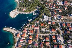
village Mandre on Pag island

village Mandre on Pag island

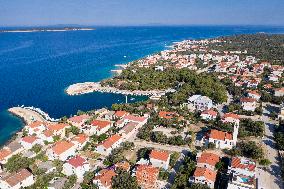
village Mandre (CTK Photo/Ondrej Zaruba)

  •  
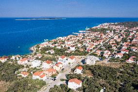
village Mandre on Pag island

village Mandre on Pag island

village Mandre (CTK Photo/Ondrej Zaruba)

  •  
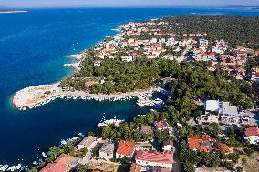
village Mandre on Pag island

village Mandre on Pag island

village Mandre (CTK Photo/Ondrej Zaruba)

  •  
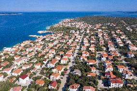
village Mandre on Pag island

village Mandre on Pag island

village Mandre (CTK Photo/Ondrej Zaruba)

  •  
village Mandre on Pag island

village Mandre on Pag island

village Mandre (CTK Photo/Ondrej Zaruba)

  • Main
  • Top
  • Editorial
  • Creative
  • About Us
  • About ILG
  • Terms of use
  • Company
  • BEHIND
  • Price List
  • Single Plan
  • Monthly Plan
  • Services
  • Shooting
  • Rights Clearance
  • Support
  • FAQ
  • How To Buy
  • Contact Us
  • Become a Partner

© KYODO NEWS IMAGES INC

All Rights Reserved.

  • Editorial
  • Olympics
  • News
  • Sports
  • Japan
  • Tech
  • Royal
  • Disaster
  • NorthKorea
  • Old Japan
  • SNS
  • Creative
  • Food
  • Japan
  • Landscape
  • Animal
  • Popular
  • #Ukraine
  • #Russia
  • #coronavirus
  • #N. Korea
  • #China
  • #Thailand
  • #Ukraine
  • #Russia
  • #coronavirus
  • #N. Korea
  • #China
  • #Thailand
  • Food
  • Japan
  • Landscape
  • Animal
  • Olympics
  • News
  • Sports
  • Japan
  • Tech
  • Royal
  • Disaster
  • NorthKorea
  • Old Japan
  • SNS