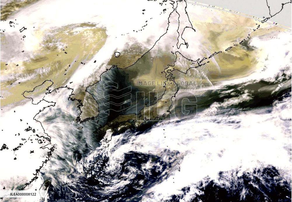
Satellite data shows sand covered northwest Pacific
TOKYO, Japan - Photo of satellite imagery, provided by Akiko Higurashi, shows that sand blown over from continental Asia which recently affected Japan's northernmost main island of Hokkaido covered a vast swathe of the northwestern Pacific. Higurashi, a researcher from the National Institute for Environmental Studies in Tsukuba, Ibaraki Prefecture, said the sand reached from the Sea of Japan in the east, covering Hokkaido and the northern tip of the main island of Honshu, stretching northeast over the Kurile Islands and the Sea of Okhotsk.
- Product Code
- ILEA000008122
- Registered date
- 2001/4/13 00:00:00
- Credit
- Kyodo / Kyodo News Images
- Media source
- Media size
- 1762 × 1221 pixel
- Resolution
- 72 dpi
- Deployment size
- 215.46(KB)*
- Special instruction
*File size when opened in Photoshop, etc.