Satellite Image Shows Mount Etna Spewing Lava From Above
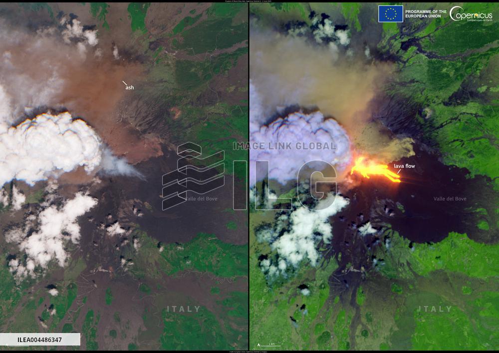
Handout photo dated June 2, 2025, shows The Copernicus Sentinel-2C satellite acquired an image of the area at 09:40 UTC, just minutes after the onset of the eruption. On the left, the natural colour image clearly depicts a dense ash plume in the summit crater area, partially obscured by a pyrocumulus cloud drifting westward towards inland Sicily. On the right, a false colour composite using shortwave infrared channels reveals the intense thermal signature of active lava flows descending into the Valle del Bove. Jaw-dropping satellite images shows Mount Etna erupting. At 11:24 am local time on 2 June, the most active volcano in Europe produced a spectacular eruption, propelling a dense column of ash and smoke several kilometres into the atmosphere. According to Italy’s National Institute of Geophysics and Volcanology (INGV), the eruption originated from the South East Crater, one of the most active summit vents in recent years. The event was characterised by vigorous Strombolian activity, lava effusion, and a
- Product Code
- ILEA004486347
- Registered date
- 2025/6/02 00:00:00
- Credit
- Abaca Press / Kyodo News Images
- Media source
- ABACA
- Media size
- 4960 × 3507 pixel
- Resolution
- 72 dpi
- Deployment size
- 2.94(MB)*
- Special instruction
*File size when opened in Photoshop, etc.

