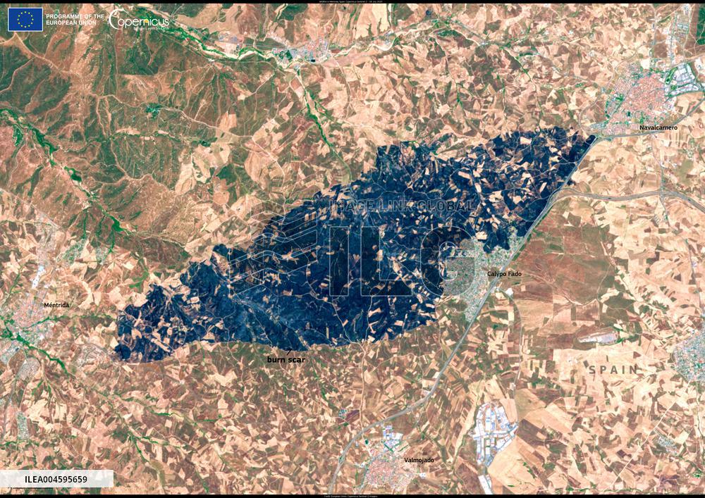
Satellite View of Mentrida Wildfire - Spain
Handout photo dated on 18 July 2025 shows Mentrida Wildfire - Spain. On 17 July 2025, a large wildfire broke out in the municipality of Méntrida, located in the province of Toledo, within Spain’s Castilla-La Mancha region. Driven by strong winds, the fire burnt over 3,000 hectares of land by the end of the day, prompting road closures and the evacuation of residents from nearby areas. Winds carried the smoke over Madrid, where skies turned orange and thick with haze during the afternoon. This image, acquired by one of Copernicus Sentinel-2 satellites on 18 July 2025, shows the burn scar caused by the fire. Photo by European Union, Copernicus Sentinel-2 imagery via ABACAPRESS.COM
- Product Code
- ILEA004595659
- Registered date
- 2025/7/18 00:00:00
- Credit
- Abaca Press / Kyodo News Images
- Media source
- ABACA
- Media size
- 4960 × 3507 pixel
- Resolution
- 72 dpi
- Deployment size
- 5.16(MB)*
- Special instruction
*File size when opened in Photoshop, etc.


