Satellite views of Uluru - Australia
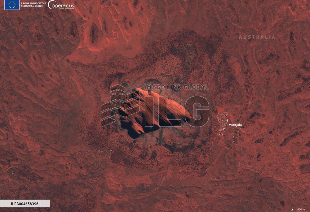
Handout photo dated August 14, 2025, shows Uluru, also known as Ayers Rock, is a massive sedimentary rock formation located in the heart of Australia’s Northern Territory. Rising 348 metres above the surrounding plain, Uluru is not only a striking natural landmark but also holds deep spiritual significance for the Anangu people. Estimated to be over 500 million years old, this UNESCO World Heritage Site hosts diverse vertebrate fauna and threatened species. This Copernicus Sentinel-2 image, acquired on 14 August 2025, shows Uluru from above. Buildings of the Mutitjulu Aboriginal community are visible to the east of Uluru. Photo by European Union, Copernicus Sentinel-2 imagery via ABACAPRESS.COM
- Product Code
- ILEA004658396
- Registered date
- 2025/8/14 00:00:00
- Credit
- Abaca Press / Kyodo News Images
- Media source
- ABACA
- Media size
- 4930 × 3379 pixel
- Resolution
- 72 dpi
- Deployment size
- 4.49(MB)*
- Special instruction
*File size when opened in Photoshop, etc.


