Groundwater Mapping in Normandy - France
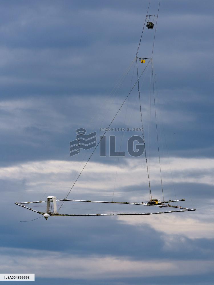
Eaux-SCARS, a large-scale scientific program involving the BRGM (Bureau of Geological and Mining Research), local authorities, and in this case the SMABI (Joint Development Authority for the Iton Basin) in the Normandy region. A helicopter from Germany, piloted by a specialist in this type of mission, tows a polygon measuring around 20 meters in diameter. This giant probe can map groundwater tables to a depth of 300 meters and see the interconnections with rivers. The Danish company SkyTEM is carrying out this work, which covers several regions of France, on October 31, 2025, in Saint Andre de l'Eure, Normandy, France. Photo by Mario Fourmy/ABACAPRESS.COM
- Product Code
- ILEA004869698
- Registered date
- 2025/10/31 00:00:00
- Credit
- Abaca Press / Kyodo News Images
- Media source
- Fourmy Mario/ABACA
- Media size
- 6726 × 8968 pixel
- Resolution
- 72 dpi
- Deployment size
- 4.98(MB)*
- Special instruction
*File size when opened in Photoshop, etc.


