Satellite View of Gulf of Morbihan - France
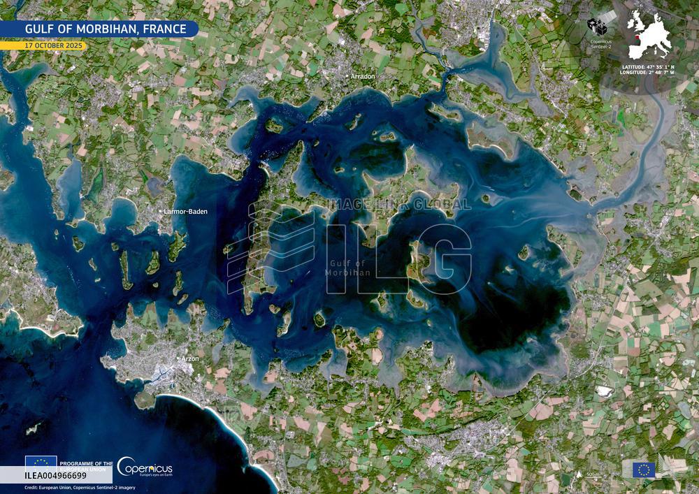
Handout Satellite View, dated October 17, 2025, shows the Gulf of Morbihan in France. The Gulf of Morbihan, part of the Natura 2000 network, forms one of France’s most distinctive coastal landscapes. This inland sea is dotted with dozens of small islands and peninsulas, creating a labyrinth of sheltered bays, narrow channels, and shifting tidal flats. Its highly indented shape supports a mosaic of coastal habitats, from eelgrass meadows to mudflats, which provide vital feeding and breeding grounds for migratory birds and numerous marine species. Located in Brittany, near towns such as Vannes, Arradon, and Arzon, the gulf’s intricate contours are clearly visible in this Copernicus Sentinel-2 image acquired on 17 October 2025. The deep blues highlight the flooded channels at high tide, while surrounding vegetation appears in bright green. Photo by European Union, Copernicus Sentinel-2 imagery via ABACAPRESS.COM
- Product Code
- ILEA004966699
- Registered date
- 2025/10/17 00:00:00
- Credit
- Abaca Press / Kyodo News Images
- Media source
- ABACA
- Media size
- 4961 × 3508 pixel
- Resolution
- 72 dpi
- Deployment size
- 5.57(MB)*
- Special instruction
*File size when opened in Photoshop, etc.


