•  
KENYA-NAIROBI-FORMER PRESIDENT-MWAI KIBAKI-REQUIEM MASS

KENYA-NAIROBI-FORMER PRESIDENT-MWAI KIBAKI-REQUIEM MASS

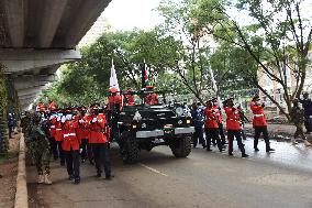
(220429) -- NAIROBI, April 29, 2022 (Xinhua) -- Kenya Defence Forces (KDF) soldiers escort a gun carriage carrying the coffin of the late President Mwai Kibaki during a requiem mass along a highway in Nairobi, Kenya, April 29, 2022. African leaders on Friday paid tribute to Kenya's former President Mwai Kibaki during a requiem mass in the capital Nairobi. TO GO WITH "African leaders pay tribute to former Kenyan president Kibaki" (Photo by John Okoyo/Xinhua)

  •  
Mt. Asama seen from Katsukake

Mt. Asama seen from Katsukake

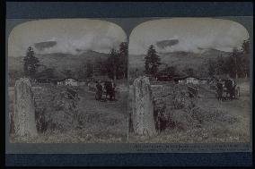
Mt. Asama (2568m) as seen from the post town of Kutsukake, one of the three post towns of Asama-Negoshi. The Nakasendo Highway passes the southern foot of the mountain. It was after the opening of the first road built as part of the Seven Route Construction Project of Nagano Prefecture in 1883 that carriage traffic appeared. The stream is Yukawa. This area was reserved for agricultural use, but there some old stands of fir trees.==Date:1904, Place:Nagano, Photo:Underwood, (Credit:Nagasaki University Library/Kyodo News Images) [Cabinet Number97‐62‐0]

  •  
Imaichi,the Nikko Road

Imaichi,the Nikko Road

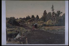
Although said to depict Imaichi on the Nikko Highway, the photograph does show a scene of the cedar-lined highway. Some cedar trees are visible in the centre, but it is difficult to tell whether they are a part of the highway. The rice has already been harvested, and irrigation ditches are visible next to the fields. Deciduous trees stand in the yard of a farm house. A serene farming village scene.==Date:unknown, Place:Nikko, Photo:Usui Shuzaburo, (Credit:Nagasaki University Library/Kyodo News Images) [Cabinet Number94‐4‐0]

  •  
Odawara

Odawara

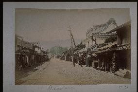
The street in the centre is the present-day National Route No. 1 leading to Hakone. The Odawara Basha (horse drawn carriage) Railway became electric in 1900. The telegraph lines that had started operation in 1872 between Tokyo and Nagasaki as well as the power lines that had started operation in 1900 can be seen. The building with the sign Uirau was a shop famous for medicine and sweets that opened during Soun Hojo's reign. The shop is also mentioned in the kabuki play Gero-uri.==Date:unknown, Place:Odawara, Photo:unknown, (Credit:Nagasaki University Library/Kyodo News Images) [Cabinet Number92‐17‐0]

  •  
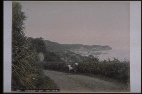
Honmoku Point seen from the Fudozaka slope

Honmoku Point seen from the Fudozaka slope

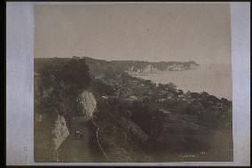
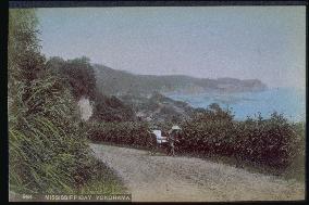
Negishi Village is at the foot of the hill, and Honmoku Peninsula is visible in the background, with (from the left) the Ichinotani, Ninotani, and Sannotani Valleys. Negishi Bay was known to foreigners as Mississippi Bay after the nickname given to it by Commodore Perry. Part of the new road built for foreigners, Fudo Slope was praised by them as one of the most beautiful scenes in the world.==Date:unknown, Place:Yokohama, Photo:unknown, (Credit:Nagasaki University Library/Kyodo News Images) [Cabinet Number92‐5‐0]

  •  
Honmoku Point seen from the Fudozaka slope

Honmoku Point seen from the Fudozaka slope

Negishi Village is at the foot of the hill, and Honmoku Peninsula is visible in the background, with (from the left) the Ichinotani, Ninotani, and Sannotani Valleys. Negishi Bay was known to foreigners as Mississippi Bay after the nickname given to it by Commodore Perry. Part of the new road built for foreigners, Fudo Slope was praised by them as one of the most beautiful scenes in the world.==Date:unknown, Place:Yokohama, Photo:unknown, (Credit:Nagasaki University Library/Kyodo News Images) [Cabinet Number89‐10‐0]

  •  
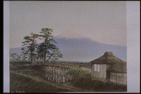
Mt. Fuji seen from a bridge on the Tokaido Road

Mt. Fuji seen from a bridge on the Tokaido Road

Northern view of Mt. Fuji from Kawai Bridge in Suzukawa, Fuji City. The bridge crosses Numa River on the Tokaido Highway. Pine trees are growing on the west side of the bridge. Huts with thatched roofs stand on the east side, which serves as a harbor. The absence of carriage tracks on the bridge indicates that this photograph was taken before 1891.==Date:unknown, Place:Shizuoka, Photo:A. Farsari, (Credit:Nagasaki University Library/Kyodo News Images) [Cabinet Number82‐1‐0]

  •  
Honmoku Point seen from the Fudozaka slope

Honmoku Point seen from the Fudozaka slope

Negishi Village is at the foot of the hill, and Honmoku Peninsula is visible in the background, with (from the left) the Ichinotani, Ninotani, and Sannotani Valleys. Negishi Bay was known to foreigners as Mississippi Bay after the nickname given to it by Commodore Perry. Part of the new road built for foreigners, Fudo Slope was praised by them as one of the most beautiful scenes in the world.==Date:unknown, Place:Yokohama, Photo:Tamamura Kozaburo, (Credit:Nagasaki University Library/Kyodo News Images) [Cabinet Number80‐22‐0]

  •  
Honmoku Point seen from the Fudozaka slope

Honmoku Point seen from the Fudozaka slope

Negishi Village is at the foot of the hill, and Honmoku Peninsula is visible in the background, with (from the left) the Ichinotani, Ninotani, and Sannotani Valleys. Negishi Bay was known to foreigners as Mississippi Bay after the nickname given to it by Commodore Perry. Part of the new road built for foreigners, Fudo Slope was praised by them as one of the most beautiful scenes in the world.==Date:unknown, Place:Yokohama, Photo:R. Stillfried, (Credit:Nagasaki University Library/Kyodo News Images) [Cabinet Number78‐2‐0]

  •  
Suma coast

Suma coast

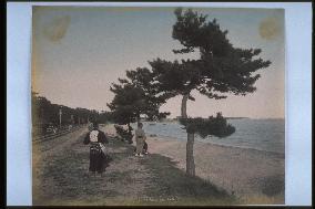
Eastern view from what is now Sumaura Park. This scenic area is famous as the site of a decisive battle between the Genji and Heike clans in 1184. Since the Sanyo Railway Company's Hyogo-Himeji Line opened in December 1888, this photograph was probably taken between 1890 and 1910. The former Saigoku Kaido Highway (present-day National Route #2) stretches along the other side of the railroad tracks.==Date:unknown, Place:Kobe, Photo:unknown, (Credit:Nagasaki University Library/Kyodo News Images) [Cabinet Number56‐24‐0]

  •  
Bamboo groove

Bamboo groove

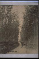
A rickshaw man at Gojo Slope. The fence is designed to prevent the bamboo from spreading into the road. The road is just wide enough for rickshaws to pass. This photograph was probably taken before 1909, when the road was expanded to a width of approximately 7.2 meters.==Date:unknown, Place:Kyoto, Photo:unknown, (Credit:Nagasaki University Library/Kyodo News Images) [Cabinet Number52‐35‐0]

  •  
The Mogi Road

The Mogi Road

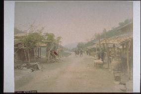
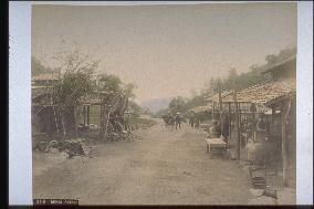
The road from Nagasaki to Mogi used since the Edo Period. This photograph captures the scene near Yanagiyama just beyond Tagami. Since this road was steep and difficult to negotiate for horses and carts, a new road (the former prefectural road) was built in 1885. In 1934 a new prefectural road (the present day National Route 34) opened.==Date:unknown, Place:Nagasaki, Photo:Tamamura Kozaburo, (Credit:Nagasaki University Library/Kyodo News Images) [Cabinet Number48‐117‐0]

  •  
Honmoku Point seen from the Fudozaka slope

Honmoku Point seen from the Fudozaka slope

Negishi Village is at the foot of the hill, and Honmoku Peninsula is visible in the background, with (from the left) the Ichinotani, Ninotani, and Sannotani Valleys. Negishi Bay was known to foreigners as Mississippi Bay after the nickname given to it by Commodore Perry. Part of the new road built for foreigners, Fudo Slope was praised by them as one of the most beautiful scenes in the world.==Date:unknown, Place:Yokohama, Photo:Tamamura Kozaburo, (Credit:Nagasaki University Library/Kyodo News Images) [Cabinet Number48‐85‐0]

  •  
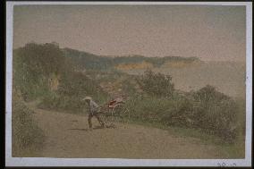
A jinrikisha going up the Fudozaka slope

A jinrikisha going up the Fudozaka slope

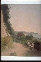
Negishi Bay was known to foreigners as Mississippi Bay after the nickname given to it by Commodore Perry. Part of the new road built for foreigners, Fudo Slope was praised by them as one of the most beautiful scenes in the world. This area was later reclaimed from the ocean and is presently an industrial zone.==Date:unknown, Place:Yokohama, Photo:Tamamura Kozaburo, (Credit:Nagasaki University Library/Kyodo News Images) [Cabinet Number48‐86‐0]

  •  
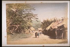
Teahouse at Nezame-no-toko Pass

Teahouse at Nezame-no-toko Pass

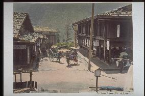
Probably the Fukushima juku with a sekisho on the Nakasendo, presently the Fukushimacho of Kisogun of Nagano prefecture. The annex of the Kiso family was built earlier than the other lodging villages in Kiso. The woman on the rickshaw in the center and a person with a balancing pole is seen in the bottom right.==Date:unknown, Place:Nagano, Photo:Kusakabe Kinbei, (Credit:Nagasaki University Library/Kyodo News Images) [Cabinet Number38‐10‐0]

  •  
Entire view of nikko hachi-ishi

Entire view of nikko hachi-ishi

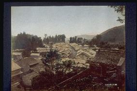
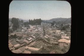
The town of Nikko Hatsuishi seen from the middle of the mountain of Kannonji to the west. Nikko Kaido made a turn in the location of the present Kannonji and the Nikko City Office, leading to the Kami bridge which is at the entrance of Nikko Shaji.==Date:unknown, Place:Nikko, Photo:unknown, (Credit:Nagasaki University Library/Kyodo News Images) [Cabinet Number37‐10‐0]

  •  
NIKKO IROHA slop

NIKKO IROHA slop

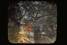
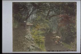
A palanquin and traveler stand on the zigzag slope of Chuzenjido. The new road was completed after 1887, and after that rickshaws could take this route. It was a difficult route for palanquins until then. Identical to the photo numbered 11-18.==Date:unknown, Place:Nikko, Photo:unknown, (Credit:Nagasaki University Library/Kyodo News Images) [Cabinet Number31‐79‐0]

  •  
A row of Japanese cedar trees along the Nikko Road

A row of Japanese cedar trees along the Nikko Road

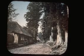
Imaichi was a stronghold on the way to Nikko, where Onari (Nikko) Kaido, Reiheishi Kaido and Aizunishi Kaido met. The cedar boulevard donated by Matsudaira Masatsuna to commemorate the 33rd anniversary of the death of Tokugawa Ieyasu stands on these Kaido. Identical to the photo numbered 25-57.==Date:unknown, Place:Imaichi, Photo:unknown, (Credit:Nagasaki University Library/Kyodo News Images) [Cabinet Number31‐80‐0]

  •  
Entire view of nikko hachi-ishi

Entire view of nikko hachi-ishi

A photo of the city of Hatsuishi of Nikko from the middle of the western side of the mountain of Kannonji. Near Kannonji and the present Nikko City Office, Nikko Road took a turn leading to Kami Bridge at the entrance to Nikko Shrine.==Date:unknown, Place:Nikko, Photo:unknown, (Credit:Nagasaki University Library/Kyodo News Images) [Cabinet Number31‐40‐0]

  •  
NIKKO IROHA SLOPE

NIKKO IROHA SLOPE

A palanquin and rickshaw climb the zigzag slope of the Chuzenjido. The new road was completed after 1887, and after that rickshaws could take this route. It was a difficult route for palanquins until then.==Date:unknown, Place:Nikko, Photo:unknown, (Credit:Nagasaki University Library/Kyodo News Images) [Cabinet Number31‐37‐0]

  •  
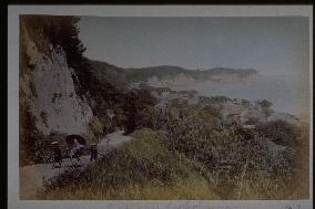
Honmoku Point seen from the Fudozaka slope

Honmoku Point seen from the Fudozaka slope

The promenade from the Bluff of Yokohama to the hills of Negishi end at the beach after going through Fudosaka. At present reclamation of the sea makes it impossible to view this scene. This was a famous spot favoured by foreigners living in the settlement, and many pictures remain.==Date:unknown, Place:Yokohama, Photo:Ogawa Kazumasa, (Credit:Nagasaki University Library/Kyodo News Images) [Cabinet Number25‐72‐0]

  •  
CHUZENJI road

CHUZENJI road

Chuzenjido leads to Chuzenji from Umagaeshi to the winding slope and passes through the steep hills of Mt. Nantai. A palanquin and a traveler descend the slope by the river.==Date:unknown, Place:Nikko, Photo:Ogawa Kazumasa, (Credit:Nagasaki University Library/Kyodo News Images) [Cabinet Number25‐59‐0]

  •  
A row of Japanese cedar trees along the Nikko Road

A row of Japanese cedar trees along the Nikko Road

Imaichi was an important crossroad for transportation into Nikko, where Onari (Nikko) Kaido, Reiheishi Kaido and Aizunishi Kaido met. The cedar boulevard donated by Matsudaira Masatsuna to commemorate the 33rd anniversary of the death of Tokugawa Ieyasu stands in the Kaido. The same as the picture numbered 31-80.==Date:unknown, Place:Imaichi, Photo:Ogawa Kazumasa, (Credit:Nagasaki University Library/Kyodo News Images) [Cabinet Number25‐57‐0]

  •  
Travellers in kago,a palanquin

Travellers in kago,a palanquin

The palanquin seen in this photo is a simple one called yamakago . The cedar trees in the background are probably those of Nikko or Hakone. The procession of palanquins is not on the road, creating an unnatural atmosphere. This was probably a dramatization for the photo.==Date:unknown, Place:unknown, Photo:unknown, (Credit:Nagasaki University Library/Kyodo News Images) [Cabinet Number18‐16‐0]

  •  
Kago,a palanquin,going along a road

Kago,a palanquin,going along a road

There is another photo which conveys the same scenery as this picture, entitled Hakonejuku , on page 87 of Scenery and People at the end of the Shogunate era . The location of this photo cannot be specified, but it conveys the atmosphere of the hotels at the end of the Shogunate era.==Date:unknown, Place:unknown, Photo:unknown, (Credit:Nagasaki University Library/Kyodo News Images) [Cabinet Number16‐38‐0]

  •  
CHUZENJI road

CHUZENJI road

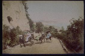
A palanquin and traveler standing on the winding Chuzenji Road. The new winding road was constructed after 1887, and not only palanquins but also rickshaws were able to climb the path. Until then, it was a difficult road for mountain palanquins.==Date:unknown, Place:Nikko, Photo:Tamamura Kozaburo, (Credit:Nagasaki University Library/Kyodo News Images) [Cabinet Number11‐18‐0]

  •  
Tagami at mogi road

Tagami at mogi road

The pass on the way to Mogi from Nagasaki. Tagami Pass was an important route from Nagasaki to Mogi, and was called Mogi guchi . The tea house and rickshaw evoke the feeling of the times. Probably developed from the same negative as that numbered 8-11.==Date:unknown, Place:Nagasaki, Photo:Ogawa Kazumasa, (Credit:Nagasaki University Library/Kyodo News Images) [Cabinet Number8‐40‐0]

  •  
Tagami at mogi road

Tagami at mogi road

The pass on the way from Nagasaki to Mogi. Tagami Pass was called the entrance to Mogi and served as an important crossroad between Nagasaki and Mogi. The tea houses on the road and the rickshaw depict the times.==Date:unknown, Place:Nagasaki, Photo:Ogawa Kazumasa, (Credit:Nagasaki University Library/Kyodo News Images) [Cabinet Number8‐11‐0]

  •  
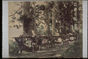
Travelling in kago,palanquins along hakone highway

Travelling in kago,palanquins along hakone highway

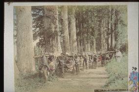
A procession of yamakago (mountain palanquins) and kumosuke (palanquin bearers) along the cedar path in Motohakone. This photo has been copied many times and is famous as the work of Kumosuke, but from the number of the negative in the first photo, this is believed to be by Kusakabe Kinbei. The pose suggests that the procession was arranged to make a souvenir photo.==Date:unknown, Place:Hakone, Photo:Ogawa Kazumasa, (Credit:Nagasaki University Library/Kyodo News Images) [Cabinet Number5‐35‐0]

  •  
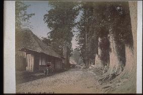
A row of Japanese cedar trees along the Nikko Road

A row of Japanese cedar trees along the Nikko Road

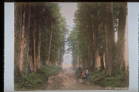
Imaichi was an important junction on the way to Nikko, where Onari (Nikko) Kaido, Riheishi Kaido and Aizu Nishi Kaido meet. These boulevards are lined with cedar trees donated by Matsudaira Masatsuna on the occasion of the 33th anniversary of the death of the Shogun Ieyasu. The rickshaw and puller in the centre of the road emphasize the size of the cedar trees.==Date:unknown, Place:Imaichi, Photo:Kusakabe Kinbei, (Credit:Nagasaki University Library/Kyodo News Images) [Cabinet Number2‐33‐0]

  •  
A row of Japanese cedar trees along the Nikko Road

A row of Japanese cedar trees along the Nikko Road

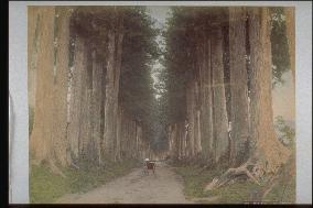
Imaichi was an important transportation link to Nikko, where the Onari (Nikko) Kaido, Reiheishi Kaido and Aizu Nishi Kaido met. Cedar trees donated by Matsudaira Masatsuna to commemorate the 33rd anniversary of the death of Tokugawa Ieyasu lined these roads. The great size of the cedar trees is emphasized by the rickshaw and carrier in the middle of the road.==Date:unknown, Place:Imaichi, Photo:Kusakabe Kinbei, (Credit:Nagasaki University Library/Kyodo News Images) [Cabinet Number1‐27‐0]

  •  
Hotarujaya and Ichinose-bashi Bridge

Hotarujaya and Ichinose-bashi Bridge

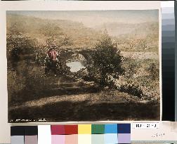
Hotarujaya is viewed from the upstream side. Ichinose Bridge is on the right of the teahouse, and the handrail is visible through the trees. The road on the left is Nagasaki Road leading to Himi Pass. A new road stretching from this point to Yagami on the other side of the mountain was constructed in 1882 by the Himi Shindo Co. led by Matsuda Gengoro and eight others. This was Japan's first toll road, charging one sen a person.==Date:unknown, Place:Nagasaki, Photo:unknown, (Credit:Nagasaki University Library/Kyodo News Images) [Cabinet Number109‐31‐0]

  •  
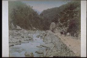
Road to Mogi

Road to Mogi

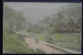
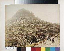
Mogi prospered as a resort for foreigners and a stopover on the way to Unzen and Kumamoto. As a result, the Mogi highway was refurbished in 1885 as a modern road for rickshaws and luggage carts. This photograph taken around 1895 shows the area on the way to Tagami Pass. The terraced farms covering the slope of Mt. Atago were a feature of Nagasaki, which had little flat land for farming.==Date:unknown, Place:Nagasaki, Photo:unknown, (Credit:Nagasaki University Library/Kyodo News Images) [Cabinet Number107‐12‐0]

  • Main
  • Top
  • Editorial
  • Creative
  • About Us
  • About ILG
  • Terms of use
  • Company
  • BEHIND
  • Price List
  • Single Plan
  • Monthly Plan
  • Services
  • Shooting
  • Rights Clearance
  • Support
  • FAQ
  • How To Buy
  • Contact Us
  • Become a Partner

© KYODO NEWS IMAGES INC

All Rights Reserved.

  • Editorial
  • Olympics
  • News
  • Sports
  • Japan
  • Tech
  • Royal
  • Disaster
  • NorthKorea
  • Old Japan
  • SNS
  • Creative
  • Food
  • Japan
  • Landscape
  • Animal
  • Popular
  • #Ukraine
  • #Russia
  • #coronavirus
  • #N. Korea
  • #Thailand
  • #China
  • #Ukraine
  • #Russia
  • #coronavirus
  • #N. Korea
  • #Thailand
  • #China
  • Food
  • Japan
  • Landscape
  • Animal
  • Olympics
  • News
  • Sports
  • Japan
  • Tech
  • Royal
  • Disaster
  • NorthKorea
  • Old Japan
  • SNS