•  
Hiroshige - 53 Stations of the Tokaido - Print 53

Hiroshige - 53 Stations of the Tokaido - Print 53

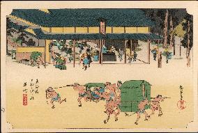
53 Kusatsu - View of a rest-house on for coolies, and horses on the road; coolies passing in foreground with a kago and a covered palanquin. The Nakasendo, another large highway which ran through the mountainous region between Edo and Kyoto joined the Tokaido at this station to form a single highway for the remainder of the highway to Kyoto. Utagawa Hiroshige (1797 - 1858). The Fifty-Three Stations of the Tokaido - Hoeido edition (1831-4) Date: 1831 - 1834

  •  
Tokyo Olympic torch relay

Tokyo Olympic torch relay

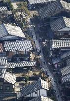
Photo taken from a Kyodo News helicopter shows the Tokyo Olympic torch relay taking place on April 3, 2021, in Gifu Prefecture's Nakatsugawa, which was a post town on the Nakasendo road from Kyoto to Edo during the Edo period (1603-1868).

  •  
Tokyo Olympic torch relay

Tokyo Olympic torch relay

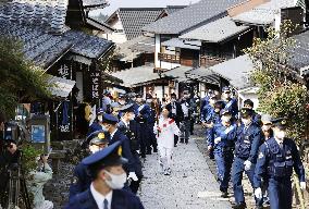
The Tokyo Olympic torch relay took place on April 3, 2021, in Gifu Prefecture's Nakatsugawa, which was a post town on the Nakasendo road from Kyoto to Edo during the Edo period (1603-1868).

  •  
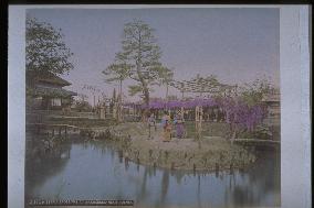
Wisteria trellis,Maebashi,the Nakasendo Road

Wisteria trellis,Maebashi,the Nakasendo Road

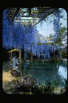
Maehashi lies in central Gunma Prefecture. The prefecture capital was established here, and the city prospered as a collection and distribution centre for silk products. The exact location of this wisteria trellis is unknown, but if it is indeed Maehashi city, then it is probably close to the bank of Tone River, north of the prefecture office, because aqueducts and ponds are visible.==Date:unknown, Place:Maebashi, Photo:unknown, (Credit:Nagasaki University Library/Kyodo News Images) [Cabinet Number98‐43‐0]

  •  
Wisteria trellis,Maebashi,the Nakasendo Road

Wisteria trellis,Maebashi,the Nakasendo Road

Maehashi lies in central Gunma Prefecture. The prefecture capital was established here, and the city prospered as a collection and distribution centre for silk products. The exact location of this wisteria trellis is unknown, but if it is indeed Maehashi city, then it is probably close to the bank of Tone River, north of the prefecture office, because aqueducts and ponds are visible.==Date:1904, Place:Maebashi, Photo:unknown, (Credit:Nagasaki University Library/Kyodo News Images) [Cabinet Number98‐14‐0]

  •  
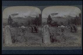
Mt. Asama seen from Katsukake

Mt. Asama seen from Katsukake

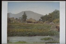
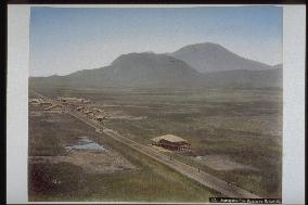
Mt. Asama (2568m) as seen from the post town of Kutsukake, one of the three post towns of Asama-Negoshi. The Nakasendo Highway passes the southern foot of the mountain. It was after the opening of the first road built as part of the Seven Route Construction Project of Nagano Prefecture in 1883 that carriage traffic appeared. The stream is Yukawa. This area was reserved for agricultural use, but there some old stands of fir trees.==Date:1904, Place:Nagano, Photo:Underwood, (Credit:Nagasaki University Library/Kyodo News Images) [Cabinet Number97‐62‐0]

  •  
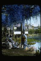
Wisteria trellis at a teahouse,the Nakasendo Road

Wisteria trellis at a teahouse,the Nakasendo Road

Wisteria blossoms on Nakasendo probably refers to the wisteria at Ushijima (present-day Ushijima in Kasukabe City, Saitama Prefecture), but this is not certain. If so, however, this would be the Shingon Sect Rengein Temple grounds where wisterias, said to have been planted by Kobo Daishi (the founder of the Shingon Sect), still can be found today. The wisteria trees are 1,200 years old, and the plot is some 700 square meters in area. The trees were designated a National Natural Monument in 1928. A private company called Tokaen currently manages the garden.==Date:unknown, Place:Tokyo, Photo:unknown, (Credit:Nagasaki University Library/Kyodo News Images) [Cabinet Number88‐34‐0]

  •  
The Kasatori Pass

The Kasatori Pass

Kasatori Pass (752m) is located between the post towns of Ashida (Tateshina-machi, Nagano Prefecture) and Nagakubo (Nagato-machi) on the Nakasendo Highway. The pine trees along the highway appear in the woodblock prints entitled The 63 Post Towns of Nakasendo by Ando Hiroshige. The mountain in the background is Mt. Asama (2568m), an active volcano.==Date:unknown, Place:Nagano, Photo:Usui Shuzaburo?, (Credit:Nagasaki University Library/Kyodo News Images) [Cabinet Number65‐8‐0]

  •  
A row of pine trees along the Tokaido Road

A row of pine trees along the Tokaido Road

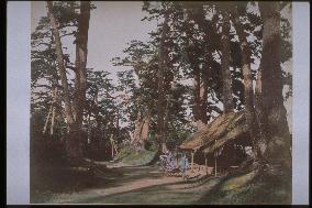
Opened in 1602, Nakasendo was the second of the five major highways in Japan. Pine and cedar trees were planted along the highway, and the cedar trees of Annaka (Gunma Prefecture) became famous. After World War II, many trees died due to pollution caused by car exhaust. Luckily, the decision to build National Route 142 parallel to the old Nakasendo Highway saved the trees at Kasatori Pass. The photograph with the rickshaw parked in front of the tea house shows how the highway had been renovated so that carriages could pass.==Date:unknown, Place:Nagano, Photo:unknown, (Credit:Nagasaki University Library/Kyodo News Images) [Cabinet Number64‐48‐0]

  •  
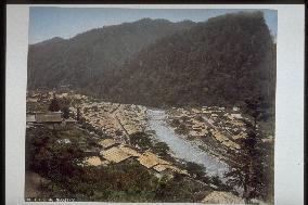
Nakasendo Matsuida Inns from Usui River

Nakasendo Matsuida Inns from Usui River

The Usui River which originates from Mt. Komochi to the east of Usui range on the former Nakasendo. The houses of Matsuida juku can be seen. The center fore may be a broken bridge. A man fishes with his pole. Usui River is famous for fishing ayu (sweetfish) to the present day.==Date:unknown, Place:Gunma, Photo:Kusakabe Kinbei, (Credit:Nagasaki University Library/Kyodo News Images) [Cabinet Number38‐55‐0]

  •  
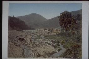
Mt. Asama from Nakasendo Kutsukake Inns

Mt. Asama from Nakasendo Kutsukake Inns

Mt. Asama seen from Kutsukake on the Nakasendo which is located between the jukus of Karuizawa and Oiwake. The river flowing to the fore is the Yu River which meets the Chikuma River at Shionada. The bridge to the right of the picture supported by a stone fence is probably Nagakura Bridge.==Date:unknown, Place:Nagano, Photo:Kusakabe Kinbei, (Credit:Nagasaki University Library/Kyodo News Images) [Cabinet Number38‐51‐0]

  •  
Inns at Nakasendo Nagakubo

Inns at Nakasendo Nagakubo

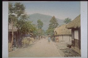
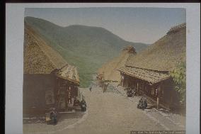
A view of Nagakubo village where Nagakubo juku, one of the jukus on the Nakasendo, was located. Thatched roofed houses line up, and a villager is seen to the left, and a traveler wearing a hat can be seen in the center. Nagakubo village was divided into the old and new town after the flooding in 1631.==Date:unknown, Place:Nagano, Photo:Kusakabe Kinbei, (Credit:Nagasaki University Library/Kyodo News Images) [Cabinet Number38‐46‐0]

  •  
Inns at Nakasendo Oiwake

Inns at Nakasendo Oiwake

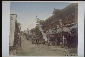
Could be the eastern edge of Oiwake juku, over the Shojin Bridge and a little further onwards. Aburaya can be seen to the right, but this hotel prospered even when Oiwake became rather bleak during the Meiji and Taisho eras. The fact that many novelists such as Hori Tatsuo stayed there is famous.==Date:unknown, Place:Nagano, Photo:Kusakabe Kinbei, (Credit:Nagasaki University Library/Kyodo News Images) [Cabinet Number38‐49‐0]

  •  
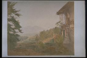
Usui Pass from Nakasendo Sakamoto Inns

Usui Pass from Nakasendo Sakamoto Inns

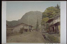
Sakamoto juku is located at the eastern foot of the range, and the 600 meters distance from here (500 meters above sea level) to the range is a climb of 450 meters. Hotels line along the road with a width of 15 meters. The mountain that looks like a pile of rocks is the Funzan. This path leads to Usui Range.==Date:unknown, Place:Gunma, Photo:Kusakabe Kinbei, (Credit:Nagasaki University Library/Kyodo News Images) [Cabinet Number38‐54‐0]

  •  
Ochiai Bridge near Nakasendo Wada

Ochiai Bridge near Nakasendo Wada

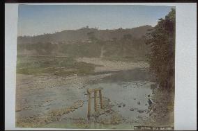
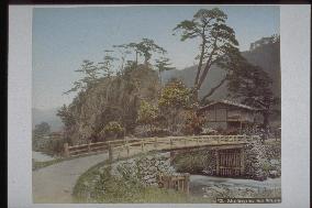
Ochiai Bridge built over the meeting place of the Rivers Daimon and Yorita near the present Wada village of Chiisagata gun of Nagano prefecture. The Nakasendo proceeds to the Yorita River after passing this bridge. The Yorita River originates from the Wada range.==Date:unknown, Place:Nagano, Photo:Kusakabe Kinbei, (Credit:Nagasaki University Library/Kyodo News Images) [Cabinet Number38‐45‐0]

  •  
Nakasendo Usui Pass

Nakasendo Usui Pass

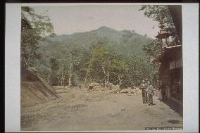
The range on the former Nakasendo, on the borders of Sakamoto of Matsuida-cho in Gunma prefecture and Karuizawa of Karuizawa-cho in Nagano Prefecture. It was an important cross road connecting the Kinai and Kanto areas via Shinshu. Because it was a difficult path, a new Usui range road was built, starting in 1884 and completing in 1886. Three waitresses look in the direction of the camera in front of the tea house to the right.==Date:unknown, Place:Gunma, Photo:Kusakabe Kinbei, (Credit:Nagasaki University Library/Kyodo News Images) [Cabinet Number38‐53‐0]

  •  
Mt. Asama from Nakasendo Karuisawa

Mt. Asama from Nakasendo Karuisawa

A view of the Mt. Asama from Karuizawa coming down west from Sakamoto juku on the Nakasendo over the Usui Range. Karuizawa prospered with its restaurants, but it was devastated in the explosion of Mt. Asama in 1783. As the new Usui Range road opens in the Meiji era, the village declines.==Date:unknown, Place:Nagano, Photo:Kusakabe Kinbei, (Credit:Nagasaki University Library/Kyodo News Images) [Cabinet Number38‐52‐0]

  •  
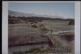
Ida River near Nakasendo Wada

Ida River near Nakasendo Wada

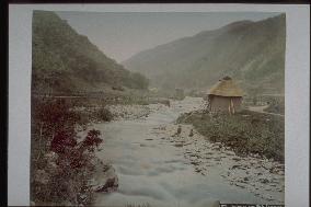
Wada village of Chiisagata gun located in the upper stream of the Yorita River is presently a typical Kaso village (most of the villagers have gone to the city to work, with a drastic population decrease), with remnants of the juku of the Nakasendo during the middle ages. Wada range is known to be the most difficult pass on the Nakasendo from the past.==Date:unknown, Place:Nagano, Photo:Kusakabe Kinbei, (Credit:Nagasaki University Library/Kyodo News Images) [Cabinet Number38‐44‐0]

  •  
Nishi-Mochiya Teahouse at Nakasendo Wada Pass

Nishi-Mochiya Teahouse at Nakasendo Wada Pass

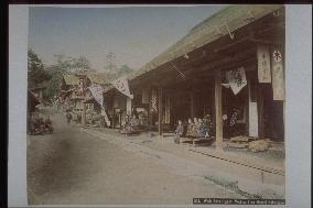
A view of the travelers resting in Wada range in Wadajuku, the most difficult pass on the Nakasendo. Tea houses line along the Nishimochiya, and was a resting spot for travelers going over the Wada range. In the winter, there was 3 meters of snowfall, and going over the range was terribly difficult.==Date:unknown, Place:Nagano, Photo:Kusakabe Kinbei, (Credit:Nagasaki University Library/Kyodo News Images) [Cabinet Number38‐41‐0]

  •  
Funa Bridge over Chikuma River at Nakasendo Shionada Inns

Funa Bridge over Chikuma River at Nakasendo Shionada Inns

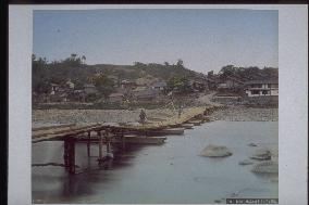
A bridge connecting the Shionata juku and the kaido, located along the Nakasendo to the right bank of the Chikuma River. It was the responsibility of this juku to take care of this bridge and secure transport. The bridge was destroyed many times by the steep flow of the Chikuma River. The stone moor of that time exists to this day.==Date:unknown, Place:Nagano, Photo:Kusakabe Kinbei, (Credit:Nagasaki University Library/Kyodo News Images) [Cabinet Number38‐47‐0]

  •  
Inns at Nakasendo Iwamurata

Inns at Nakasendo Iwamurata

A view of the Iwata village (presently the Saku City of Nagano prefecture) on the Nakasendo. The fore could be a canal. Travelers can be seen on the path. At Iwata village, Nakasendo, Zenkojido, Koshukaido, Shimonitado met, so its was an important place for transporting commodities.==Date:unknown, Place:Nagano, Photo:Kusakabe Kinbei, (Credit:Nagasaki University Library/Kyodo News Images) [Cabinet Number38‐48‐0]

  •  
Large tree at Nakasendo Shimo-no-Suwa Shrine

Large tree at Nakasendo Shimo-no-Suwa Shrine

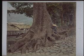
The magnificent tree which roots spread out. It was at the entrance side of Suwa Taisha Shimosha Akimiya. The size can be observed from the traveler, holding the trunk. Now, this tree had lost.\r\nAlso there are no stone pavement for the approach maintenance.\r\n==Date:unknown, Place:Nagano, Photo:Kusakabe Kinbei, (Credit:Nagasaki University Library/Kyodo News Images) [Cabinet Number38‐38‐0]

  •  
Inns at Nakasendo Wada

Inns at Nakasendo Wada

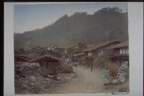
A village near the Wadajuku. Houses with stones on the roofs to protect them from the strong winds can be seen together with some villagers. Wadajuku was an important place of transport from the early days with the most difficult Wada range pass on the Nakasendo at range. After the Meiji era, it was not a part of the main avenues of travel, so development was hopeless.==Date:unknown, Place:Nagano, Photo:Kusakabe Kinbei, (Credit:Nagasaki University Library/Kyodo News Images) [Cabinet Number38‐43‐0]

  •  
Higashi-Mochiya Teahouse at Nakasendo Wada Pass

Higashi-Mochiya Teahouse at Nakasendo Wada Pass

The view of the Higashimochiya of Wada range in Wadajuku, the most difficult pass on the Nakasendo. There were five tea houses, and was a resting spot. Inhabitants also played the role of rescue workers for the travelers, so a fuji was provided per person (5 go of unpolished rice a day).==Date:unknown, Place:Nagano, Photo:Kusakabe Kinbei, (Credit:Nagasaki University Library/Kyodo News Images) [Cabinet Number38‐42‐0]

  •  
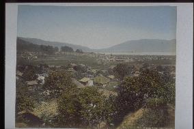
Inns at Nakasendo Shimo-no-Suwa and Suwa Lake

Inns at Nakasendo Shimo-no-Suwa and Suwa Lake

Shimosuwa village on the Nakasendo, one of the five kaidos. Shimosuwa is located to the northeast bank of Lake Suwa, and spreads with the Yashima highlands to the back. There are many spas in the juku, and was also called the city of spas. It is the terminal point of the Koshukaido.==Date:unknown, Place:Nagano, Photo:Kusakabe Kinbei, (Credit:Nagasaki University Library/Kyodo News Images) [Cabinet Number38‐40‐0]

  •  
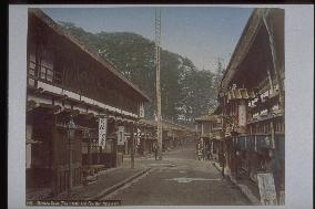
Fire bell and inn at Nakasendo Shimo-no-Suwa

Fire bell and inn at Nakasendo Shimo-no-Suwa

The townscape of Shimosuwa-juku(post town) on the Nakasendo. Tea houses line on both sides of the road and you can see the man at the foot of high ladder, hanging the fire bell in the center. In the back, you can see the Shaso(Shrine forest) of Suwa Taisha Shimosha Akimiya. Shimosuwa-juku is near Wada-toge(pass) and have much hot spings, it has prospered for a junction of Koshukaido.\r\n==Date:unknown, Place:Nagano, Photo:Kusakabe Kinbei, (Credit:Nagasaki University Library/Kyodo News Images) [Cabinet Number38‐39‐0]

  •  
Snow-covered Hida mountains from Nakasendo Kikyogahara

Snow-covered Hida mountains from Nakasendo Kikyogahara

Yukiyama of Hida seen from Kikyogahara of Siojiri on the Nakasendo. People gathering in the center seem to be building something out of lumber.==Date:unknown, Place:Nagano, Photo:Kusakabe Kinbei, (Credit:Nagasaki University Library/Kyodo News Images) [Cabinet Number38‐34‐0]

  •  
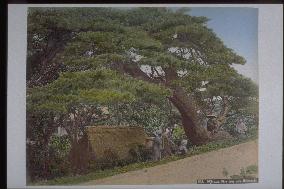
Pine tree at Nakasendo Senba

Pine tree at Nakasendo Senba

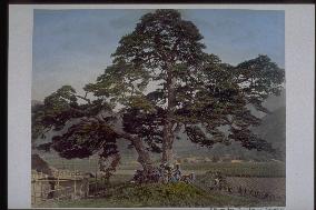
A view of the area around the entrance of Seba juku on the Nakasendo. Hijimatsu which occupies the whole photo, is probably the pine where Hosokawa Yusai placed his elbow and read poems. Travelers resting at the foot of the pine and women in work attire can be seen.==Date:unknown, Place:Nagano, Photo:Kusakabe Kinbei, (Credit:Nagasaki University Library/Kyodo News Images) [Cabinet Number38‐33‐0]

  •  
Nakasendo Torii Pass

Nakasendo Torii Pass

Men climbing the Torii range on the Nakasendo. The Torii range was one of the most difficult spots on the Nakasendo located on the borders of Narai of Tarukawa village of Kisogun and Yabuhara of Kiso village of Kisogun, with a height of approximately 260 meters from both locations.==Date:unknown, Place:Nagano, Photo:Kusakabe Kinbei, (Credit:Nagasaki University Library/Kyodo News Images) [Cabinet Number38‐25‐0]

  •  
Pine tree at Nakasendo Kikyogahara

Pine tree at Nakasendo Kikyogahara

Many travelers rest at the foot of a huge pine tree along the Nakasendo. Almost all of them wear hats.==Date:unknown, Place:Nagano, Photo:Kusakabe Kinbei, (Credit:Nagasaki University Library/Kyodo News Images) [Cabinet Number38‐35‐0]

  •  
Road near Nakasendo Sakurasawa

Road near Nakasendo Sakurasawa

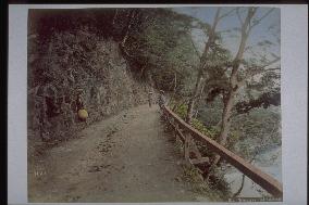
The view of the Nakasendo near the Sakurazawa. A fence is built along the Kiso River to the right. Three travelers wearing hats can be seen. The name Sakurazawa is said to originate both from the cherry blossoms that bloom there and the war lord Sakurazawa family who reigned in the region during the middle ages.==Date:unknown, Place:Nagano, Photo:Kusakabe Kinbei, (Credit:Nagasaki University Library/Kyodo News Images) [Cabinet Number38‐31‐0]

  •  
Suwa Lake from Nakasendo Shiojiri Pass

Suwa Lake from Nakasendo Shiojiri Pass

Shiojiri range is also called Shiomine, and has a height of 1000 m. It has a view of the surrounding villages and Lake Suwa below, and to the distant left is Yatsugatake and Kirigamine. On a clear day, Mt. Fuji should come into view to the rear of the front.==Date:unknown, Place:Nagano, Photo:Kusakabe Kinbei, (Credit:Nagasaki University Library/Kyodo News Images) [Cabinet Number38‐36‐0]

  •  
Suspension bridge at Nakasendo Motoyama

Suspension bridge at Nakasendo Motoyama

Could be the hanging bridge on the Nakasendo near the Motoseba village, built over the Narai River. Many travelers wearing hats are seen passing by on the bridge.==Date:unknown, Place:Nagano, Photo:Kusakabe Kinbei, (Credit:Nagasaki University Library/Kyodo News Images) [Cabinet Number38‐32‐0]

  •  
Teahouse at Nakasendo Sakurasawa

Teahouse at Nakasendo Sakurasawa

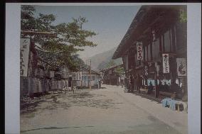
It is probably what the tea house looked like in a shuku (location unknown) on the Nakasendo. Many shops line along the road. To the right is a traveler resting.==Date:unknown, Place:Nagano, Photo:Kusakabe Kinbei, (Credit:Nagasaki University Library/Kyodo News Images) [Cabinet Number38‐30‐0]

  •  
Inns at Nakasendo Niegawa

Inns at Nakasendo Niegawa

A photo of the Niekawa village which was a shukuba on the Nakasendo. Two people are seen in the center below. There is not much cultivating land due to the mountainous region, but villagers ran a business during the months without agricultural labor. It was combined with the Narai village in 1909 when administrative reform took place, and the new name of the village became Narakawa village.==Date:unknown, Place:Nagano, Photo:Kusakabe Kinbei, (Credit:Nagasaki University Library/Kyodo News Images) [Cabinet Number38‐28‐0]

  •  
Nakasendo Torii Pass and Narai Inns

Nakasendo Torii Pass and Narai Inns

The difficult spot of Torii range on the Nakasendo and a view of Narai village at its foot. Some villagers are seen in the central river bed. The village was designated as a shukuba of the Nakasendo in the 7th year of Keicho (1602). It was not a good location for agriculture due to the high altitude and low temperature. The main industry was crafts.==Date:unknown, Place:Nagano, Photo:Kusakabe Kinbei, (Credit:Nagasaki University Library/Kyodo News Images) [Cabinet Number38‐26‐0]

  •  
Nakasendo Torii Pass

Nakasendo Torii Pass

A house on the way from the Torii range on the former Nakasendo, and a woman standing in front of it. People climbing the range can be seen in the distance. The Torii range was one of the most difficult spots on the Nakasendo located on the borders of Narai of Tarukawa village of Kisogun and Yabuhara of Kiso village of Kisogun.==Date:unknown, Place:Nagano, Photo:Kusakabe Kinbei, (Credit:Nagasaki University Library/Kyodo News Images) [Cabinet Number38‐24‐0]

  •  
Bridge at Nakasendo Sakurasawa

Bridge at Nakasendo Sakurasawa

A scene from Sakurazawa (presently Nakano City of Nagano prefecture, formerly Nobetoku village) of the former Nakasendo. To the left, the flow of the Kiso River can be seen. Many of the paddy field were in the low marshes of off Nobetoku, so after the mid-Edo era, people were suffered from numerous floods when the cultivating new paddy fields reached a limit.==Date:unknown, Place:Nagano, Photo:Kusakabe Kinbei, (Credit:Nagasaki University Library/Kyodo News Images) [Cabinet Number38‐29‐0]

  •  
Momooka village near Nakasendo Niegawa

Momooka village near Nakasendo Niegawa

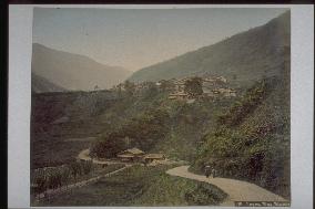
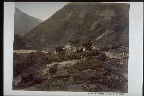
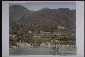
Momooka village on the Nakasendo. Similar to other villages on the Nakasendo, some houses stick to the steep slope, showing the severe nature conditions.==Date:unknown, Place:Nagano, Photo:Kusakabe Kinbei, (Credit:Nagasaki University Library/Kyodo News Images) [Cabinet Number38‐27‐0]

  •  
Suge Bridge at Nakasendo Yabuhara

Suge Bridge at Nakasendo Yabuhara

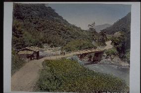
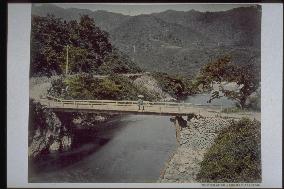
Probably the bridge built over the Kiso River. A magnificent stone foundation to support the bridge can be seen to the right corner. In the center of the bridge, a man rests holding a parasol, sitting on the girders of the bridge.==Date:unknown, Place:Nagano, Photo:Kusakabe Kinbei, (Credit:Nagasaki University Library/Kyodo News Images) [Cabinet Number38‐22‐0]

  •  
Site of Yoshinaka s castle at Nakasendo Miyanokoshi

Site of Yoshinaka s castle at Nakasendo Miyanokoshi

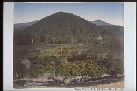
Kiso River runs to the fore, and the mountain to the rear is the Komagatake which is located to the north of the Kiso range. The peak of Komagateke is formed of the Main peak, middle peak, front peak, and Hokendake etc., and especially the Tengu Rock of Hokendake is famous for its rare shape.==Date:unknown, Place:Nagano, Photo:Kusakabe Kinbei, (Credit:Nagasaki University Library/Kyodo News Images) [Cabinet Number38‐20‐0]

  •  
Grave of Kiso Yoshinaka at Tokuonji Temple in Nakasendo Miyanokoshi

Grave of Kiso Yoshinaka at Tokuonji Temple in Nakasendo Miyanokoshi

The village in the center of the photo is Hiyoshimura, and the rear is probably Kiso range. 20 villagers stand in the shore and middle island of the Kiso River running to the fore. There are many historical sites in the village such as Kaionji which is the tomb place of Kiso Yoshinaka and others.==Date:unknown, Place:Nagano, Photo:Kusakabe Kinbei, (Credit:Nagasaki University Library/Kyodo News Images) [Cabinet Number38‐19‐0]

  •  
Yabuhara and Kiso River from Nakasendo Torii Pass

Yabuhara and Kiso River from Nakasendo Torii Pass

Looking down at the Kiso River and the Yabuhara village (presently Kiso village )from the Torii range on the Nakasendo. The Yabuhara juku of the village prospered as a resting place before the difficult path on the Nakasendo Kisoji of Torii range and the parting point leading to Hidatakayama on the Nagawado of Hida Kaido.==Date:unknown, Place:Nagano, Photo:Kusakabe Kinbei, (Credit:Nagasaki University Library/Kyodo News Images) [Cabinet Number38‐23‐0]

  •  
Inns at Nakasendo Fukushima

Inns at Nakasendo Fukushima

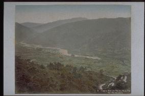
A view of the village where Fukushimajuku, one of the lodging locations on the Nakasendo was located. The Kiso River flows in a zigzag in the center of the photo. There were hotels and tea houses within the Shuku, as well as the active craftsmen for Japanese cypress crafts, and lacquer ware.==Date:unknown, Place:Nagano, Photo:Kusakabe Kinbei, (Credit:Nagasaki University Library/Kyodo News Images) [Cabinet Number38‐17‐0]

  •  
Suspension bridge at Nakasendo Kiso

Suspension bridge at Nakasendo Kiso

The famous scene Kakehashi of Kiso, the same as photo number 38-11, is taken from a farther spot. A small shrine is also seen in the right corner.==Date:unknown, Place:Nagano, Photo:Kusakabe Kinbei, (Credit:Nagasaki University Library/Kyodo News Images) [Cabinet Number38‐12‐0]

  •  
Suspension bridge at Nakasendo Kiso

Suspension bridge at Nakasendo Kiso

The angle is different, but another scene from Kakehashi of Kiso, on the Nakasendo, similar to the three previous photos. To the left on the road, a man stands wearing a hat, probably to travel on the Nakasendo.==Date:unknown, Place:Nagano, Photo:Kusakabe Kinbei, (Credit:Nagasaki University Library/Kyodo News Images) [Cabinet Number38‐14‐0]

  •  
Mt. Komagatake from Nakasendo Hiyoshi Village

Mt. Komagatake from Nakasendo Hiyoshi Village

The Kiso Komagatake seen from Hishoshimura which was a shukuba of the former Nakasendo. Hiyoshimura is located to the northeast of Kisogun and southwest of Nagano prefecture, and most of the land is forest. Komagatake is a beautiful mountain made of all granite, in the north of the Kiso range, and to the west of Ina Basin.==Date:unknown, Place:Nagano, Photo:Kusakabe Kinbei, (Credit:Nagasaki University Library/Kyodo News Images) [Cabinet Number38‐18‐0]

  •  
Suspension bridge at Nakasendo Kiso

Suspension bridge at Nakasendo Kiso

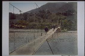
Kakehashi over the Kiso River near the Agematsujuku of Nakasendo. Kakehashi is the name of the Aza, and is known from ancient days as the Kakehashi of Kiso. (It is also quoted in the Kojien as an example of kakehashi. ) But what the actual Kakehashi implies is unknown.==Date:unknown, Place:Nagano, Photo:Kusakabe Kinbei, (Credit:Nagasaki University Library/Kyodo News Images) [Cabinet Number38‐11‐0]

  •  
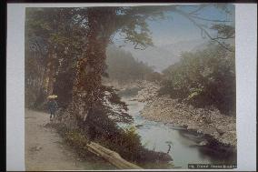
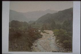
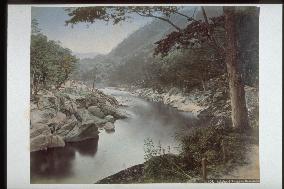
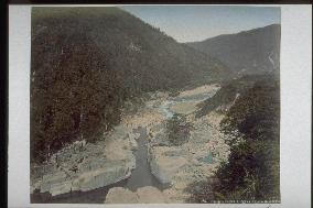
Nezame-no-toko

Nezame-no-toko

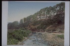
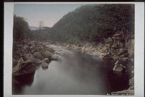
The steep flow of Urashima in the Nezame no toko, a scenic spot along the Kiso River on the Nakasendo. The same scene as the photo numbered 1560 is photographed again from a farther distance. This valley was formed from the granite, which was formed about 700 million years ago, washed away by the steep flow of the Kiso River.==Date:unknown, Place:Nagano, Photo:Kusakabe Kinbei, (Credit:Nagasaki University Library/Kyodo News Images) [Cabinet Number38‐9‐0]

  •  
Inns at Nakasendo Fukushima

Inns at Nakasendo Fukushima

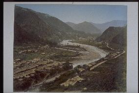
A distant view of one of the eleven Kiso lodgings of the Nakasendo, the Fukushima juku, which was established in Fukushima village. In the outskirts of the village, Fukushimazeki which was regarded to be four of the biggest sekisho (guard house). Fukushima was also famous as the entrance to the mountain of faith, Ontakesan.==Date:unknown, Place:Nagano, Photo:Kusakabe Kinbei, (Credit:Nagasaki University Library/Kyodo News Images) [Cabinet Number38‐16‐0]

  • Main
  • Top
  • Editorial
  • Creative
  • About Us
  • About ILG
  • Terms of use
  • Company
  • BEHIND
  • Price List
  • Single Plan
  • Monthly Plan
  • Services
  • Shooting
  • Rights Clearance
  • Support
  • FAQ
  • How To Buy
  • Contact Us
  • Become a Partner

© KYODO NEWS IMAGES INC

All Rights Reserved.

  • Editorial
  • Olympics
  • News
  • Sports
  • Japan
  • Tech
  • Royal
  • Disaster
  • NorthKorea
  • Old Japan
  • SNS
  • Creative
  • Food
  • Japan
  • Landscape
  • Animal
  • Popular
  • #Ukraine
  • #China
  • #coronavirus
  • #N. Korea
  • #Russia
  • #Thailand
  • #Ukraine
  • #China
  • #coronavirus
  • #N. Korea
  • #Russia
  • #Thailand
  • Food
  • Japan
  • Landscape
  • Animal
  • Olympics
  • News
  • Sports
  • Japan
  • Tech
  • Royal
  • Disaster
  • NorthKorea
  • Old Japan
  • SNS