•  

Nanchuan Ancient Street, a new cultural landmark along China's Grand Canal

STORY: Nanchuan Ancient Street, a new cultural landmark along China's Grand Canal SHOOTING TIME: Recent footage DATELINE: June 20, 2024 LENGTH: 00:00:59 LOCATION: CANGZHOU, China CATEGORY: CULTURE/SOCIETY SHOTLIST: 1. various of the aerial view of the Grand Canal 2. various of the Nanchuan Ancient Street 3. SOUNDBITE 1 (Chinese): JIA JINGJING, Visitor at Nanchuan Ancient Street 4. SOUNDBITE 2 (Chinese): LUO JINGYA, General manager, Cangzhou Grand Canal Operation and Management Co., Ltd. STORYLINE: Nanchuan Ancient Street in north China's Cangzhou City has evolved into a new cultural landmark along the Grand Canal. With a history of more than 2,500 years, the Grand Canal served as a significant transportation artery in ancient China. Bathed in rich history and culture along the Grand Canal, the street has been revitalized with a blend of traditional architecture and modern commercial industries. SOUNDBITE 1 (Chinese): JIA JINGJING, Visitor at Nanchuan Ancient Street "I often come here with my friends and

  •  

Storm Kathleen Brings Strong Winds, High Waves To Ireland, UK Coasts 2

Storm Kathleen brought strong winds to Ireland, Northern Ireland, Scotland and parts of western England on Saturday, April 6. Videos posted on social media show big waves hitting the coasts across the regions.

  •  
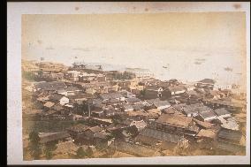
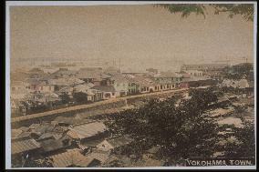
View of settlement

View of settlement

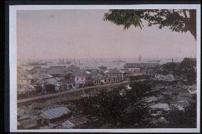
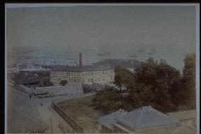
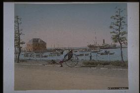
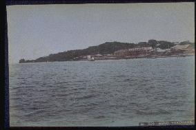
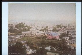
From the comparison with other photos, this is probably a view of Yokohama. The large building in the upper left is probably the Yokohama Grand Hotel, but it has been rebuilt and renovated many times, so a comparison with other photos is not possible.==Date:unknown, Place:Yokohama, Photo:unknown, (Credit:Nagasaki University Library/Kyodo News Images) [Cabinet Number16‐41‐0]

  •  
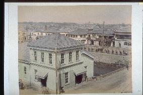
Houses and streets in tokyo

Houses and streets in tokyo

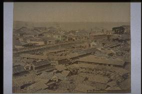
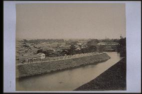
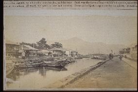
A panel board with Eguchi Shoten can be seen across the river. There are no markings on the western building in the fore.==Date:unknown, Place:Tokyo, Photo:Ogawa Kazumasa, (Credit:Nagasaki University Library/Kyodo News Images) [Cabinet Number9‐11‐0]

  •  
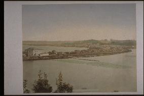
Railway premises around takashimacho

Railway premises around takashimacho

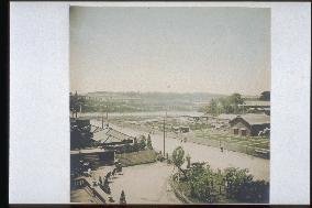
The caption reads railway to Kanagawa from Yokohama in English, but it is the railway on reclaimed land seen from the Kanagawa side. Takashima Kisaemon, who was engaged in the sale of lumber, carved the mountain and completed the railroad. The right is Hiranuma and the central rear is Yokohama city.==Date:unknown, Place:Yokohama, Photo:Kusakabe Kinbei, (Credit:Nagasaki University Library/Kyodo News Images) [Cabinet Number3‐17‐0]

  •  
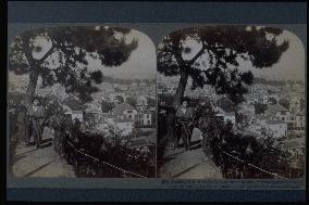
A view of the city of Kobe from Mt. Suwa

A view of the city of Kobe from Mt. Suwa

Like #4949 and #4950, this is a stereograph made by the American company Underwood & Underwood. View from Mt. Suwa facing southwest. The cylindrical building on the right is science building of Eiwa Girls School (present-day Kobe Jogakuin School before relocation) completed in 1893. The caption saying that the company obtained the publishing rights in 1904 indicates that the photograph was taken between 1893 and 1904.==Date:1904, Place:Kobe, Photo:Underwood, (Credit:Nagasaki University Library/Kyodo News Images) [Cabinet Number97‐15‐0]

  •  
The Yokohama Customs Inspection office and the main pier

The Yokohama Customs Inspection office and the main pier

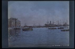
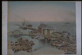
Panoramic view of the great pier from the waterfront. A symbol of Yokohama Harbour, the 19-meter-wide, 730-meter-long pier was built as part of the first port construction project started in 1889 and completed in 1894. The building on the left is the Customs Supervision Department built the same year.==Date:unknown, Place:Yokohama, Photo:Kusakabe Kinbei, (Credit:Nagasaki University Library/Kyodo News Images) [Cabinet Number96‐88‐0]

  •  
The Yokohama foreign settlement seen from Yamate

The Yokohama foreign settlement seen from Yamate

View from the Motomachi Hyakudan. The neighbourhood beyond the Horikawa Waterway is the Yamashita Settlement. The Yakushi-do of Zotokuin Temple is at the right edge and the large two-story Western-style building in the far left is the new Grand Hotel. Probably taken around 1897.==Date:unknown, Place:Yokohama, Photo:unknown, (Credit:Nagasaki University Library/Kyodo News Images) [Cabinet Number96‐22‐0]

  •  
A distant view of Yokohama Station

A distant view of Yokohama Station

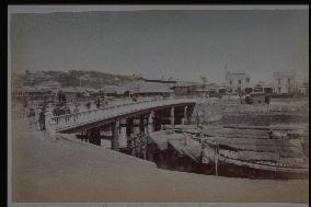
This is the original Yokohama Station designed by American architect R. P. Bridgens and built in 1871. The building is of stone and wood construction. This is the site of present-day Sakuragi-cho Station. Connecting to Honmachi Dori on the right is Benten Bridge, a triple-arch bridge built by the Train Works Division of the Ministry of Engineering in 1871.==Date:unknown, Place:Yokohama, Photo:unknown, (Credit:Nagasaki University Library/Kyodo News Images) [Cabinet Number93‐28‐0]

  •  
A distant view of Yokohama Station

A distant view of Yokohama Station

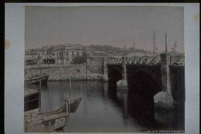
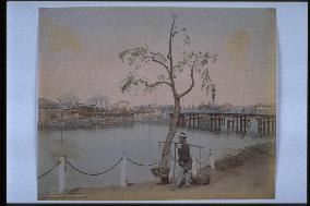
This is the original Yokohama Station designed by American architect R. P. Bridgens and built in 1871. The building is of stone and wood construction. This is the site of present-day Sakuragi-cho Station. Since the bridge is of iron construction, this photograph must have been taken after 1885. The shack by the river is a public lavatory.==Date:unknown, Place:Yokohama, Photo:unknown, (Credit:Nagasaki University Library/Kyodo News Images) [Cabinet Number92‐4‐0]

  •  
A view of Grand Hotel from Tanitozaka Slope

A view of Grand Hotel from Tanitozaka Slope

The building in the centre is the old Grand Hotel. The new hotel, designed by P. Sarda and completed in 1887, is visible in the background to the left. The house with the large Japanese-style roof is the former Hepburn residence. The property on this side of Yato Bridge would later become the French Consulate, also designed by P. Sarda and built in 1896.==Date:unknown, Place:Yokohama, Photo:unknown, (Credit:Nagasaki University Library/Kyodo News Images) [Cabinet Number92‐2‐0]

  •  
Grand Hotel

Grand Hotel

View of the eastern edge of the Bund and the Yamate area. In the centre are the new and old buildings of the Grand Hotel. The British navy storehouse, later the site of the navy hospital garden, is visible beyond Horikawa Waterway. The person in the foreground is standing on the Furansu Hatoba (French Wharf).==Date:unknown, Place:Yokohama, Photo:unknown, (Credit:Nagasaki University Library/Kyodo News Images) [Cabinet Number85‐15‐0]

  •  
The city of Yokohama

The city of Yokohama

View of the Yamashita foreign settlement from the top of Motomachi Hyakudan (one hundred steps). The neighbourhood on this side of the Horikawa Waterway is Motomachi. Zotokuin Temple is visible on the right. The white-coloured light house was built in 1896 during improvements to Yokohama harbour facilities. This photograph was probably taken the following year.==Date:unknown, Place:Yokohama, Photo:unknown, (Credit:Nagasaki University Library/Kyodo News Images) [Cabinet Number85‐16‐0]

  •  
The Yokohama Customs Inspection office and the main pier

The Yokohama Customs Inspection office and the main pier

Panoramic view of the great pier from Yokohama Customs Building. The curved stone-walled quay stretching from the edge of the pier to the left was called the Elephant Trunk and was one of the protrusions of Igirisu Hatoba (British Wharf) built at the time of the port-opening.==Date:unknown, Place:Yokohama, Photo:A. Farsari, (Credit:Nagasaki University Library/Kyodo News Images) [Cabinet Number81‐8‐0]

  •  
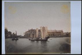
The Yokohama Customs Inspection office and the main pier

The Yokohama Customs Inspection office and the main pier

Panoramic view of the great pier from the waterfront. A symbol of Yokohama Harbour, the 19-meter-wide, 730-meter-long pier was built as part of the first port construction project started in 1889 and completed in 1894. The building on the left is the Customs Supervision Department built the same year.==Date:unknown, Place:Yokohama, Photo:A. Farsari, (Credit:Nagasaki University Library/Kyodo News Images) [Cabinet Number81‐9‐0]

  •  
Waterfront of the Kobe foreign settlement

Waterfront of the Kobe foreign settlement

View of the waterfront street in the foreign settlement (present-day Chuo Ward), looking from the western edge facing east in the mid-Meiji Period. The building on the left is the Kobe branch of Hong Kong and Shanghai Banking Corporation. Trading companies, banks and consulates line the street, revealing the port in its heyday. On the right is a promenade where foreigners enjoyed strolling.==Date:unknown, Place:Kobe, Photo:unknown, (Credit:Nagasaki University Library/Kyodo News Images) [Cabinet Number79‐9‐0]

  •  
A view of the Goji-in plain outside Ichihashi-mon Gate

A view of the Goji-in plain outside Ichihashi-mon Gate

View of Shimizu-mon (gate) located half-way up Kudan-zaka (in front of Tayasu Gate). The gate visible in the centre back is Shimizu-mon. Since the gate was destroyed in 1873, this photograph must have been taken before that date. The building on its right is the guardsmen's artillery station at Takebashi. The moat in the foreground was called Ushigafuchi (Bull Ravine). The Shinsen Tokyo Meishozue (Newly Selected Famous Places of Tokyo) states that, A bull and cart carrying coins went down into the moat and never came up, and this is the origin of the name. When attached to photograph #4003, this becomes a continuous panoramic scene.==Date:unknown, Place:Tokyo, Photo:R. Stillfried, (Credit:Nagasaki University Library/Kyodo News Images) [Cabinet Number78‐22‐0]

  •  
The foreigh settlement seen from the sea

The foreigh settlement seen from the sea

View of the Bund and Yamate Hill. The two rather large buildings in the centre right are the old (left) and new buildings of the Grand Hotel located on the eastern edge of the Bund. The British Navy warehouse is on the left of the Horikawa Waterway. A boat house is visible at Furansu Hatoba (French Wharf) on the far right.==Date:unknown, Place:Yokohama, Photo:Tamamura Kozaburo, (Credit:Nagasaki University Library/Kyodo News Images) [Cabinet Number68‐15‐2]

  •  
Grand Hotel

Grand Hotel

View from the eastern edge of the Bund. The building in the foreground is the old Grand Hotel. A building of wood and stone construction, the hotel was designed by American architect R. P. Bridgens and opened in 1873. Neither the new hotel, completed in 1887, nor the pine trees planted along the street in 1885, are visible here. Furansu Hatoba (French Wharf) is visible on the far right.==Date:unknown, Place:Yokohama, Photo:unknown, (Credit:Nagasaki University Library/Kyodo News Images) [Cabinet Number64‐73‐0]

  •  
A view of Yamate, Kobe

A view of Yamate, Kobe

The hill on the left is Ujinoyama, the area from present-day Nakayamate Dori 6- and 7-chome to Yamamoto Dori 5-chome in Chuo Ward, probably taken sometime in the first half of the Meiji Period. Although part of a mixed-residence area outside the foreign settlement, this section to the west contained some Western-style buildings. Yet to be reforested, the Rokko Mountain Range looks desolate.==Date:unknown, Place:Kobe, Photo:unknown, (Credit:Nagasaki University Library/Kyodo News Images) [Cabinet Number56‐31‐0]

  •  
The damage from a typhoon at the Kobe foreign settlement

The damage from a typhoon at the Kobe foreign settlement

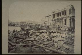
View of the waterfront street in the mixed residential area (present-day Chuo Ward) after the typhoon of July 4, 1871. Taken from the Meriken Wharf, facing west. The building on the right with a broken veranda is the Hiogo Hotel, which was under construction at the time. A photograph taken from the same spot and about the same time was published in the July 17, 1871 issue of The Far East.==Date:unknown, Place:Kobe, Photo:unknown, (Credit:Nagasaki University Library/Kyodo News Images) [Cabinet Number56‐3‐0]

  •  
A distant view of Yokohama Station

A distant view of Yokohama Station

This is the original Yokohama Station designed by American architect R. P. Bridgens and built in 1871. The building is of stone and wood construction. Renamed Sakuragi-cho Station in 1915, the building was destroyed in the Great Kanto Earthquake of 1923.==Date:unknown, Place:Yokohama, Photo:unknown, (Credit:Nagasaki University Library/Kyodo News Images) [Cabinet Number55‐40‐0]

  •  
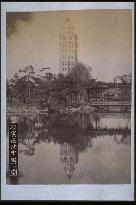
The twelve-level Ryounkaku,Asakusa

The twelve-level Ryounkaku,Asakusa

While Rokumeikan, built around the same time, is a representative building of the nobility, Ryounkaku was a building for the common people. At a time when tall buildings were all but nonexistent in Tokyo, it was one of the few portrayed by photographers in vertical composition. This photograph provides a rare view of Ryounkaku reflected in Oike Pond. The top half of Ryounkaku was destroyed in the Great Earthquake of 1923 and the rest of the building was later demolished. This is Ryounkaku soon after its completion in October 1890.==Date:unknown, Place:Tokyo, Photo:unknown, (Credit:Nagasaki University Library/Kyodo News Images) [Cabinet Number55‐38‐2]

  •  
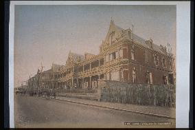
Grand Hotel

Grand Hotel

View of the new Grand Hotel (No.18-19). Designed by French architect P. Sarda, the hotel was completed in 1887. The back of the building looked out onto the Bund, while the main entrance faced Mizumachi Street.==Date:unknown, Place:Yokohama, Photo:unknown, (Credit:Nagasaki University Library/Kyodo News Images) [Cabinet Number55‐30‐0]

  •  
Grand Hotel

Grand Hotel

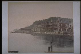
View of the Grand Hotel on lots No.18-20 in the foreign settlement at the eastern edge of the Bund. The hotel was a Yokohama landmark until its destruction in the Great Kanto Earthquakeof 1923. The facility consists of the old hotel on the left (No.20) and the new hotel on the right (No.18-19). The iron bridge Yatobashi spans the mouth of the Horikawa Waterway to the left of the old hotel.==Date:unknown, Place:Yokohama, Photo:unknown, (Credit:Nagasaki University Library/Kyodo News Images) [Cabinet Number55‐16‐0]

  •  
The Yokohama foreign settlement seen from Yamate

The Yokohama foreign settlement seen from Yamate

View from the Motomachi Hyakudan. The neighbourhood beyond the Horikawa Waterway is the Yamashita Settlement. The Yakushi-do of Zotokuin Temple is at the right edge and the large two-story Western-style building in the far left is the new Grand Hotel. Probably taken around 1897.==Date:unknown, Place:Yokohama, Photo:unknown, (Credit:Nagasaki University Library/Kyodo News Images) [Cabinet Number55‐2‐0]

  •  
A view of the Bund Yamate from the sea

A view of the Bund Yamate from the sea

View of the Bund and Yamate Hill. The two rather large buildings in the centre right are the old (left) and new buildings of the Grand Hotel located on the eastern edge of the Bund. The British Navy warehouse is on the left of the Horikawa Waterway. A boat house is visible at Furansu Hatoba (French Wharf) on the far right.==Date:unknown, Place:Yokohama, Photo:Tamamura Kozaburo, (Credit:Nagasaki University Library/Kyodo News Images) [Cabinet Number48‐79‐0]

  •  
Sakurada Moat at the Imperial Palace and the General Staff Office

Sakurada Moat at the Imperial Palace and the General Staff Office

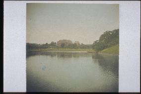
This is a view of the Japanese Army Headquarters at Miyakezaka from the approach to the Sakurada Gate of Imperial Palace. The Army Headquarters, where national security and strategies were planned, was under direct control of the emperor. ==Date:unknown, Place:Tokyo, Photo:unknown, (Credit:Nagasaki University Library/Kyodo News Images) [Cabinet Number46‐148‐0]

  •  
View of a town from a hotel

View of a town from a hotel

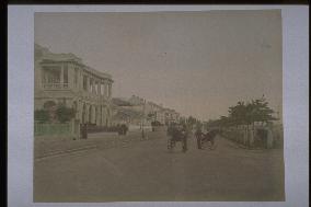
Four rickshaws can be seen to the left below, but the huge court entrance of this hotel was designed to enable big carriages to enter.==Date:unknown, Place:Tokyo, Photo:unknown, (Credit:Nagasaki University Library/Kyodo News Images) [Cabinet Number46‐146‐0]

  •  
Site of the National Industrial Exhibition

Site of the National Industrial Exhibition

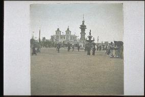
A view of the exhibition. The refrigerator was the most popular among the exhibits. People lined up for 20 to 30 minutes to see it.==Date:1903, Place:Osaka, Photo:unknown, (Credit:Nagasaki University Library/Kyodo News Images) [Cabinet Number46‐77‐0]

  •  
The city of Yokohama

The city of Yokohama

Caption reads In Kanagawa. The location is unknown.==Date:unknown, Place:Yokohama, Photo:Kusakabe Kinbei, (Credit:Nagasaki University Library/Kyodo News Images) [Cabinet Number43‐28‐0]

  •  
Grand Hotel

Grand Hotel

A view of the direction from the Bluff and the east corner of the Band. The Grand Hotel has the old building opened in 1873 and the new building numbered 18 and 19. This building was designed by the architect Salda of the French settlement, and was opened in 1887.==Date:unknown, Place:Yokohama, Photo:Kusakabe Kinbei, (Credit:Nagasaki University Library/Kyodo News Images) [Cabinet Number43‐20‐0]

  •  
Old arsenal at Yokosuka

Old arsenal at Yokosuka

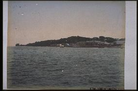
The building of the dock is seen built around the harbour. A long building stands to the right of the screen, and an island can be seen beyond. Two ships are moored to the harbour.==Date:unknown, Place:Yokosuka, Photo:Suzuki Shin-ichi, (Credit:Nagasaki University Library/Kyodo News Images) [Cabinet Number41‐12‐0]

  •  
Yokosuka Docks

Yokosuka Docks

The Yokohama Iron Foundry built by the Bakufu in 1865 was taken over by the Meiji government during the Meiji Restoration, and it was renamed Yokosuka Shipyard when the first dock was completed in 1871. The buildings of the shipyard are shown.==Date:unknown, Place:Yokosuka, Photo:unknown, (Credit:Nagasaki University Library/Kyodo News Images) [Cabinet Number37‐28‐0]

  •  
The Oura foreign settlement seen from Minamiyamate

The Oura foreign settlement seen from Minamiyamate

A distant view of Dejima over the Oura foreign settlement from present-day Glover Garden in Minamiyamate. To the right is the Belle Vue Hotel, located where the ANA HOTEL now stands. The Russell Hall built in 1876 is still not seen in Higashiyamate . Same as the photo numbered 28-25.==Date:unknown, Place:Nagasaki, Photo:F. Beato, (Credit:Nagasaki University Library/Kyodo News Images) [Cabinet Number36‐28‐0]

  •  
YOKOHAMA settlement from mt france

YOKOHAMA settlement from mt france

The foreign settlement seen from the Bluff. The nearly completed Yokohama settlement and Motomachi are photographed across the Hori River. Photo by F. Beato.==Date:unknown, Place:Yokohama, Photo:F. Beato, (Credit:Nagasaki University Library/Kyodo News Images) [Cabinet Number36‐1‐0]

  •  
View of NAGASAKI from graveyard near koshima

View of NAGASAKI from graveyard near koshima

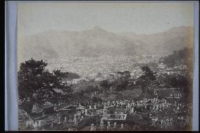
A view of the central part of Nagasaki from around the cemetery of Donnoyama in Koshima to the upper right of Shokakuji in Nagasaki. To the right is Kiyomizudera, and the building in the centre left is the sanatorium built by Pompe, the predecessor of Nagasaki Medical College.==Date:1864, Place:Nagasaki, Photo:F. Beato, (Credit:Nagasaki University Library/Kyodo News Images) [Cabinet Number28‐27‐0]

  •  
Oura foreign settlement and Dejima

Oura foreign settlement and Dejima

The view of Dejima in the distance from the site of present-day Glover Garden in Minamiyamate, looking over the Oura Foreign Settlement. The warehouses in Dejima can be seen. The right fore is the Bell Vue Hotel which used to stand where the present ANA HOTEL stands. The Russell Building built in 1882 on the hillside of Higashiyamate, has not appeared yet.==Date:unknown, Place:Nagasaki, Photo:F. Beato, (Credit:Nagasaki University Library/Kyodo News Images) [Cabinet Number28‐25‐0]

  •  
The Yokohama foreign settlement seen from Yamate

The Yokohama foreign settlement seen from Yamate

The view from Kaigarazaka in Yokohama, the slope leading up to the Bluff. The fore is Motomachi, and the rear is the foreign settlement. The fore is the Japanese cemetery. Photo by F. Beato.==Date:unknown, Place:Yokohama, Photo:F. Beato, (Credit:Nagasaki University Library/Kyodo News Images) [Cabinet Number28‐10‐0]

  •  
Scene in a foreign country

Scene in a foreign country

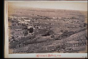
At the bottom edge of the frame is written, Cantonment Bellary. It is the Bellary lodgings. Bellary is a town in the south of India, an important stronghold for the railway. The gigantic bare rocks and the remains of an old round fortress to the left provides a contrast with the modern barracks that stand here and there. It is probably an English army base.==Date:unknown, Place:unknown, Photo:[R. Stillfried], (Credit:Nagasaki University Library/Kyodo News Images) [Cabinet Number27‐33‐0]

  •  
The Oura foreign settlement seen from Minamiyamate

The Oura foreign settlement seen from Minamiyamate

A view of Dejima from Minamiyamate in the Oura foreign settlement. The building to the right is the Bell Vue Hotel located where the ANA HOTEL stands today. Taken from a slightly higher and left angle compared to the photos numbered 28-25, 36-28.==Date:unknown, Place:Nagasaki, Photo:Uchida Kuichi, (Credit:Nagasaki University Library/Kyodo News Images) [Cabinet Number26‐43‐0]

  •  
A panoramic view of Kobe

A panoramic view of Kobe

A distant view of the city along Sanomiya Avenue from Mt. Suwa.==Date:unknown, Place:Kobe, Photo:unknown, (Credit:Nagasaki University Library/Kyodo News Images) [Cabinet Number23‐17‐0]

  •  
Entrance of ouragawa river

Entrance of ouragawa river

A view of the entrance of Oura River from slightly upstream. The bridge over Oura River is the Matsugae Bridge. There are many street lights on the wide road beside the river. The Western-style houses in the Sagarimatsu settlement can be seen clearly. The pines gave Sagarimatsu ( Drooping Pines ) its name.==Date:1871, Place:Nagasaki, Photo:unknown, (Credit:Nagasaki University Library/Kyodo News Images) [Cabinet Number21‐31‐0]

  •  
MOGI

MOGI

Same angle as the photo numbered 8-17, but the tide is full. The time is slightly later, and new buildings are seen at the tip of the cape. The pier built in 1892 is still not seen. The street is the former Kaido (highway).==Date:unknown, Place:Nagasaki, Photo:unknown, (Credit:Nagasaki University Library/Kyodo News Images) [Cabinet Number21‐25‐0]

  •  
Steamer and Minamiyamate from akunoura

Steamer and Minamiyamate from akunoura

A photo of Nagasaki Harbour and Minamiyamate seen from the opposite bank in Akunoura. The Naminohira, Kosone and Matsugae neighborhoods line the opposite bank. At the foot of Mt. Nabekanmuri, Western-style buildings such as the Russian Consulate can be seen. The loading of coal from lighters onto the warships is a rare scene in the old photos.==Date:Middle Meiji, Place:Nagasaki, Photo:unknown, (Credit:Nagasaki University Library/Kyodo News Images) [Cabinet Number21‐12‐0]

  •  
Settlement for foreigners at NAGASAKI oura

Settlement for foreigners at NAGASAKI oura

Taken by Beato. Written Part of the European settlement, and city of Nagasaki, June. 65 . The waterfront street of Oura as it looked in the 1860's and details of the Western residences in Higashiyamate can be seen. There are still no buildings on the hill at the right.==Date:1865, Place:Nagasaki, Photo:F. Beato, (Credit:Nagasaki University Library/Kyodo News Images) [Cabinet Number17‐32‐0]

  •  
Nagasaki Harbour seen from Akunoura

Nagasaki Harbour seen from Akunoura

The panorama of Nagasaki from Inasa and Akunoura. The original is compsed of four quarters photos. This is one of the quarters. The building to the right is the Nagasaki Iron Foundry owned by the government. In the port, The steamships show the hustle and bustle of Nagasaki harbour. It is probably a copy of the original photo.==Date:1872, Place:Nagasaki, Photo:Uchida Kuichi, (Credit:Nagasaki University Library/Kyodo News Images) [Cabinet Number15‐34‐0]

  •  
Nagasaki Harbour seen from Akunoura

Nagasaki Harbour seen from Akunoura

A panorama of Nagasaki harbour seen from Akunoura. This photo is a quarter of a larger picture. A steamship is anchored in the harbour. The central right building is the government-owned Nagasaki Iron Foundry. It is thought to be a duplicate of the original photo.==Date:1872, Place:Nagasaki, Photo:Uchida Kuichi, (Credit:Nagasaki University Library/Kyodo News Images) [Cabinet Number12‐15‐0]

  •  
Port town with factories

Port town with factories

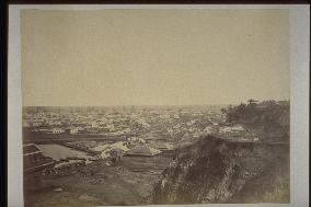
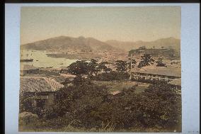
The factories and Western houses suggest that this is Yokosuka. If it is, the factory is a ship dockyard, and the presence of Western houses can be understood.==Date:unknown, Place:Yokosuka, Photo:unknown, (Credit:Nagasaki University Library/Kyodo News Images) [Cabinet Number12‐4‐0]

  •  
A panoramic view of Nagasaki Harbour

A panoramic view of Nagasaki Harbour

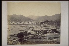
A bird's eye view of the north part of the city from Kazagashira. Nakashima River was later diverted to the back of Dejima and now has a bridge built over it. The customs building is seen on the sea.The caption reads Nagasaki Harbour in English at the left corner. The photo was taken from the same angle as the photo numbered 21-10.==Date:unknown, Place:Nagasaki, Photo:Tamamura Kozaburo, (Credit:Nagasaki University Library/Kyodo News Images) [Cabinet Number11‐45‐0]

  • Main
  • Top
  • Editorial
  • Creative
  • About Us
  • About ILG
  • Terms of use
  • Company
  • BEHIND
  • Price List
  • Single Plan
  • Monthly Plan
  • Services
  • Shooting
  • Rights Clearance
  • Support
  • FAQ
  • How To Buy
  • Contact Us
  • Become a Partner

© KYODO NEWS IMAGES INC

All Rights Reserved.

  • Editorial
  • Olympics
  • News
  • Sports
  • Japan
  • Tech
  • Royal
  • Disaster
  • NorthKorea
  • Old Japan
  • SNS
  • Creative
  • Food
  • Japan
  • Landscape
  • Animal
  • Popular
  • #Ukraine
  • #Russia
  • #coronavirus
  • #N. Korea
  • #China
  • #Thailand
  • #Ukraine
  • #Russia
  • #coronavirus
  • #N. Korea
  • #China
  • #Thailand
  • Food
  • Japan
  • Landscape
  • Animal
  • Olympics
  • News
  • Sports
  • Japan
  • Tech
  • Royal
  • Disaster
  • NorthKorea
  • Old Japan
  • SNS