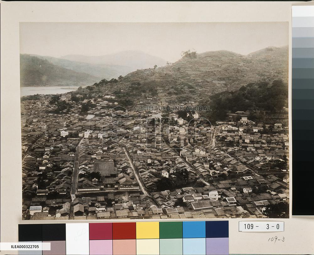
Panoramic view of NAGASAKI
This panoramic photograph of central Nagasaki was taken from Mt. Kazagashira. This is the first of three panels (#5615-5617) showing the area from the elevation of Umegasaki, Nagasaki Prefecture Office and Nagasaki City Hall to the then high school (now Sakura-machi Primary School) and all the way to Suwa Shinto Shrine. The date is after 1893, because the re-routing of Nakashima River has been completed. This third panel depicts (from the left) the area from Sakura-machi to the former high school and Suwa Shinto Shrine. Koeiji Temple is visible on the lower left along with the bridges Ichiran-bashi, Furumachi-bashi, Amigasa-bashi and Oide-bashi.==Date:unknown, Place:Nagasaki, Photo:unknown, (Credit:Nagasaki University Library/Kyodo News Images) [Cabinet Number109‐3‐0]
- Product Code
- ILEA000322705
- Registered date
- 1900/12/31 00:19:00
- Credit
- Nagasaki University Library / Kyodo News Images
- Media source
- Nagasaki University Library
- Media size
- 1636 × 1330 pixel
- Resolution
- 600 dpi
- Deployment size
- 1.66(MB)*
- Special instruction
- **The text may be generated by an automatic translation system**
*File size when opened in Photoshop, etc.


